Brakel
Brakel (Dutch pronunciation: [ˈbraːkəl]) is a municipality in the Belgian province of East Flanders in the Denderstreek and the Flemish Ardennes. The name is derived from a Carolingian villa Braglo first mentioned in 866 and located in the center of Opbrakel. Since 1970, the municipality has comprised the villages of Nederbrakel, Opbrakel, Michelbeke, Elst, Zegelsem. In 1977 Everbeek, Parike and part of Sint-Maria-Oudenhove were added. On January 1, 2006, Brakel had a population of 13,726. The area is 56.46 km² which gives a population density of 243 per km². The mayor is Stefaan De Vleeschouwer.
Brakel | |
|---|---|
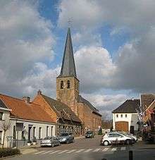 Michelbeke church | |
 Flag  Coat of arms | |
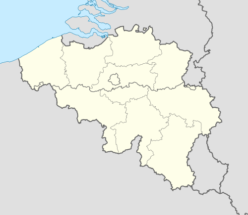 Brakel Location in Belgium
Location of Brakel in East Flanders 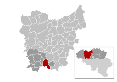 | |
| Coordinates: 50°48′N 03°45′E | |
| Country | Belgium |
| Community | Flemish Community |
| Region | Flemish Region |
| Province | East Flanders |
| Arrondissement | Oudenaarde |
| Government | |
| • Mayor | Stefaan De Vleeschouwer (VLD) |
| • Governing party/ies | VLD |
| Area | |
| • Total | 56.46 km2 (21.80 sq mi) |
| Population (2018-01-01)[1] | |
| • Total | 14,781 |
| • Density | 260/km2 (680/sq mi) |
| Postal codes | 9660, 9661 |
| Area codes | 055 |
| Website | www.brakel.be |
The region is known for the green hills and valleys, which attract cyclists and walkers and play a role in the Tour of Flanders cycling race.
The Braekel chicken is named after the town.
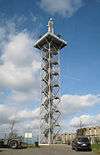
The Uitkijktoren, a 32 metres (105 ft) high[2] viewing tower was opened in April 2001.[3] It is located at 50.8124°N 3.7391°E on the Twaalfbunderstraat, north-west of Nederbrakel. Orientation boards at the top enable visitors to identify places of interest in all directions.
Famous inhabitants
- Herman De Croo, politician, former president of the Belgian Chamber of Representatives
- Alexander De Croo, politician, Minister
- Robbie McEwen, cyclist, won 12 stages in the Tour de France
- Peter van Petegem, cyclist, won Paris–Roubaix and the Tour of Flanders
References
- "Wettelijke Bevolking per gemeente op 1 januari 2018". Statbel. Retrieved 9 March 2019.
- "Uitkijktoren Brakel" (in Dutch). Toerisme Oost-Vlaanderen. Retrieved 2009-05-12.
- "Sign at the foot of the Uitkijktoren" (in Dutch).
External links

- Official website (in Dutch)
Places adjacent to Brakel | |
|---|---|
