Black Forest National Park
The Black Forest National Park (German: Nationalpark Schwarzwald) was created on 1 January 2014 and is the first national park in Baden-Württemberg, Germany. The state parliament voted for its establishment on 28 November 2013.[1] The national park has an area of 10,062 hectares (100.62 km2; 38.85 sq mi) and is located on the main crest of the Northern Black Forest, mainly between the Black Forest High Road (Schwarzwaldhochstraße) and the valley of the Murg. It comprises two separate areas, roughly 3.5 kilometres apart, around Ruhestein (7,615 ha) and Hoher Ochsenkopf/Plättig (2,447 ha) and is part of the Central/North Black Forest Nature Park (Naturpark Schwarzwald Mitte/Nord). The park was officially opened on 3 May 2014[2]
| Black Forest National Park | |
|---|---|
| Nationalpark Schwarzwald | |
IUCN category II (national park) | |
 The Huzenbacher See, one of several tarns in the national park | |
 Location of the Black Forest National Park in the northwestern Black Forest | |
| Location | Baden-Württemberg, Germany |
| Nearest city | Baden-Baden, Freudenstadt |
| Coordinates | 48°33′40″N 8°13′17″E |
| Area | 10,062 ha (24,860 acres) |
| Established | 1 January 2014 |
| www | |
 Black Forest National Park in the southwest of the map | |
The establishment of a national park in the Black Forest was politically controversial. It was opposed by the state's opposition parties - the CDU and FDP - by representatives of the timber industry and by some of the affected population, whilst being supported by the SPD and Greens, the conservation associations and other parts of the populations of the Northern Black Forest.
Location and extent
The northern part of the area, the High Ochsenkopf / Plättig includes the upper Schwarzenbach valley and the regions around the High Ochsenkopf (1,055 m above sea level (NHN)) in the centre, the Mehliskopf (1,008 m) in the west, the Badener Höhe (1,003 m) in the north and the Nägeliskopf (994 m) in the east. The lowest and most easterly point of this park is at the confluence of the Schwarzbach and Raumünzach streams, at a height of just below 500 m. Excluded are the village of Herrenwies as well as smaller areas around Plättig, Sand and the youth hostel of Badener Höhe. In the northeast, it borders to the Schwarzenbach Reservoir, and in the west to the Bühlerhöhe beyond the Black Forest High Road. Most of the state forest here belongs to the municipality of Forbach (in the county of Rastatt). The towns of Bühl (Rastatt) and Baden-Baden own other municipal forests in the area around Plättig.
The greater part of the Ruhestein area extends reaches a height of approximately 1,150 m above NHN near Dreifürstenstein in the southeasternmost summit region of the Hornisgrinde, the highest mountain in the northern Black Forest. Other summits are the bird's head (Vogelskopf) (1,056 m) and the Schliffkopf (1,054 m) to the west, the Seekopf (1,054 m) in the northwest, the Riesenköpfle (1,001 m) in the centre, the Leinkopf (992 m) in the north and the Großhahnberg (940 m) in the northeast. In this southern part of the National Park are the tarns of Wildsee, Huzenbacher See and Buhlbachsee and the upper Schönmünz valley and the headwaters of the Murg headstreams, the Rechtmurg and Rotmurg and other Murg tributaries. On the western slopes of the Schliffkopf this subregions extends down as far as the All Saints Waterfalls, where it reaches is lowest and most westerly point at a height of approximately 500 m. Excluded from the Ruhestein area are the Ruhestein itself with its two ski slopes and the Great Ruhestein Ski Jump, the Darmstädter Hut, the Schliffkopf Hotel, the Rotmurg Hunting Lodge, the hamlet of Schonmünz (Volzenhäuser) and other small areas. The state forest land here belongs mainly to the collective municipality of Baiersbronn (in the county of Freudenstadt), other elements belong to Oppenau, Ottenhöfen and Seebach (in the county of Ortenaukreis).[3][4]
The park covers an area of 10,062 hectares, of which 2,447 hectares are within the High Ochsenkopf/Plättig and 7,615 hectares around the Ruhestein. The two areas are separated by the Forbach parish of Hundsbach.
.jpg)
References
- Nationalpark im Schwarzwald Archived 2014-01-03 at the Wayback Machine Website of the Baden-Württemberg Ministry of Rural Affairs and Consumer Protection. Retrieved 30 November 2013
- with the motto "Eine Spur wilder": Das wilde Herz beginnt zu schlagen (press release) at www.baden-wuerttemberg.de
- Gesetzentwurf der Landesregierung, Drucksache 15/4127 dated 8 October 2013 (pdf; 11 MB). Contains detailed mapping.
- Nationalpark Schwarzwald – Übersichtskarte Archived December 12, 2013, at the Wayback Machine, Anlage 1 zu § 2 Absatz 1 NLPG (PDF; 2,56 MB), retrieved 8 December 2013
External links
| Wikimedia Commons has media related to Nationalpark Schwarzwald. |
Photo gallery


_Alpenpanorama_Aussichtspunkt_Zugang-1.JPG) Viewpoint "Alpine panorama" in Ibach
Viewpoint "Alpine panorama" in Ibach The municipality Schönwald im Schwarzwald
 The Black Forest National Park in the wintertime
 Climber in the Black Forest
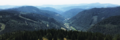
| North Germany | ||
|---|---|---|
| Central Germany | ||
| South Germany | ||
| Authority control |
|
|---|