Bishop, Georgia
Bishop is a town in Oconee County, Georgia, United States. As of the 2010 census, the city had a population of 224.[5]
Bishop, Georgia | |
|---|---|
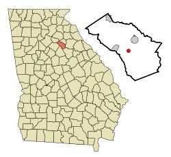 Location in Oconee County and the state of Georgia | |
| Coordinates: 33°48′59″N 83°26′11″W | |
| Country | United States |
| State | Georgia |
| County | Oconee |
| Area | |
| • Total | 0.79 sq mi (2.05 km2) |
| • Land | 0.78 sq mi (2.03 km2) |
| • Water | 0.01 sq mi (0.02 km2) |
| Elevation | 781 ft (238 m) |
| Population (2010) | |
| • Total | 224 |
| • Estimate (2019)[2] | 274 |
| • Density | 349.94/sq mi (135.11/km2) |
| Time zone | UTC-5 (Eastern (EST)) |
| • Summer (DST) | UTC-4 (EDT) |
| ZIP code | 30621 |
| Area code(s) | 706 |
| FIPS code | 13-08200[3] |
| GNIS feature ID | 0311456[4] |
| Website | www |
History
The community was named after W. H. Bishop, a local landowner and politician.[6] A post office called Bishop has been in operation since 1889.[7] The town was incorporated in 1890.[8]
Geography
Bishop is located at 33°48′59″N 83°26′11″W (33.816355, -83.436304).[9]
According to the United States Census Bureau, the town has a total area of 0.8 square miles (2.1 km2), all land.
Demographics
| Historical population | |||
|---|---|---|---|
| Census | Pop. | %± | |
| 1910 | 268 | — | |
| 1920 | 300 | 11.9% | |
| 1930 | 241 | −19.7% | |
| 1940 | 217 | −10.0% | |
| 1950 | 253 | 16.6% | |
| 1960 | 214 | −15.4% | |
| 1970 | 235 | 9.8% | |
| 1980 | 172 | −26.8% | |
| 1990 | 158 | −8.1% | |
| 2000 | 146 | −7.6% | |
| 2010 | 224 | 53.4% | |
| Est. 2019 | 274 | [2] | 22.3% |
| U.S. Decennial Census[10] | |||
As of the census[3] of 2000, there were 146 people, 57 households, and 38 families residing in the town. The population density was 188.2 people per square mile (72.3/km2). There were 67 housing units at an average density of 86.4 per square mile (33.2/km2). The racial makeup of the town was 100.00% White.
There were 57 households, out of which 29.8% had children under the age of 18 living with them, 57.9% were married couples living together, 7.0% had a female householder with no husband present, and 31.6% were non-families. 26.3% of all households were made up of individuals, and 12.3% had someone living alone who was 65 years of age or older. The average household size was 2.56 and the average family size was 2.97.
In the town, the population was spread out, with 24.7% under the age of 18, 9.6% from 18 to 24, 27.4% from 25 to 44, 20.5% from 45 to 64, and 17.8% who were 65 years of age or older. The median age was 36 years. For every 100 females, there were 87.2 males. For every 100 females age 18 and over, there were 89.7 males.
The median income for a household in the town was $43,125, and the median income for a family was $51,250. Males had a median income of $31,250 versus $16,875 for females. The per capita income for the town was $15,630. There were 2.8% of families and 4.8% of the population living below the poverty line, including no under eighteens and 15.8% of those over 64.
References
- "2019 U.S. Gazetteer Files". United States Census Bureau. Retrieved July 9, 2020.
- "Population and Housing Unit Estimates". United States Census Bureau. May 24, 2020. Retrieved May 27, 2020.
- "U.S. Census website". United States Census Bureau. Retrieved 2008-01-31.
- "US Board on Geographic Names". United States Geological Survey. 2007-10-25. Retrieved 2008-01-31.
- United States Census
- Krakow, Kenneth K. (1975). Georgia Place-Names: Their History and Origins (PDF). Macon, GA: Winship Press. p. 19. ISBN 0-915430-00-2.
- "County". Jim Forte Postal History. Retrieved 11 September 2017.
- Candler, Allen Daniel; Evans, Clement Anselm (1906). Georgia: Comprising Sketches of Counties, Towns, Events, Institutions, and Persons. State historical association. p. 186.
- "US Gazetteer files: 2010, 2000, and 1990". United States Census Bureau. 2011-02-12. Retrieved 2011-04-23.
- "Census of Population and Housing". Census.gov. Retrieved June 4, 2015.
Municipalities and communities of Oconee County, Georgia, United States | ||
|---|---|---|
| Towns | 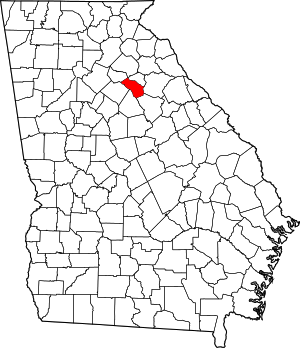 Map of Georgia highlighting Oconee County | |
| Unincorporated communities | ||
| Ghost town | ||
| Footnotes | ‡This populated place also has portions in an adjacent county or counties | |
| Authority control |
|
|---|