Biggers, Arkansas
Biggers is a town in Randolph County, Arkansas, United States. The population was 355 at the 2000 census.
Biggers, Arkansas | |
|---|---|
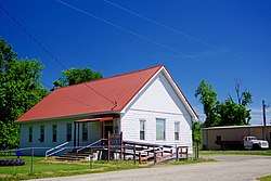 City Hall | |
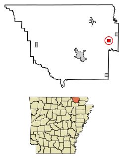 Location of Biggers in Randolph County, Arkansas. | |
| Coordinates: 36°19′56″N 90°48′27″W | |
| Country | United States |
| State | Arkansas |
| County | Randolph |
| Area | |
| • Total | 1.02 sq mi (2.64 km2) |
| • Land | 1.00 sq mi (2.60 km2) |
| • Water | 0.02 sq mi (0.05 km2) |
| Elevation | 279 ft (85 m) |
| Population (2010) | |
| • Total | 347 |
| • Estimate (2019)[2] | 339 |
| • Density | 338.32/sq mi (130.57/km2) |
| Time zone | UTC-6 (Central (CST)) |
| • Summer (DST) | UTC-5 (CDT) |
| ZIP code | 72413 |
| Area code(s) | 870 |
| FIPS code | 05-06040 |
| GNIS feature ID | 0046616 |
History
During the first half of the 19th century, what is now Biggers was part of a large plantation owned by Arkansas governor Thomas Stevenson Drew. In 1889, a businessman named B.F. Bigger, the town’s namesake, bought the land at the town site and established a ferry and distillery. In 1901, a depot was established with the completion of the Southern Missouri and Arkansas Railroad (later part of the St. Louis–San Francisco Railway).[3]
Geography
Biggers is located at 36°19′56″N 90°48′27″W (36.332334, -90.807521).[4] The Current River passes through the northern part of town.
According to the United States Census Bureau, the town has a total area of 1.0 square mile (2.6 km2), of which 1.0 square mile (2.6 km2) is land and 0.04 square miles (0.10 km2) (1.92%) is water.
List of highways
US Highways 62 and 67 run concurrently, just to the southeast of town; no actual state or federal maintained highway runs through the town, however, the original U.S. Highway 67 did run through the town as the current day, "Biggers-Reyno Road" before the town was bypassed and the original route was decommissioned.
Demographics
| Historical population | |||
|---|---|---|---|
| Census | Pop. | %± | |
| 1910 | 435 | — | |
| 1920 | 447 | 2.8% | |
| 1930 | 466 | 4.3% | |
| 1940 | 456 | −2.1% | |
| 1950 | 333 | −27.0% | |
| 1960 | 274 | −17.7% | |
| 1970 | 372 | 35.8% | |
| 1980 | 363 | −2.4% | |
| 1990 | 337 | −7.2% | |
| 2000 | 355 | 5.3% | |
| 2010 | 347 | −2.3% | |
| Est. 2019 | 339 | [2] | −2.3% |
| U.S. Decennial Census[5] 2014 Estimate[6] | |||
As of the census[7] of 2000, there were 355 people, 139 households, and 99 families residing in the town. The population density was 347.9 inhabitants per square mile (134.4/km2). There were 149 housing units at an average density of 146.0 per square mile (56.4/km2). The racial makeup of the town was 95.49% White, 1.97% Black or African American, 1.41% Native American, 0.28% from other races, and 0.85% from two or more races. 0.28% of the population were Hispanic or Latino of any race.
There were 139 households, out of which 28.1% had children under the age of 18 living with them, 61.9% were married couples living together, 6.5% had a female householder with no husband present, and 28.1% were non-families. 23.7% of all households were made up of individuals, and 16.5% had someone living alone who was 65 years of age or older. The average household size was 2.55 and the average family size was 2.98.
In the town, the population was spread out, with 24.2% under the age of 18, 7.3% from 18 to 24, 26.2% from 25 to 44, 20.8% from 45 to 64, and 21.4% who were 65 years of age or older. The median age was 37 years. For every 100 females, there were 95.1 males. For every 100 females age 18 and over, there were 90.8 males.
The median income for a household in the town was $26,250, and the median income for a family was $31,250. Males had a median income of $19,821 versus $17,917 for females. The per capita income for the town was $10,926. About 13.5% of families and 17.3% of the population were below the poverty line, including 18.9% of those under age 18 and 22.5% of those age 65 or over.
Education
Corning School District serves Biggers. The consolidation of Biggers-Reyno School District into the Corning District was effective July 1, 2004.[8] Prior to that point, the community was served by Biggers-Reyno High School in Biggers,[9] and Biggers-Reyno Elementary School in Reyno.[10]
Education for some unincorporated areas near Biggers is provided by Pocahontas School District, which leads students to graduate from Pocahontas High School.[11]
References
| Wikimedia Commons has media related to Biggers, Arkansas. |
- "2019 U.S. Gazetteer Files". United States Census Bureau. Retrieved June 30, 2020.
- "Population and Housing Unit Estimates". United States Census Bureau. May 24, 2020. Retrieved May 27, 2020.
- Derek Allen Clements, "Biggers (Randolph County)," Encyclopedia of Arkansas, 2017.
- "US Gazetteer files: 2010, 2000, and 1990". United States Census Bureau. 2011-02-12. Retrieved 2011-04-23.
- "Census of Population and Housing". Census.gov. Retrieved June 4, 2015.
- "Annual Estimates of the Resident Population for Incorporated Places: April 1, 2010 to July 1, 2014". Archived from the original on May 22, 2015. Retrieved June 4, 2015.
- "U.S. Census website". United States Census Bureau. Retrieved 2008-01-31.
- "ConsolidationAnnex_from_1983.xls." Arkansas Department of Education. Retrieved on October 13, 2017.
- "Biggers-Reyno High School." Biggers-Reyno School District. June 10, 2001. Retrieved on October 14, 2017. "Bigger-Reyno [sic] High School 3440 Biggers-Reyno Road Biggers, Arkansas 72413"
- "Biggers-Reyno Elementary School." Biggers-Reyno School District. June 10, 2001. Retrieved on October 14, 2017.
- "SCHOOL DISTRICT REFERENCE MAP (2010 CENSUS): Randolph County, AR." U.S. Census Bureau. Retrieved on October 14, 2017.
Municipalities and communities of Randolph County, Arkansas, United States | ||
|---|---|---|
| Cities |  Map of Arkansas highlighting Randolph County | |
| Towns | ||
| Unincorporated communities |
| |
| Townships | ||
| Ghost towns |
| |