Benton Heights, Michigan
Benton Heights is an unincorporated community in Berrien County in the U.S. state of Michigan. It is also a census-designated place (CDP) for statistical purposes without any legal status as an incorporated municipality. The population was 4,084 at the 2010 Census,[3] down from 5,458 at the 2000 census. The community is a part of Benton Charter Township and is adjacent to the city of Benton Harbor.
Benton Heights, Michigan | |
|---|---|
 Location within Berrien County | |
 Benton Heights Location within the state of Michigan | |
| Coordinates: 42°07′52″N 86°24′26″W | |
| Country | United States |
| State | Michigan |
| County | Berrien |
| Township | Benton |
| Area | |
| • Total | 3.9 sq mi (10.0 km2) |
| • Land | 3.9 sq mi (10.0 km2) |
| • Water | 0.0 sq mi (0.0 km2) |
| Elevation | 633 ft (193 m) |
| Population (2010) | |
| • Total | 4,084 |
| • Density | 1,061/sq mi (409.8/km2) |
| Time zone | UTC-5 (Eastern (EST)) |
| • Summer (DST) | UTC-4 (EDT) |
| ZIP code(s) | 49022 |
| Area code(s) | 269 |
| FIPS code | 26-07540[2] |
| GNIS feature ID | 0621145[1] |
History
Benton Heights was formerly called "Euclid Center"; the present name was adopted in 1957.[4]
Geography
According to the United States Census Bureau, the CDP has a total area of 3.9 square miles (10.0 km2), all land.[3]
Demographics
As of the census[2] of 2000, there were 5,458 people, 1,944 households, and 1,310 families residing in the CDP. The population density was 1,419.8 per square mile (548.8/km2). There were 2,175 housing units at an average density of 565.8 per square mile (218.7/km2). The racial makeup of the CDP was 30.51% White, 65.63% Black or African American, 0.40% Native American, 0.13% Asian, 0.88% from other races, and 2.46% from two or more races. Hispanic or Latino of any race were 1.45% of the population.
There were 1,944 households, out of which 39.6% had children under the age of 18 living with them, 28.4% were married couples living together, 32.7% had a female householder with no husband present, and 32.6% were non-families. 27.6% of all households were made up of individuals, and 10.2% had someone living alone who was 65 years of age or older. The average household size was 2.74 and the average family size was 3.31.
In the CDP, the population was spread out, with 36.3% under the age of 18, 8.6% from 18 to 24, 25.8% from 25 to 44, 17.1% from 45 to 64, and 12.2% who were 65 years of age or older. The median age was 29 years. For every 100 females, there were 88.1 males. For every 100 females age 18 and over, there were 79.6 males.
The median income for a household in the CDP was $19,651, and the median income for a family was $22,610. Males had a median income of $24,740 versus $17,816 for females. The per capita income for the CDP was $9,959. About 31.3% of families and 38.0% of the population were below the poverty line, including 53.2% of those under age 18 and 19.6% of those age 65 or over.
References
- U.S. Geological Survey Geographic Names Information System: Benton Heights, Michigan
- "U.S. Census website". United States Census Bureau. Retrieved 2008-01-31.
- "Geographic Identifiers: 2010 Demographic Profile Data (G001): Benton CDP, Michigan". U.S. Census Bureau, American Factfinder. Archived from the original on February 12, 2020. Retrieved January 13, 2014.
- "Euclid Center Votes New Name". The News-Palladium. Benton Harbor, MI. February 25, 1957. p. 1.
Municipalities and communities of Berrien County, Michigan, United States | ||
|---|---|---|
| Cities | 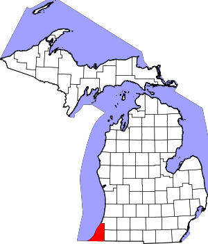 Map of Michigan highlighting Berrien County | |
| Villages | ||
| Charter townships | ||
| General law townships | ||
| CDPs | ||
| Other unincorporated communities | ||
| Indian reservation | ||
| Footnotes | ‡This populated place also has portions in an adjacent county or counties | |