Balatan, Camarines Sur
Balatan, officially the Municipality of Balatan (Rinconada Bikol: Banwaān ka Balatan; Tagalog: Bayan ng Balatan), is a 4th class municipality in the province of Camarines Sur, Philippines. According to the 2015 census, it has a population of 30,922 people.[3]
Balatan | |
|---|---|
| Municipality of Balatan | |
 | |
 Seal | |
| Motto(s): Balateño, Oragon! | |
 Map of Camarines Sur with Balatan highlighted | |
OpenStreetMap 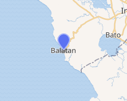
| |
.svg.png) Balatan Location within the Philippines | |
| Coordinates: 13°19′N 123°14′E | |
| Country | |
| Region | Bicol Region (Region V) |
| Province | Camarines Sur |
| District | 5th district |
| Founded | 1951 |
| Barangays | 17 (see Barangays) |
| Government | |
| • Type | Sangguniang Bayan |
| • Mayor | Nena B. Bagasbas |
| • Vice Mayor | Gabriel R. Huab |
| • Congressman | Jocelyn F. Fortuno |
| • Electorate | 19,891 voters (2019) |
| Area | |
| • Total | 93.09 km2 (35.94 sq mi) |
| Population (2015 census)[3] | |
| • Total | 30,922 |
| • Density | 330/km2 (860/sq mi) |
| • Households | 5,801 |
| Economy | |
| • Income class | 4th municipal income class |
| • Poverty incidence | 51.68% (2015)[4] |
| • Revenue (₱) | 79,346,071.13 (2016) |
| Time zone | UTC+8 (PST) |
| ZIP code | 4436 |
| PSGC | |
| IDD : area code | +63 (0)54 |
| Climate type | tropical rainforest climate |
| Native languages | Rinconada Bikol Central Bikol Tagalog |
Balatan was founded by Don Gregorio Balatan, also its first mayor and founder of the municipality's first school, the Balatan Institute Memorial High School (formerly Balatan Institute). The current and the 6th mayor is Ernesto "Bares" Arillas Bagasbas.
The town's economy is supported by people from the Burias Island of Masbate province who are mostly trading their products in this small municipality. Balatan celebrates the Pintakasi and Pagkamundag Festivals annually on February 18 and December 1–3 respectively.
History
Balatan is not an old municipality like the other towns in the fourth district. It was once a sitio known as Siramag which belonged to the town of Nabua.
In 1951, Camarines Sur Provincial Board Member Gregorio O. Balatan Sr. proposed a resolution to divide Nabua into two municipalities: Nabua and Balatan. Balatan then was separated from its mother town and became independent on December 3, 1951 under Executive Order (EO) No. 485 of then President Elpidio Quirino. It was named after the father of Board Member Balatan, Don Rufino Balatan.
Seven years after its establishment as a town, the Parish of Our Mother of Perpetual Help was erected by Archbishop Pedro P. Santos. Balatan observes the annual Pintakasi fiesta celebration every February 16–18.
Geography
This town bounded by the municipalities of Bula, Bato, and Nabua, as well as bordering on the Ragay Gulf.
Animasola Island is part of this municipality's territory.
Barangays
Balatan is politically subdivided into 17 barangays.
- Cabanbanan
- Cabungan
- Camangahan
- Cayogcog
- Coguit
- Duran
- Laganac
- Luluasan
- Montenegro (formerly Maguiron, renamed in honor of Mayor Candido Montenegro)
- Pararao (Parao)
- Siramag (Poblacion)
- Pulang Daga
- Sagrada Nacacale
- San Francisco
- Santiago Nacacale
- Tapayas
- Tomatarayo
Climate
| Climate data for Balatan, Camarines Sur | |||||||||||||
|---|---|---|---|---|---|---|---|---|---|---|---|---|---|
| Month | Jan | Feb | Mar | Apr | May | Jun | Jul | Aug | Sep | Oct | Nov | Dec | Year |
| Average high °C (°F) | 33 (91) |
32 (90) |
36 (97) |
37 (99) |
38 (100) |
37 (99) |
35 (95) |
33 (91) |
33 (91) |
34 (93) |
33 (91) |
32 (90) |
34 (94) |
| Average low °C (°F) | 27 (81) |
27 (81) |
29 (84) |
31 (88) |
32 (90) |
32 (90) |
31 (88) |
29 (84) |
30 (86) |
29 (84) |
28 (82) |
28 (82) |
29 (85) |
| Average precipitation mm (inches) | 36.63 (1.44) |
49.6 (1.95) |
46.66 (1.84) |
78.81 (3.10) |
93.81 (3.69) |
135.51 (5.34) |
326.31 (12.85) |
406.10 (15.99) |
214.85 (8.46) |
313.98 (12.36) |
76.2 (3.00) |
262 (10.3) |
2,040.46 (80.32) |
| Average rainy days | 19 | 23 | 17 | 19 | 23 | 27 | 31 | 29 | 27 | 29 | 24 | 29 | 297 |
| Source: World Weather Online[5] | |||||||||||||
Demographics
|
| |||||||||||||||||||||||||||||||||
| Source: Philippine Statistics Authority[3][6][7][8] | ||||||||||||||||||||||||||||||||||
In the 2015 census, the population of Balatan, Camarines Sur, was 30,922 people,[3] with a density of 330 inhabitants per square kilometre or 850 inhabitants per square mile.
Rinconada Bikol is the mother tongue spoken by 96.67% of the population.
In the period 1960 to 1997, there was an average of 97.60% of total housing units in the municipality that were occupied while only 3.40% were vacant.
Literacy Rate:
- Urban area literacy rate: 98.29%
- Rural area literacy rate: 97.17%
Religious affiliation:
- Catholics: 96.50%
- Iglesia Ni Cristo: 2.00%
- Others: 1.50%
Economy

Minor central business district consists of public market, grocery, sari-sari stores, welding and vulcanizing shop, calling office, fish dealer, bakery, barber shop, beauty parlor, billiard hall, coco lumber dealer, junk shop and cable network. Neighborhood centers consists of sari-sari stores, bakery, videoke/bar, mini-sound system, repair shops, piggery, cockpit, bakery, furniture shop, fish dealer, repair and welding shops, copra dealer, among others.
The only industrial business is a mini-containerized ice plant which caters to the needs of rich-fishing activities, and a few rice mills. There are six beach resorts catering to domestic tourism.
Agriculture sector:
- 75.04% of the total municipal land area are devoted to crops such as rice, corn, vegetables, legumes, coffee, high value crops and fruits, sugar cane, coconut, banana, abaca, root crops and industrial crops
- For livestock production: 37 private owners engaged in raising carabaos, cattle, swine or poultry
- For fishery production: 2 commercial, 298 local.
Infrastructure
Transportation

Land transportation refers to the present road circulation system as well as bus, van, and jeepney terminal. Marine transportation facility operates through the existing Balatan Municipal Port of Ragay Gulf.
Utilities
Water supply is distributed under Level III and Level I water systems: Level III is operated by the Balatan Water District; Level I water supply system consisting of either shallow wells, deep wells or improved spring provides alternative water supply source.
Power and electricity:
- 95% of the total households in the municipality are now served with electricity
- Barangays with electricity are serviced by CASURECO III
Communication facilities include the postal services, telegraph and telegraphic transfer service facilities, and telephone services.
Public services
Health
- Crude birth rate: 19.97%
- Crude death rate: 2.05%
- Infant mortality rate: 11.49%
- Young child mortality: 1.53%
- Maternal mortality rate: 3.22%
- General medical consultation rate: 358.68%
- Hospitalization rate: 6.57%
- Health service and facilities implemented by the municipal health office through its Rural Health Unit
- Community Hospital (under-construction)
- Existence of four barangay health stations
Protective
Facilities for protective services include the police headquarters, police substation, fire station, municipal jail, and Coast Guard.
Social welfare
Existing social welfare organizations or institutions include CVRD’S People Organization, KALIPI (Women) PYM, Federation of Day Care Workers, 4P's, RincoMESA(Rinconada Movement for Environment and Sustainable Agriculture) and Kalahi-CIDDS.
Education

- 17 public elementary schools
- 1 private elementary school
- 3 public secondary schools
- 1 institution offering vocational/technical education
- 1 Public Tertiary Institution, to be operational by 2012
- Community College (under-construction)
References
- "Municipality". Quezon City, Philippines: Department of the Interior and Local Government. Retrieved 31 May 2013.
- "Province: Camarines Sur". PSGC Interactive. Quezon City, Philippines: Philippine Statistics Authority. Retrieved 12 November 2016.
- Census of Population (2015). "Region V (Bicol Region)". Total Population by Province, City, Municipality and Barangay. PSA. Retrieved 20 June 2016.
- "PSA releases the 2015 Municipal and City Level Poverty Estimates". Quezon City, Philippines. Retrieved 1 January 2020.
- "Balatan, Camarines Sur: Average Temperatures and Rainfall". World Weather Online. Retrieved 29 October 2017.
- Census of Population and Housing (2010). "Region V (Bicol Region)". Total Population by Province, City, Municipality and Barangay. NSO. Retrieved 29 June 2016.
- Censuses of Population (1903–2007). "Region V (Bicol Region)". Table 1. Population Enumerated in Various Censuses by Province/Highly Urbanized City: 1903 to 2007. NSO.
- "Province of Camarines Sur". Municipality Population Data. Local Water Utilities Administration Research Division. Retrieved 17 December 2016.
External links
| Wikimedia Commons has media related to Balatan, Camarines Sur. |
Places adjacent to Balatan, Camarines Sur | ||||||||||
|---|---|---|---|---|---|---|---|---|---|---|
| ||||||||||
Pili (capital) | |
| Municipalities | |
| Component city | |
| Independent component city |
|