Astoria Township, Fulton County, Illinois
Astoria Township is one of twenty-six townships in Fulton County, Illinois, USA. As of the 2010 census, its population was 1,464 and it contained 665 housing units.[2]
Astoria Township | |
|---|---|
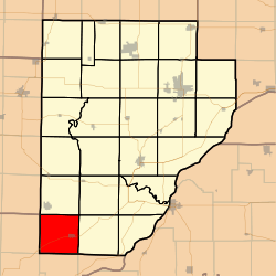 Location in Fulton County | |
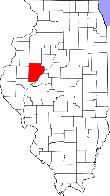 Fulton County's location in Illinois | |
| Coordinates: 40°13′53″N 90°23′58″W | |
| Country | United States |
| State | Illinois |
| County | Fulton |
| Established | November 6, 1849 |
| Area | |
| • Total | 36.56 sq mi (94.7 km2) |
| • Land | 36.13 sq mi (93.6 km2) |
| • Water | 0.43 sq mi (1.1 km2) 1.18% |
| Elevation | 679 ft (207 m) |
| Population (2010) | |
| • Estimate (2016)[1] | 1,396 |
| • Density | 40.5/sq mi (15.6/km2) |
| Time zone | UTC-6 (CST) |
| • Summer (DST) | UTC-5 (CDT) |
| ZIP codes | 61484, 61501 |
| FIPS code | 17-057-02648 |
Geography
According to the 2010 census, the township has a total area of 36.56 square miles (94.7 km2), of which 36.13 square miles (93.6 km2) (or 98.82%) is land and 0.43 square miles (1.1 km2) (or 1.18%) is water.[2]
Cities, towns, villages
- Astoria
- Washington (no longer exists due to another town in the state with the name). The village contained 48 lots. It was laid out in 1836 & it had a small general store, a few cabins, blacksmith shop and a school house nearby which was also used to hold church services. The village never grew & ceased to exist.
- Vienna was laid out by Zach Gilbert, Benjamin Clark & a Mr Bacon on June 9, 1837. Due to there being another town in the state with this name it was changed to Astoria.
Cemeteries
The township contains these five cemeteries: Astoria, Oak Grove, Salem, South Fulton and Union Chapel.
Major highways

Airports and landing strips
- Campbell Landing Strip
Lakes
- Emmanuel Lake
School districts
- Astoria Community Unit School District 1
- V I T Community Unit School District 2
Political districts
- Illinois' 17th congressional district
- State House District 94
- State Senate District 47
References
- "Astoria Township, Fulton County, Illinois". Geographic Names Information System. United States Geological Survey. Retrieved 2010-01-16.
- United States Census Bureau 2007 TIGER/Line Shapefiles
- United States National Atlas
- "Population and Housing Unit Estimates". Retrieved June 9, 2017.
- "Population, Housing Units, Area, and Density: 2010 - County -- County Subdivision and Place -- 2010 Census Summary File 1". United States Census. Archived from the original on 2020-02-12. Retrieved 2013-05-28.
- "Census of Population and Housing". Census.gov. Retrieved June 4, 2016.
External links
Places adjacent to Astoria Township, Fulton County, Illinois | |
|---|---|
Municipalities and communities of Fulton County, Illinois, United States | ||
|---|---|---|
| Cities | Map of Illinois highlighting Fulton County | |
| Town | ||
| Villages | ||
| Townships | ||
| Unincorporated communities | ||
| Ghost towns | ||
| Footnotes | ‡This populated place also has portions in an adjacent county or counties | |
This article is issued from Wikipedia. The text is licensed under Creative Commons - Attribution - Sharealike. Additional terms may apply for the media files.