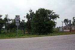
Arkansas Highway 244
Arkansas Highway 244 is the name of two state highways in Northwest Arkansas.[1][2] Both routes serve as brief connectors.
| ||||
|---|---|---|---|---|
| Route information | ||||
| Maintained by ArDOT | ||||
| Section 1 | ||||
| Length | 6.68 mi (10.75 km) | |||
| West end | ||||
| East end | ||||
| Section 2 | ||||
| Length | 0.55 mi (0.89 km) | |||
| West end | ||||
| East end | ||||
| Highway system | ||||
| ||||

Section 1
Arkansas Highway 244 is a state highway of 6.68 miles (10.75 km) in Washington and Benton Counties.[1][2]
Route description
AR 244 ends at Arkansas Highway 16 near Wedington.
Segment one begins at AR 59 north of Cincinnati in Washington County and runs east. The route shifts north slightly to run along the Benton/Washington County for 3.17 miles (5.10 km) until terminating at AR 16.
Major intersections
| County | Location | mi[1][2] | km | Destinations | Notes |
|---|---|---|---|---|---|
| Washington | Cincinnati | 0.0 | 0.0 | Western terminus | |
| Wedington | 6.68 | 10.75 | Eastern terminus | ||
| 1.000 mi = 1.609 km; 1.000 km = 0.621 mi | |||||
Section 2
Arkansas Highway 244 is a state highway of 0.55 miles (0.89 km) in extreme western Washington County.[1]
Route description
The route begins at the Oklahoma state line and Oklahoma State Highway 51 north of Evansville and runs east to terminate at AR 59.
See also
References
- "Washington County, Arkansas." Arkansas State Highway and Transportation Department. AHTD Washington County map Retrieved on October 29, 2010.
- "Benton County, Arkansas." Arkansas State Highway and Transportation Department. AHTD Benton County map Retrieved on October 29, 2010.
External links
![]()
This article is issued from Wikipedia. The text is licensed under Creative Commons - Attribution - Sharealike. Additional terms may apply for the media files.