Arkansas Highway 122
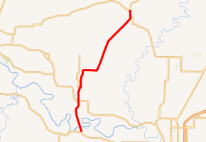
Arkansas Highway 122 (AR 122, Hwy. 122) is an east–west state highway in Independence County, Arkansas. The route of 16.49 miles (26.54 km) runs from Highway 14 near Oil Trough north and east through Newark to Highway 25 near Cord.[2]
| ||||
|---|---|---|---|---|
| ||||
| Route information | ||||
| Maintained by ArDOT | ||||
| Length | 16.49 mi[1] (26.54 km) | |||
| Major junctions | ||||
| West end | ||||
| North end | ||||
| Location | ||||
| Counties | Independence | |||
| Highway system | ||||
| ||||

Route description
AR 122 begins near Oil Trough at Highway 14. The route runs north past Akron Cemetery to intersect Highway 69 before entering Newark. Highway 112 runs as Locust Street and intersects Highway 69B (6th Street) before passing the Dearing House, which is listed on the National Register of Historic Places, and exiting town northbound.[3] The route passes through a rural part of the county lined with trees and farms before serving as the northern terminus for Highway 37 at Cord. Less than 1 mile (1.6 km) north of this intersection, Highway 122 has a junction with Highway 25, where Highway 122 terminates.
Traffic counts from the Arkansas State Highway and Transportation Department (AHTD) reveal that approximately 1100–1800 vehicles per day (VPD) use Highway 122. These counts are entirely within this range except for the rural portion between Newark and Cord, which sees an average of 660 VPD.[1]
Major intersections
The entire route is in Independence County.
| Location | mi[1] | km | Destinations | Notes | |
|---|---|---|---|---|---|
| | 0.00 | 0.00 | Southern terminus | ||
| | 3.63 | 5.84 | |||
| Newark | 5.07 | 8.16 | |||
| Cord | 15.71 | 25.28 | Northern terminus of AR 37 | ||
| 16.49 | 26.54 | Northern terminus | |||
| 1.000 mi = 1.609 km; 1.000 km = 0.621 mi | |||||
References
- Planning and Research Division (2010). "Arkansas Road Log Database". Arkansas State Highway and Transportation Department. Archived from the original (Database) on 23 June 2011. Retrieved June 9, 2011.
- General Highway Map, Independence County, Arkansas (PDF) (Map). 1:62500. Cartography by Planning and Research Division. Arkansas State Highway and Transportation Department. 2006. Retrieved October 14, 2011.
- Map of Magness and Newark, Independence County, Arkansas (PDF) (Map). Cartography by Planning and Research. Arkansas State Highway and Transportation Department. 2008. Retrieved October 14, 2011.