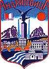
Andrijevica Municipality
Andrijevica Municipality is one of the municipalities of Montenegro. The center is Town of Andrijevica. Its territory is outspread on 340 km2 and it is surrounded by massives of mountains Komovi, Bjelasica and Prokletije in northeastern Montenegro.
Andrijevica Municipality Opština Andrijevica | |
|---|---|
 Coat of arms | |
 Andrijevica Municipality in Montenegro | |
| Country | Montenegro |
| Seat | Andrijevica |
| Area | |
| • Total | 283 km2 (109 sq mi) |
| Elevation | 740 m (2,430 ft) |
| Population (2019) | |
| • Total | 4,585 |
| • Density | 16/km2 (42/sq mi) |
| Time zone | UTC+1 (CET) |
| • Summer (DST) | UTC+2 (CEST) |
| Area code(s) | +382 51 |
| ISO 3166 code | ME-01 |
| Vehicle registration | AN |
| Website | www |
Geography and tourism
Andrijevica is surrounded by the mountains of Komovi, Bjelasica and Prokletije, situated on a terrace 40m above river Lim. Tourist activities in the area includes mountaineering (alpinism, hiking), biking, rafting, sports (soccer, basketball), fishing, etc. Main tourist attraction is mountain Komovi (2461 m). This mountain can be accessed by a car in less than 45 minutes, by the mountainous Andrijevica-Mateševo road. Andrijevica is connected with rest of Montenegro by two-laned motorways. Local roads connect Andrijevica with Berane and Kolašin (both around 30 km (19 mi) away), where local roads merge with E65/E80 road, which is main road connection of Montenegro's coast and Podgorica with northern Montenegro and Serbia. Andrijevica is on the corridor of the future Bar-Boljare motorway. Podgorica Airport is around 120 km (75 mi) away, and has regular flights to major European destinations.
Administration
The municipal parliament consists of 31 deputies elected directly for a five-year term. Following the last local election, the ruling DPS has an absolute majority with 20 deputies.
| Party | Seats | Gov't? |
|---|---|---|
| Democratic Party of Socialists (DPS) | 20 | Yes |
| Democratic Front (DF) | 5 | No |
| Socialist People's Party (SNP) | 5 | No |
| Social Democrats (SD) | 1 | Yes |
Demographics
Andrijevica Municipality in 2011 had a population of 5,071.[2]
|
|
|
Gallery
 World War II memorial in Andrijevica
 Vasojevići Eastern Orthodox Church
 Komovi Mounthain, Andrijevica Municipality
 Market in the town of Andrijevica, 1903
References