Anakie Siding, Queensland
Anakie Siding is a rural locality in the Central Highlands Region, Queensland, Australia.[1] The town of Anakie is within the locality (23.5511°S 147.7475°E).[2] It is a sapphire mining area.
| Anakie Siding Queensland | |||||||||||||||
|---|---|---|---|---|---|---|---|---|---|---|---|---|---|---|---|
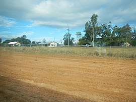 Outskirts of Anakie, 2013 | |||||||||||||||
 Anakie Siding | |||||||||||||||
| Coordinates | 23.5750°S 147.8075°E | ||||||||||||||
| Postcode(s) | 4702 | ||||||||||||||
| Area | 574.4 km2 (221.8 sq mi) | ||||||||||||||
| Time zone | AEST (UTC+10:00) | ||||||||||||||
| Location | |||||||||||||||
| LGA(s) | Central Highlands Region | ||||||||||||||
| State electorate(s) | Gregory | ||||||||||||||
| Federal Division(s) | Flynn | ||||||||||||||
| |||||||||||||||
Anakie was one of three towns within the locality of The Gemfields (the others being Sapphire and Rubyvale) until 17 April 2020, when the Queensland Government decided to replace The Gemfields with three new localities (Anakie Siding, Sapphire Central and Rubyvale) based around each of the three towns respectively. The boundaries of the localities of Emerald and Gindie were also modified to accommodate the introduction of the locality of Anakie Siding with an area of 574.4 square kilometres (221.8 sq mi).[3][4][5][6]
Geography
.jpg)
The town is located just to the south of the Capricorn Highway, 44 kilometres (27 mi) west of Emerald.
Anakie is on the Central Western railway line running from Rockhampton west to Longreach. The town is served by the Anakie railway station (23.5528°S 147.7453°E).[7][8]
There is a billabong to the south-east of the town (23.5531°S 147.7485°E).[8]
In the north-west of the locality is The Three Sisters Range which extends north into Sapphire Central (midpoint 23.5124°S 147.6542°E). It contains a number of unnamed peaks rising to 370 metres (1,210 ft) above sea level.[9]
History
Anakie Post Office opened on 12 March 1894 (a receiving office had been open since 1885).[10]
Anakie Provisional School was opened 27 July 1885.[11] On 1 January 1909 it became Anakie State School. It had occasional closures due to low student numbers.[12]
Anakie was one of three towns within the locality of The Gemfields (the others being Sapphire and Rubyvale) until 17 April 2020, when the Queensland Government decided to replace The Gemfields with three new localities (Anakie Siding, Sapphire Central and Rubyvale) based around each of the three towns respectively. The boundaries of the localities of Emerald and Gindie were also modified to accommodate the introduction of the locality of Anakie Siding with an area of 574.4 square kilometres (221.8 sq mi).[3][4][5][6]
Transport
Greyhound buses run west (and return) from Rockhampton along the Capricorn Highway.
Emerald (~44 km east) has an airport with regular services to Brisbane and other points.
Education
Anakie State School is a government primary (Prep-6) school for boys and girls at Cook Street (23.5540°S 147.7458°E).[13][14] In 2017, the school had an enrolment of 83 students with 7 teachers (6 full-time equivalent) and 7 non-teaching staff (4 full-time equivalent).[15]
There are no secondary schools in Anakie. The nearest secondary school is Emerald State High School in Emerald to the east.[8]
References
- "Anakie - bounded locality in the Central Highlands Region (entry 50495)". Queensland Place Names. Queensland Government. Retrieved 17 July 2020.
- "Anakie - population centre in the Central Highlands Region (entry 558)". Queensland Place Names. Queensland Government. Retrieved 17 July 2020.
- "Recent place name decisions: Job number 18-115: The Gemfields". Queensland Government. 17 April 2020. Archived from the original on 17 July 2020. Retrieved 17 July 2020.
- "Proposed Locality Boundaries and Names: Anakie Siding, Argyll, Emerald, Gindie, Lochington, Minerva, Rubyvale and Sapphire Central" (PDF). Queensland Government. 2019. Archived (PDF) from the original on 17 July 2020. Retrieved 17 July 2020.
- "Locality Boundaries and Names: Anakie Siding, Argyll, Emerald, Gindie, Lochington, Minerva, Rubyvale and Sapphire Central" (PDF). Queensland Government. 17 April 2020. Archived (PDF) from the original on 17 July 2020. Retrieved 17 July 2020.
- "Queensland Globe". State of Queensland. Retrieved 17 July 2020.
- "Anakie - railway station in Central Highlands Region (entry 560)". Queensland Place Names. Queensland Government. Retrieved 22 March 2020.
- "Queensland Globe". State of Queensland. Retrieved 22 March 2020.
- "The Three Sisters Range - mountain range in the Central Highlands Region (entry 34162)". Queensland Place Names. Queensland Government. Retrieved 17 July 2020.
- Premier Postal History. "Post Office List". Premier Postal Auctions. Retrieved 10 May 2014.
- "Opening and closing dates of Queensland Schools". Queensland Government. Retrieved 18 April 2019.
- Queensland Family History Society (2010), Queensland schools past and present (Version 1.01 ed.), Queensland Family History Society, ISBN 978-1-921171-26-0
- "State and non-state school details". Queensland Government. 9 July 2018. Archived from the original on 21 November 2018. Retrieved 21 November 2018.
- "Anakie State School". Retrieved 21 November 2018.
- "ACARA School Profile 2017". Archived from the original on 22 November 2018. Retrieved 22 November 2018.
External links
| Wikimedia Commons has media related to Anakie, Queensland. |