Agarak, Lori
Agarak (Armenian: Ագարակ) is a village in the Lori Province of Armenia. It lies at the end of the H-33 highway. The area is dominated by agriculture.[1]
Agarak Ագարակ | |
|---|---|
 The northern part of Armenia's northern province of Lori as seen from Pushkin Pass. Visible in this picture is the village of Agarak (background, right). | |
 Agarak Ագարակ | |
| Coordinates: 41°00′38″N 44°28′03″E | |
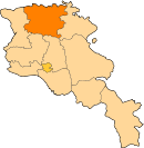
| Country | Armenia |
| Marz (Province) | Lori |
| Area | |
| • Total | 19.31 km2 (7.46 sq mi) |
| Elevation | 1,375 m (4,511 ft) |
| Population (2008) | |
| • Total | 1,388 |
| Time zone | UTC+4 ( ) |
| • Summer (DST) | UTC+5 ( ) |
References
This article is issued from Wikipedia. The text is licensed under Creative Commons - Attribution - Sharealike. Additional terms may apply for the media files.