Adilabad district
Adilabad district is a district located in the northern region of Telangana, India. It is known as the gateway district to South and Central India.[3] The town of Adilabad is its headquarters.[4]
Adilabad district | |
|---|---|
District of Telangana | |
 | |
.svg.png) Location of Adilabad district in Telangana | |
| Country | India |
| State | Telangana |
| Headquarters | Adilabad |
| Tehsils | 18 |
| Government | |
| • District collector | Sikta Patnaik[1] |
| • Vidhan Sabha constituencies | 3 |
| Area | |
| • Total | 4,177 km2 (1,613 sq mi) |
| Population (2011) | |
| • Total | 708,972 |
| • Density | 170/km2 (440/sq mi) |
| Time zone | UTC+05:30 (IST) |
| Vehicle registration | TS–01[2] |
| Website | adilabad |

History
Historically, Adilabad was known as Edlabad during the rule of Qutub Shahis.[5]
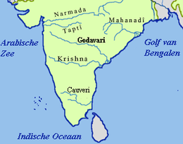
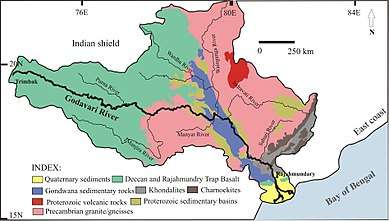
The heavily forested Godavari basin[6] was inhabited during the Mesolithic and Paleolithic periods. Excavations have taken place in the surrounding areas of Luxettipet, Komaram Bheem, Boath, Bhainsa, and Nirmal.[7]
Some Telugu inscriptions made during the time of the Kakatiya dynasty have been found in the Adilabad District, which indicates the historical importance of the area.
Due to the district's reorganization in October 2016, Adilabad was divided into four districts: Adilabad district Komaram Bheem district, Mancherial district, and Nirmal district.[3]
Geography
The Adilabad district is located in the Telangana state of India. It is bordered to the north by the Yavatmal district, to the northeast by the Chandrapur district, to the east by the Komaram Bheem district, to the southeast by the Mancherial district, to the south by the Nirmal district, and to the west by the Nanded district of the Maharashtra state. It occupies an area of 4,153 square kilometres (1,603 sq mi).[4]
Demographics
According to the Census of India, the Adilabad district has a population of 708,972.[4]
At the time of the 2011 Census of India, 59.36% of the population in the district spoke Telugu, 13.61% Marathi, 9.18% Urdu, 9.62% Gondi, 4.82% Hindi, 1.43% Kolami, 0.69% Bengali and 0.51% Koya as their first language.[8]
Religions
Badankurti[9] village in Khanapur Mandal of the Adilabad district was explored and remnants of a Buddhist monastery were found on a small island of Godavari river near Badankurthi. The town of Bhainsa was probably related to early Buddhist times, as a pair of carved feet near a mound were found. Islam is also a major religion of adilabad district[10]
Economy
In 2006, the Indian government named Adilabad as one of the 250 most backward districts (out of a total of 640) in the country.[12] It is one of the districts in the state of Telangana, currently receiving funds from the Backward Regions Grant Fund Programme (BRGF).[12]
Administrative divisions
The district is divided into two revenue divisions, Adilabad and Utnoor. These two divisions are sub-divided into 18 mandals.[4] Sikta Patnaik is the current revenue collector for the district.[13]
Mandals
The below table categorizes 14 mandals into their respective revenue divisions in the district:[14]
| S.No. | Adilabad revenue division | Utnoor revenue division |
|---|---|---|
| 1 | Adilabad (urban) | Indervelly |
| 2 | Adilabad (rural) | Narnoor |
| 3 | Mavala | Gadiguda |
| 4 | Gudihatnoor | Utnoor |
| 5 | Bazarhatnoor | |
| 6 | Talamadugu | |
| 8 | Tamsi | |
| 9 | Bela | |
| 10 | Boath | |
| 11 | Jainath |
See also
- List of districts in Telangana
References
- https://adilabad.telangana.gov.in/
- "Vehicle Registration Codes For New Districts in Telangana".
- "It's raining mandals in divided Adilabad". The Hindu. 6 October 2016. Retrieved 8 October 2016.
- "Adilabad district district" (PDF). Official website of Adilabad district. Retrieved 29 June 2017.
- "Hyderabad State". Atlantic Publishers & Distri. 26 July 1937 – via Google Books.
- "Indian Archaeology Journal 1974–75" (PDF). ASI. Archived from the original (PDF) on 8 May 2012. Retrieved 10 May 2013.
- "State Archaeology of Andhra Pradesh" (PDF). State Archaeology and Museums of Andhra Pradesh. Archived from the original (PDF) on 27 September 2013. Retrieved 10 May 2013.
- 2011 Census of India, Population By Mother Tongue
- "Article about Buddhist Site at Badankurti". The Hindu.
- "A.P. Ancient Monuments and Archaeological Sites and Remains Act" (PDF). aparchaeologymuseum. Archived from the original (PDF) on 27 September 2013. Retrieved 10 May 2013.
- S. Harpal Singh. "Adivasi education is still a mirage in Adilabad". The Hindu.
- Ministry of Panchayati Raj (8 September 2009). "A Note on the Backward Regions Grant Fund Programme" (PDF). National Institute of Rural Development. Archived from the original (PDF) on 5 April 2012. Retrieved 27 September 2011.
- "K Chandrasekhar Rao appoints collectors for new districts". Deccan Chronicle. 11 October 2016. Retrieved 13 October 2016.
- "Clipping of Andhra Jyothy Telugu Daily – Hyderabad". Andhra Jyothy. Retrieved 8 October 2016.
External links
| Wikimedia Commons has media related to Adilabad district. |
| Wikivoyage has a travel guide for Adilabad (District). |
Places adjacent to Adilabad district | |
|---|---|
| portal | |
|---|---|
| Dynasties |
|
| Districts |
|
| Commissionerates |
|
| Major cities | |
| Tourism |
|
| Municipal corporations | |
| Related lists |
|