1983 Borah Peak earthquake
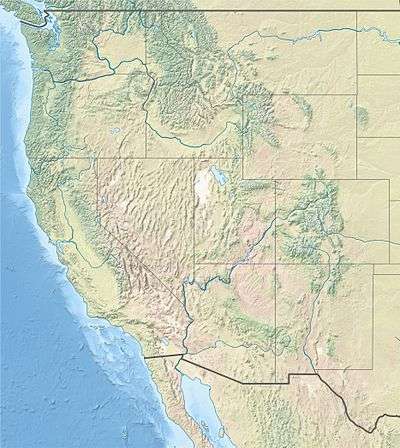
The 1983 Borah Peak earthquake occurred on October 28, at 8:06:09 a.m. MDT in the western United States, in the Lost River Range at Borah Peak in Central Idaho.[5][6]
 | |
 Challis Boise 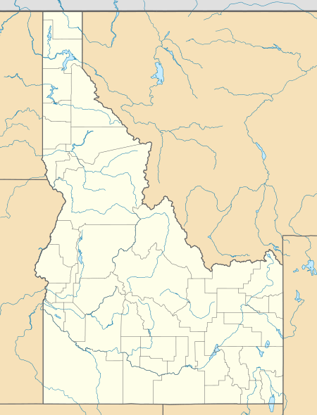 Challis Boise | |
| UTC time | 1983-10-28 14:06:09 |
|---|---|
| ISC event | 567352 |
| USGS-ANSS | ComCat |
| Local date | October 28, 1983 (Friday) |
| Local time | 08:06 MDT [1] |
| Magnitude | 6.9 Mw [1] |
| Depth | 16 km (9.9 mi) [2] |
| Epicenter | 44.08°N 113.8°W [2] |
| Fault | Lost River Fault [3] |
| Type | Normal [3] |
| Areas affected | Central Idaho United States |
| Total damage | $12.5 million [4] |
| Max. intensity | IX (Violent) [4] |
| Landslides | Yes |
| Aftershocks | 5.6 Mw Oct 28 at 19:51 UTC [2] 5.5 Mw Oct 29 at 23:29 UTC [2] |
| Casualties | 2 killed, three injured [2] |
The shock measured 6.9 on the moment magnitude scale and had a maximum Mercalli intensity of IX (Violent). It was the most violent earthquake in the lower 48 states in over 24 years, since the 1959 Hebgen Lake earthquake in nearby southwestern Montana.[7]
Earthquake
The earthquake was caused by a slip on the preexisting Lost River Fault.[8]
The event is the largest and most significant to strike in the state of Idaho. Two children were killed by falling masonry while walking to school in Challis,[5][6][9] about 120 miles (190 km) northeast of Boise, the state capital. Twelve and a half million dollars in damage took place in the Challis-Mackay region in Custer County. As a result of extreme surface faulting, a maximum Mercalli intensity of IX (Violent) was decided upon, while vibrational damage was at a Mercalli intensity of VI (Strong) to VII (Very strong).[4]
Three weeks later on November 18, President Ronald Reagan declared the earthquake a major disaster.[10][11]
Aftershocks were felt for a year afterwards;[12] nearly ten months later, a 5.4 aftershock was recorded on August 22, 1984.[11][13][14]
Surface faulting
The rupture caused clear surface faulting; a 21-mile (34 km) long northwest-trending zone of fresh scarps and ground ruptures was present on a slope of the Lost River Range. Extensive breakage occurred along a five-mile (8 km) zone between West Spring and Cedar Creek; ground surface was literally "shattered" into tilted blocks, each several meters in width. These scarps were as broad as 330 feet (100 m).[4]
The ground breakage was sixty miles (100 km), and the throw on the faulting ranged from -0.5 to 2.7 m.[15]
Damage
The Challis-Mackay region experienced rather thorough damage, with eleven commercial buildings and 39 homes sustaining major damage while another 200 houses suffered minor to moderate damage. Mackay in particular, about fifty miles (80 km) southeast of Challis, experienced the most severe damage. Most of the city's large buildings on its Main Street were damaged, to some extent;[9] eight of these buildings were deemed condemned and closed down. Most of these buildings were built from materials such as brick, concrete block, and stone, each varying.[4]
An estimated $12.5 million in property damage was recorded. In some places, the water grounds shifted.[11]
Fatalities and injuries
In Challis, two children were killed when a stone storefront collapsed on them. Two other people suffered minor injuries. In Mackay, a woman was hospitalized due to her injuries.[16]
Old Faithful
After the earthquake and aftershocks, the eruption intervals of Old Faithful geyser in Yellowstone National Park, about 150 miles (240 km) east, were noticeably lengthened.[17]
Sand blows
Near Chilly Buttes of Thousand Springs Valley, a series of artesian fountains/sand blows erupted immediately after the main shock. Groundwater gushed from these fountains forming small craters and depositing aprons of light-colored sandy sediment around each crater.
 Fault scarps that outline the graben produced near Willow Creek
 Crater caused by an artesian fountain
 Another view of the same fountain
See also
References
- ISC (2015), ISC-GEM Global Instrumental Earthquake Catalogue (1900–2009), Version 2.0, International Seismological Centre
- USGS (September 4, 2009), PAGER-CAT Earthquake Catalog, Version 2008_06.1, United States Geological Survey
- Yeats, R. S.; Sieh, K. E.; Allen, C. R. (1997). The Geology of Earthquakes. Oxford University Press. p. 476. ISBN 978-0-19-507827-5.
- Stover, C. W.; Coffman, J. L. (1993), Seismicity of the United States, 1568–1989 (Revised) – U.S. Geological Survey Professional Paper 1527 (PDF), United States Government Printing Office, pp. 216–221
- "Idaho quake measures 6.9, two killed". Spokane Chronicle. (Washington). wire reports. October 28, 1983. p. 1.
- "Quake jolts 8 states, kills 2 children". Eugene Register-Guard. (Oregon). (Los Angeles Times). October 29, 1983. p. 1A.
- AP. "TWO CHILDREN DIE AS QUAKE HITS NORTHWEST AND CANADA". Retrieved 2018-11-12.
- "Observatory Seismology". publishing.cdlib.org. Retrieved 2018-11-12.
- Warchol, Glen; DelPorto, Brett (October 29, 1983). "Idaho quake cuts a swath of death and destruction". Deseret News. (Salt Lake City, Utah). p. A1.
- "Quake disaster area declared in Idaho". Lewiston Morning Tribune. (Idaho). Associated Press. November 19, 1983. p. 3C.
- "Idaho Earthquake History". ioem.idaho.gov. Retrieved 2018-11-12.
- "4.5 aftershock quietly shakes Challis-Mackay". Deseret News. (Salt Lake City, Utah). January 25, 1984. p. 16B.
- "Idaho quake jolts, but not like 1983's". Deseret News. (Salt Lake City, Utah). UPI. August 23, 1984. p. B19.
- "Earthquake jolts Idaho". Spokesman-Review. (Spokane, Washington). wire services. August 23, 1984. p. 27.
- "Historical Earthquakes in Idaho | Idaho Geological Survey". www.idahogeology.org. Retrieved 2018-11-12.
- Shaughnessy, Rick (October 29, 1983). "Quake rocks mountain states; Strong shock kills 2 children". The Times-News. p. A1. Retrieved March 31, 2020 – via Newspapers.com.
- Reid, T.R. (October 7, 1984). "Idaho quake upsets, yet befriends Old Faithful geyser". Lewiston Morning Tribune. (Idaho). (Washington Post). p. 5E.
Further reading
- Payne, S. J. (2004), "Stress Triggering of Conjugate Normal Faulting: Late Aftershocks of the 1983 Ms 7.3 Borah Peak, Idaho, Earthquake", Bulletin of the Seismological Society of America, 94 (3): 828–844, Bibcode:2004BuSSA..94..828P, doi:10.1785/0120030122
- Reagor, Glen; Baldwin, F.W. (1984), "Intensity survey of the Borah Peak, Idaho, earthquake of October 28, 1983", Open-File Report, doi:10.3133/ofr84166
- Stover, C.W. (1984), "Preliminary isoseismal map and intensity distribution for the Borah Peak, Idaho, earthquake of October 28, 1983", Open-File Report, doi:10.3133/ofr84297
- Suzette M. Jackson, John Boatwright; Strong ground motion in the 1983 Borah Peak, Idaho, earthquake and its aftershocks. Bulletin of the Seismological Society of America ; 77 (3): 724–738.
- Youd, T. L.; Harp, E. L.; Keefer, D. K.; Wilson, R. C. (1985), "The Borah Peak, Idaho Earthquake of October 28, 1983—Liquefaction", Earthquake Spectra, 2: 71–89, doi:10.1193/1.1585303
External links
- Borah Peak earthquake – Idaho Geological Survey
- M 6.9 - southern Idaho – United States Geological Survey
- Two children die as quake hits northwest and Canada – The New York Times
- The International Seismological Centre has a bibliography and/or authoritative data for this event.