Étain, Meuse
Étain is a commune in the Meuse department in Grand Est in north-eastern France.
Étain | |
|---|---|
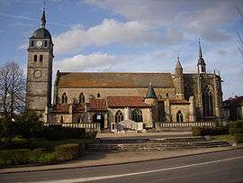 St. Martin's Church | |
.svg.png) Coat of arms | |
Location of Étain 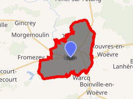
| |
 Étain 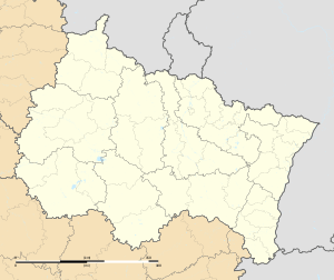 Étain | |
| Coordinates: 49°12′58″N 5°37′48″E | |
| Country | France |
| Region | Grand Est |
| Department | Meuse |
| Arrondissement | Verdun |
| Canton | Étain |
| Intercommunality | Pays d'Étain |
| Government | |
| • Mayor (2001–2008) | Jean Picart |
| Area 1 | 19.64 km2 (7.58 sq mi) |
| Population (2017-01-01)[1] | 3,580 |
| • Density | 180/km2 (470/sq mi) |
| Time zone | UTC+01:00 (CET) |
| • Summer (DST) | UTC+02:00 (CEST) |
| INSEE/Postal code | 550181 /55400 |
| Elevation | 196–236 m (643–774 ft) (avg. 210 m or 690 ft) |
| 1 French Land Register data, which excludes lakes, ponds, glaciers > 1 km2 (0.386 sq mi or 247 acres) and river estuaries. | |
It is situated on the river Orne.
Geography
It is located approximately 15 miles to the east north east of Verdun.
History
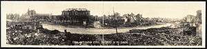
World War I damage at Étain
The town, which dates from the late 7th/early 8th century, does not have any natural defense features so has fallen to the Prussians and Russians in 1815 right after the Battle of Waterloo, and to the Germans in 1870, 1914 and again in 1940.
See also
- Communes of the Meuse department
- Étain-Rouvres Air Base
- Petitcollin
- Route nationale 18
- Sidi Brahim Barracks
References
- "Populations légales 2017". INSEE. Retrieved 6 January 2020.
External links
| Wikimedia Commons has media related to Etain, Meuse. |
| Authority control |
|
|---|
This article is issued from Wikipedia. The text is licensed under Creative Commons - Attribution - Sharealike. Additional terms may apply for the media files.