The Canadian
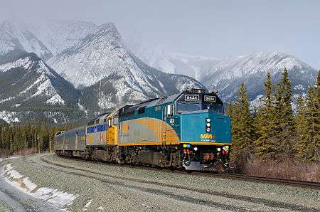
The Canadian (French: Le Canadien) is a 4,466 km (2,775 mi) passenger train route operated by Via Rail Canada running from Toronto to Vancouver, with numerous intermediate stops including Winnipeg, Saskatoon, Edmonton, Jasper and Kamloops. The trip, which takes over three days, is the longest passenger train route in North America, and covers several distinct landscapes. It runs from Toronto's financial district, through the sprawling suburbs of the Greater Toronto area, passing Ontario's Lake Country and through the massive Canadian Shield, the open expanse of the prairies, across the Rocky Mountains, and into the lush Fraser Valley of British Colombia, before ending in the bustling Pacific city of Vancouver.
- This article is an itinerary.
Understand
|
Scheduling This train is very slow and can be quite late, as much as 12 hours late (though it is not unheard of for it to be early). Via has no control over the tracks and the train often has to wait for freight trains to clear the tracks. While recent schedule changes have improved the trains' reliability significantly, Via still does not recommend you make same day connections, though it will rebook you for free if you are connecting to another Via train on the same ticket. There are faster and more efficient ways to travel across Canada, and unless you are travelling to a place not served by any other means of transportation, you are taking this train for the experience itself and not just to get from one place to another. The train is not the most efficient way to cross Western Canada. |
The Canadian is the longest scheduled passenger train outside Eurasia, and at 4,466 km, it is 542 km longer than the California Zephyr, though it is less than half the distance of the Moscow-Vladivostok Trans-Siberian Railway.
The train inherited its name from a previous service operated by the Canadian Pacific Railway, which ran from Toronto to Vancouver, albeit on a more southern route that ran through Thunder Bay, Calgary and Banff. The current route is largely that used by the rival Canadian National Railway's Super Continental. After both railways turned their passenger service over to Via in the 1970s, Via operated both trains until the southern route was mostly cancelled in the 1990s due to budget cuts, and the Canadian brand was transferred to the northern route.
The train operates using an assortment of cars used on the original Canadian and cars of the same era purchased from US railways. The cars, mostly built in the 1950s, have been rebuilt several times and while quaint, are functional and have been modernized to a limited degree. During the summer months, when demand is higher, the train will be longer than 20 cars. While the train is dominated by tourists, especially in the summer, one of its purposes is to provide transportation services to the remote communities between Capreol and Winnipeg, and thus it makes many stops in remote places along the line.
Service on the train and major stations is available in English and French, all staff will speak English and most will speak French as well. With a few exceptions the communities served by the train are primarily English-speaking.
Getting on
Tickets
|
Seasons Peak season runs from early May to mid-October. During this time the train runs thrice weekly (instead of twice weekly in the off-season). Prices are higher during this season (full comparison in the Sleep section of this article), and generally seats are harder to find on sale. |
Tickets can be purchased directly from Via Rail through its website, over the phone (+1 888 842-7245 in Canada and the United States, +1 514 989 2626 worldwide, +1 800 268-9503 TTY), in person at any staffed Via station counter, or through overseas travel agents. Unlike European rail tickets, the ticket is valid only for a specific date of departure.
See the sleep section of this article for a breakdown of classes and full prices.
Discounts
Sales and special online discounts are available through sporadically on Via's website for both economy and sleeper tickets, but unless there is a general sale, discounts for the next few weeks of travel in economy class are available every week Tuesday Toronto (Eastern) Time. Sleeper class discount fares are available on a separate page at any time. Especially in the off season these sales can halve the base fare. Via sometimes offers $15 fares for children age 11 and under between any two points on the route during the peak season.
Boarding
For passengers getting on in Toronto, Sudbury Junction, Capreol, Winnipeg, Saskatoon, Edmonton, Jasper or Vancouver, this is simply a matter of showing up at the station at the right time and if necessary checking your baggage at the baggage counter. In Toronto, sleeper class passengers have access to the Business class lounge. As Toronto is the only station on the route with frequent departures of other trains, economy passengers leaving Toronto should make sure that they get in the right line in the station concourse.
At all other stations boarding is simply a matter of waiting until the train arrives. Depending on the station, there my be a building for you to wait in, washrooms and a wheelchair lift, passengers should check the station's page on Via's website. Many remote stations will only have a signpost, and some not even that. Passengers check the status of their train ahead of time. When the train approaches at a remote station, stand a safe distance from the tracks, but so the conductor can see you. Approach the conductor when they beckon or turn a flashlight on you. They may ask you to take your baggage to the baggage car yourself and will help you board the train. At most remote stations you are on railway property and should abide by the directions of railway staff, though they will typically leave you alone if you keep out of their way.
Route
This description may not reflect what is visible on the train, some areas will inevitably be covered by darkness as the train passes through them. Westbound travellers should read the travel guide in reverse.
Vancouver-Kamloops
Vancouver-Gifford
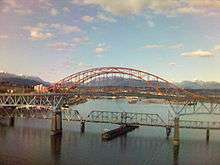
Vancouver is the third largest metropolitan area in the country, with a population of 3.4 million. The Canadian's eastbound journey begins (and the westbound ends) at 🌍 Vancouver (4,466 km/3 days, 19h to Toronto, 0 km/0h from Vancouver, Time zone: Pacific) Neoclassical Pacific Central Station, located just east of the downtown core. It uses the BNSF tracks through suburban communities including Burnaby, to New Westminster. After the train crosses the New Westminster Bridge, the Canadian leaves BNSF for CN tracks east. From New Westminster to Gifford, the route passes railway yards and industry.
Fraser and Thompson River Canyons
At Gifford, the train diverts from the CN mainline and crosses the Fraser River to Mission. CN and CPR utilize directional running through the Fraser and Thompson River canyons; eastbound trains use the CPR lines and westbounds the CN tracks. Thus, for the section through the two canyons, the Canadian runs on its original CPR route. From Mission to Cisco, the CPR runs west (north) of the river; afterwards, it runs east (south). Near Basque, the eastbound Canadian transfers onto the CN main.
Westbound, the Canadian stays on the CN tracks all the way into Vancouver. The CN route passes through Painted Canyon, and features CN's 240 m steel-arched bridge over the Fraser River and the CPR mainline at Cisco. The tracks in Painted Canyon are only approximately 60 m above the Thompson River. After Cisco, the CN mainline stays of the east/south side of the Fraser River all the way to the New Westminster Bridge, where the two routes merge.
On their regular schedules, both east and westbound Canadian's travel through the Fraser and Thompson river canyons at night.
Basque-Kamloops
Traveling eastbound from Basque, the CN line crosses back across the Thompson River. Aside from a few brief deviations across the river, the line stays on the north/west side into just outside Kamloops. Arriving in Kamloops, the train halts at 🌍 Kamloops station (4,038 km/3 days, 5h to Toronto, 428 km/9h from Vancouver, Time zone: Pacific), north of the town of 84,000.
Kamloops–Jasper

North Thompson River Canyon
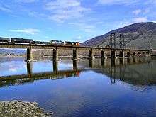
Beyond Kamloops, the eastbound train heads up the Rocky Mountains. For six hours after departing Kamloops, the tracks run north, following the North Thompson River for much of the way and indeed crossing it several times. The scenery changes gradually from the dry, rolling plateau – though miles of irrigation soften the starkness – to the lusher, evergreen forests. Narrow valleys bordered by mountains on both sides feature farmlands, pastures, forests, logging camps, and small communities. The latter often have flag stops — for example, Clearwater and Blue River. Near Clearwater, the train crosses the Clearwater River. The Monashee Mountains lie to the east for much of the way to Valemount.
Some of the most dramatic scenery along the route occurs in this area as the train clings precariously to the mountainsides – particularly Groundhog Mountain and Mount Cheadle. Although railway slide fences protect the route, the train creeps along at a cautious pace – usually around 40-50 km/h.
On the downslope side of the train lies the North Thompson River; in the distance are often-snow-covered mountains. The icefields of the Albreda Glacier should be visible for several miles. At Little Hells Gate (Port d'Enfer), lies above treacherous rapids similar to Hells Gate farther south on the Fraser. One of the prettiest sights in this area is of Pyramid Falls, which cascades 100 m down the side of Mount Cheadle. The train slows down enough for passengers to get close-up looks and maybe get a nice picture or two.
South of Valemount, the train passes a memorial to the Canoe River crash. The train then crosses the river over a 70 m bridge and arrives at another flag stop (Valemount station).
Valemount–Redpass
North of Valemount, eastbound and westbound trains routes again diverge. Eastbound trains use CN's Albreda Subdivision, which continues to climb until Milepost 65.6, a curve near Jackman. The line then runs eastward at constant elevation through Mount Robson Provincial Park, with views of Mount Robson. The line passes through a 500 m tunnel, where a 1905 avalanche buried railway workers, and then descends to Redpass Junction, where it joins with CN's Robson Subdivision. The latter is used by westbound trains; it is lower in elevation and has more favourable grades than the Albreda Subdivision.
Redpass-Yellowhead Pass
Redpass Junction is near the western shore of Moose Lake. The lake is another scenic highlight, as the train follows along the north shore of the lake for several miles, and there are a couple of splashing waterfalls cascading down from theī mountains into the lake. The south shore of the lake is the Selwyn Range, which the train has essentially detoured around. The Yellowhead Highway (Highway #16) parallels the CN tracks to the north.
After Moose Lake, the train travels through a narrow valley nestled between the mountains, crosses the Moose and Fraser rivers and continues following the Fraser. Soon the train comes to the next major scenic highlight of the trip: Yellowhead Lake. Yellowhead Mountain continues to hover overhead to the north while Mounts Rockingham (2377 m) and Mount Fitzwilliam (2909 m) can be seen to the south across the lake. The train finally crosses the Continental Divide at Yellowhead Pass, which at 1133 m is the lowest crossing of the divide in North America.
Yellowhead Pass marks the 🌍 British Columbia-Alberta Border and also between the Pacific and Mountain time zones, the Pacific and Arctic watersheds, and Mount Robson Provincial Park and Jasper National Park.
Yellowhead Pass-Jasper
Once again the train hugs mountainsides among the Victoria Cross Range (to the north) above the Miette River and creeps through tunnels and past protective slide detector fences. Whistler Mountain is in view as the train descends, rounds a curve and pulls into the 🌍 Jasper railway station (3,600 km/2 days, 16h to Toronto, 866 km/19h from Vancouver, Time zone:Mountain). Jasper is a tourist town that serves as the centre of Jasper National Park.
The Canadian, in both directions, is scheduled to be at Jasper station for an hour and a half for servicing. Mount Edith Cavell (3363 m) is visible toward the south. Pyramid Mountain (2766 m) and the Victoria Cross Ranges are to the northwest. Whistlers Mountain, to the southwest, can be summitted via the Jasper Skytram.
Passengers are encouraged to get off the train and wander around downtown Jasper. In addition to shops and restaurants, downtown Jasper contains Jasper Park Information Centre. The Centre provides maps and other information about the park and surrounding UNESCO World Heritage site through which the train travels.
The station itself has a few attractions: the Jasper Raven Totem Pole and a vintage CN 4-8-2 steam locomotive are on display, and inside the station is a café barista that also sells railway memorabilia and other gifts. The station building was constructed by the CNR in 1926 and was declared a heritage railway station by the federal government in 1992.
Jasper to Edmonton
The town of Jasper sits inside of a big "U," as it relates to the railway. The railway comes in from the northwest and rounds a curve into the station. At the station, the train is actually facing northeast. Upon leaving the station, the train continues in a more northeasterly direction rather than due east. Also the train has descended into Jasper from Yellowhead Pass and now climbs a grade shortly after leaving the Jasper railyards.
The train is once again hugging mountainsides overlooking the Athabasca Valley and River and surrounding mountains. There is usually a flock of bighorn sheep grazing on the bluffs above the train to the north. During the winter, they can often be seen licking salt off the parallel Yellowhead Highway. Other Canadian wildlife that may be seen from the train include bear, deer, elk, mountain goat, and various species of Canadian birds.
To the north/northwest, passengers will see the peaks of the Victoria Cross Range—so named because six of the peaks are named after Canadian recipients of the Victoria Cross. Mount McKean (2743 m) and Mount Zengel (2630 m) are two such mountains that can be seen from the train. Looking southward (across the river), there is the Colin Range. Hawk Mountain (2553 m), Roche Bonhomme (2495 m), and Morro Peak (1678 m) are among the peaks in this range that can be seen. English is the top of the grade, after which the train descends into the Athabasca Valley, passing Henry House. The Yellowhead Highway (Highway 16) continues to parallel the route.
The train then crosses the Snaring River.
Snaring and Chetamon Mountains (the latter 2606 m) and the De Smet Range including the Roche de Smet (2539 m) can be all seen from the train to the north. The Snaring River Campground is near the confluence of the Snaring and Athabaska Rivers. Looking to the south, passengers can see the Jacques Range including such peaks as Roche Jacques (2603 m) and Cinquefoil Mountain (2259 m).
Jasper Lake
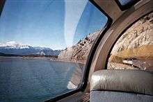
The train reaches the north shore of Jasper Lake and rides along it for several miles. The Yellowhead Highway rides along the south shore of the lake. The lake is a shallow, wide section of the Athabasca River. This has been the site of many CN publicity photographs—including of the Super Continental—through the years, and it is still popular with photographers, railfans, the present-day Canadian, its advertisers and its passengers. The Jasper Lake Sand Dunes are on the northwest shore of Jasper Lake and can be seen from the train. They are the only sand dunes ecosystem in the Canadian Rockies. Parts of the mainline have been built on causeways away from the shore, which have created several mini lakes. This adds to the effect of being out on the water, creating additional views of the lake, its waters and the forests and mountains surrounding it. The lake is surrounded by mountain ranges, many of which can be seen the train from various places along the lake. They include:
From southeast to southwest:
- Miette Range Most prominent peaks include Utopia Mountain (2602 m) and Roche Miette (2316 m).
- Jacques Range Prominent peaks: Cinquefoil Mountain (2259 m), Roche Jacques (2603 m), and Mount Merlin (2711 m).
- Colin Range: Peaks include Mount Colin (2687 m) and Roche Bonhomme (2495 m)
Northwest to northeast:
- Victoria Cross Ranges
- De Smet Range. Prominent peaks include: Roche de Smet, (2539 m) and Mount Greenock (2065 m).
- Bosche Range: Mount Aeolus (2643 m) and Roche à Bosche (2123 m)
The train crosses Stoney River, glides through a 200 m horseshoe tunnel underneath Disaster Point, and begins riding along the shores of Brûlé Lake. Along the way, it passes Black Cat Mountain (1800 m) and Mount Solomon (1585 m). The Yellowhead Highway is on the other side of the lake. Folding Mountain (2844 m) should be visible as the train crosses the Athabasca River. The river is now on the north side of the tracks.
Entrance
Entrance is the official easternmost point of the Canadian Rockies (at least on the CN), but the Miette Range usually is still visible for many miles as the train heads out across the prairies. The surrounding landscapes are still heavily forested and the riverbanks a bit dramatic, but the land slowly opens up to ever broader valleys, plains, and farmlands. About three miles west of Hinton, the train crosses an impressive trestle over Prairie Creek with the Athabasca still in sight. The train crosses a curved trestle over Sundance Creek just west of 🌍 Edson (3,430 km/2 days, 12h to Toronto, 1,245 km/1 day from Vancouver, Time zone: Mountain), a forestry town of 8,400 and the following stop. Then it crosses the McLoed River on a 325 m bridge and Wolf Creek on a 200 m bridge. The train rides along the shores of three lakes: to the north the Octopus Lake; to the south, Wabamun and Chip. Westbound, train passengers should be able to start seeing mountains (still way off in the distance) just after crossing the Sundance Creek trestle.
The train finally reaches West Junction wye, and backs into 🌍 Edmonton Via Rail station (3,221 km/2 days, 8h to Toronto, 1,036 km/1 day, 3h from Vancouver Mountain). Westbound trains also back into the station. The train is scheduled to dwell at the station for an hour for a crew change and other servicing. The Panorama car travels only between Vancouver and Edmonton. Here, the car is taken off (eastbound) or put on (westbound). Edmonton station is a suburban development across the street from the former airport Blatchford Field; the skyline of downtown Edmonton is off in the distance. The capital and second largest city of Alberta, the train backs into the station north of the downtown core, adjacent to CN's main railyard. West of Edmonton the train approaches the Rocky Mountains, while east of Edmonton the prairies continue to until Winnipeg.
Edmonton to Saskatoon
The train (in both east and westbound) backs into the station upon arrival with the train facing north while standing at the station. Departing out of Edmonton station, the train heads east past the CN Walker Yard (city skyline is visible to the south) and cuts across the Canadian prairies for nearly 470 km, paralleling Alberta Highway 14. The train stops in the rural communities of Viking and Wainwright, before turning south to follow Alberta Highway 610. The train then crosses the 🌍 Saskatchewan-Alberta border with scrub on both sides. Between the first Sunday in November and the second Sunday in March westbound travellers move one hour back while eastbound travellers move one hour forward. Oil pumps, signs of an industry that is key to the economies of both provinces, are occasionally visible along the tracks.

After the border the train stops in Unity, before passing over the Killsquaw Lakes en route to 🌍 Biggar (2,792 km/2 days 1 h to Toronto, 1,934 km/1 day, 13h from Vancouver, Time zone:Saskatchewan), a farming town of 2,000, typical of many similar towns throughout the prairies. The town, in a display of boastful prairie humour, has adopted the slogan "New York is big, but this is Biggar."
Now paralleling Saskatchewan Highway 14, the train enters 🌍 Saskatoon (2,702 km/1 day, 23h to Toronto, 2,024 km/1 day, 16h from Vancouver, Time zone: Saskatchewan) from the west, stopping at the modern Saskatoon station south of downtown on the site of the CN Chappell Yard via a short spur line. Saskatchewan’s largest city, founded as a temperance colony in 1883. The train largely bypasses the city, stopping at the modernist train station in the southwestern suburbs. Just east of the station the train crosses the South Saskatchewan River.
Saskatoon to Winnipeg
After re-joining the CN main line, the train follows Saskatchewan Highway 11 out of the urban core of Saskatoon before once again paralleling the Yellowhead Highway. Now heading southeast, it begins to follow Saskatchewan Highway 2 into Watrous, where the tracks branch off once more. Staying on the CN main line, the train heads east towards Melville, paralleling Saskatchewan Highway 15. 🌍 Melville (2,398 km/1 day, 19h to Toronto, 2,024 km/1 day, 19h from Vancouver, Time zone: Saskatchewan) is the easternmost stop in Saskatchewan. Potash mining is key to the local and provincial economy, and there are several active mines adjacent to the tracks between the Manitoba border and Saskatoon.
The 🌍 Saskatchewan-Manitoba border This is the border between the two prairie provinces, Manitoba (whose name may be derived from several indigenous languages and means "the straits of the Great Spirit" and Saskatchewan (whose name comes from Cree and means "swift flowing river"). While the two provinces are on the same time zone, Saskatchewan does not observe Daylight Savings Time, so between the second Sunday in March and the first Sunday in November westbound travellers move one hour back while eastbound travellers move one hour forward. Along the border the train is following the Qu'Appelle River.
.jpg)
After entering Manitoba, the train stops in Rivers, and heads east to 🌍 Portage la Prairie, now following the Trans-Canada Highway. Until Winnipeg, the land is mostly flat prairie and agriculture is the primary industry. It then continues east towards Winnipeg, where the tracks turn north, following the Assiniboine River, and enter the historic 🌍 Winnipeg Union Station (1,943 km/1 day, 8h to Toronto, 2,479 km/2 days, 2h from Vancouver, Time zone: Central). Winnipeg, the capital and largest city of Manitoba is one of the train's major service stops. Depending on how on schedule the train is, it can spend up to 5 hours in Winnipeg. The opulent train station, designed by the same firm responsible for New York's Grand Central Terminal, is located in the downtown. Here, passengers can transfer to the Winnipeg-Churchill train.
On westbound trains, Via will offer guided tours for a fee. Passengers who want to see Winnipeg on their own can walk out of the back (east) doors of the station into The Forks: a major social hub and important historical area with entertainment, exploration, opportunities for dining at different price ranges. The odd-shaped Canadian Museum for Human Rights is also just outside the station and is a part of The Forks area, as is the Manitoba Children's Museum. If you wish to go further, cross the Red River into St. Boniface, the city's French quarter, or head north of the station in the Exchange District with its collection of early 20th century warehouses.
Northeast of Union Station, the train crosses over the Red River of the North, and heads east through CN's Transcona Yards. This section has a distance of nearly 714 kilometers (443 miles).
Winnipeg to Toronto
Winnipeg to Sioux Lookout
With its journey through the prairies almost over, the train heads out of the yards and continues east, following Manitoba Provincial Trunk Hwy. 15. From the end of the praries just after Winnipeg until Capreol, the landscape is dominated by granite outcrops, lakes, peat bogs (known locally as muskeg), and spruce trees. The area is sparsely populated and forestry, mining and resource-based tourism are the dominant industries. The train will pass through a series of small hamlets, stopping sporadically. Between Winnipeg and Capreol tickets can be purchased for any point on the line, regardless of whether or not it is on the schedule. The many flag stops on this stretch are usually only accessible by rail transport.
The next regular stop, the rural community of 🌍 Elma (1,854 km/1 day, 5h to Toronto, 2,568 km/2 days, 7h from Vancouver, Time zone: Central), is located on the western edge of the Whiteshell Provincial Park. West of Elma the land flattens out and forests are gradually replaced with farmland, while to the east are the granite outcrops, lakes, bogs and mixed forests of the Canadian Shield, the railway turns east-northeast towards Brereton Lake, Ophir and Winnitoba and crosses the 🌍 Ontario-Manitoba border after traversing Whiteshell Provincial Park. Depending on your direction of travel, this is either the train's first or last crossing of a provincial border. The westbound train is entering Whiteshell Provincial Park, and the eastbound train is entering Northern Ontario. There will be 5 short tunnels cut through rock between the Manitoba border and Sioux Lookout.
Now in Ontario, the train travels through the rugged Canadian Shield, stopping at Rice Lake and Copelands Landing en route to Malachi. After Malachi, the train loops around and heads through Ottermere to 🌍 Minaki (1,758 km/1 day, 4h to Toronto, 2,664 km/2 days, 8h from Vancouver, Time zone:Central). Minaki is the largest and least isolated of several cottage communities you pass through between Sioux Lookout. Minaki has road access, but communities such as Ottermere can only be easily accessed by train or boat.
Just east of Minaki the train crosses the Winnipeg River. Then follows Redditt, Farlane, Canyon and Red Lake Road, where it loops around once more and stops at Richan and Millidge, and passes through an active sawmill and a floatplane base on the north side of the tracks before entering into the town of 🌍 Sioux Lookout .(1,537 km/1 day, 2h to Toronto, 2,885 km/2 days, 13h from Vancouver Time zone:Central) Sioux Lookout, the largest community you pass through between Sudbury and Winnipeg, is a regional transportation hub and key centre for the forestry and tourism industries. The train stops downtown, next to the Tudor Revival former station.
Small stops in western Ontario
.jpg)
During the summer the train will make several stops between Sioux Lookout and Hornepayne to pick up tourists staying at remote hunting and fishing lodges.
After Sioux Falls it heads through Savant Lake, Flindt Landing and 🌍 Allanwater Bridge (1,401 km/1 day to Toronto, 3,201 km/2 days, 17h from Vancouver, Time zone:Central/Eastern) , a signpost near a fishing lodge. Allanwater Bridge is notable only because it represents the boundary between Eastern and Central Time, and that it serves as an access point to the remote lakes of Wabakimi Provincial Park. Allanwater Bridge is followed by Collins and 🌍 Armstrong (1,314 km/23h to Toronto, 3,108 km/2 days, 18h from Vancouver, Time zone: Eastern), a small, isolated village that serves as a hub for shipping timber and the furthest north the train will get in Ontario.
Next stops are Mud River, Ferland, Auden, Nakina and then the tracks curve sharply southward before arriving in 🌍 Longlac (1,084 km/19h to Toronto, 3,607 km/2 days, 20h from Vancouver, Time zone: Eastern), a town located on the shores of the eponymous Long Lake. Then comes Caramat, and Hillsport en route to 🌍 Hornepayne (921 km/16h to Toronto, 3,607 km/3 days from Vancouver Time zone:Eastern). Hornepayne is a forestry town that has seen more prosperous days. It is a service stop and passengers are allowed to disembark while the train is being serviced.
After Hornepayne, it stops at 🌍 Oba (859 km/15h to Toronto, 3,607 km/3 days, 1h from Vancouver, Time zone: Eastern), where passengers could connect with the Algoma Central Railway's Agawa Canyon tour train until the latter's demise. Further stops are made at Elsas, Foleyet, Gogama, Westree, Ruel, Felix, McKee's Camp, and Laforest before the train enters 🌍 Capreol (444 km/8h to Toronto, 4,022 km/3 days, 10h from Vancouver, Time zone:Eastern). A small satellite town of Sudbury, Capreol is the first/last major service stop. Passengers are allowed to get off the train while it refuels. Capreol also marks the eastern boundary of the Canadian Shield.
At Sudbury, the train stops at 🌍 Sudbury Junction (422 km/7h to Toronto, 4,044 km/3 days, 11h from Vancouver, Time zone: Eastern Time) Located 10 km from the city of Sudbury (Ontario), passengers must take a taxi or arrange a pickup. Sudbury is a nickel mining town, and the train will pass several large piles of mining tailings south of the stop. Pulling into the station on the west side of the train the massive chimney of the Vale Nickel smelter is visible, the second tallest chimney in the world.
Parry Sound and Bala to Toronto
The train then turns south towards Parry Sound and Washago. From the junction of Wanup to Parry Sound, directional running with both CN and CP Railways is again put into place. This time however, eastbound (southbound) trains utilize the CN Bala Subdivision, whilst westbound (northbound) trains use the CP Parry Sound Subdivision. Thus the latter follows its original CPR route here, traversing the Parry Sound CPR Trestle. 🌍 Parry Sound (241 km/5h to Toronto, 4,225 km/3 days, 15h from Vancouver, Time zone:Eastern) sits on Georgian Bay, a part of Lake Huron. The Eastbound and Westbound trains use different tracks and thus stop at different places. Through Parry Sound, all trains make use of both CNR and CPR stations depending on the direction of travels. At Bala, both CN's Bala Subdivision and the adjacent CPR line diverges for the final time.
From Bala, the trains continue along the CN line for approximately 40 km to 🌍 Washago (143 km/3h, 4,323 km/3 days, 18h, Eastern), its final stop before the Toronto terminus. Washago is a small village that marks the approximate boundary between the forested lands of Ontario's "Cottage Country" and the Golden Horseshoe (and the farmlands of Southwestern Ontario).
A disused spur to Casino Rama is located due south, while the Bala Sub parallels the shore of Lake Simcoe as far as Port Bolster before heading southwest into York Region. South of Gormley, the route is shared with GO Transit's Richmond Hill line commuter services, although the latter does not share stations with the Canadian. The Canadian passes through Richmond Hill and western Markham into the City of Toronto proper, with a scenic route paralleling the Don River for the final 10 km.
Toronto Terminal
🌍 Toronto (0 km / 0h to Toronto, 4,466 km/ 3 days, 21h from Vancouver, Eastern) Canada's largest city and financial centre. The Canadian begins and ends at the massive limestone Union Station in the downtown core, a short distance from Lake Ontario and the CN Tower. Vancouver-bound trains travel slowly through the suburbs, at one point reversing a considerable distance to enter a junction. Trains entering Toronto travel through the scenic Don Valley.
Trains returning to Vancouver would leave Union Station either from the East as it came in from (if turned around prior), or from the West. In the latter case, the train would then proceed North along the Newmarket Subdivision, shared by GO Transit's Barrie line. This subdivision is a portion of a former route for the transcontinental line; however, the train only continues as far as Snyder Diamond in Vaughan. There it would then proceed Eastbound along the York Subdivision towards Thornhill to meet up with the Bala Subdivision at Doncaster Diamond and from there continue Northwest leaving the Greater Toronto Area towards Washago and eventually Vancouver.
On board
Cars
Coach cars
These cars have large seats with significant legroom and recline, leg and foot rests and airline-style tray tables, and AC plugins. Seats are in a 2-2 configuration, with some pairs facing each other that are typically reserved for families. There are washrooms at each end of the car, one of which is wheelchair accessible and has a changing table.
Sleeping cars
Sleeping cars, which make up the bulk of the train during the peak season, come in two different configurations: Manour and Château. The Château cars are usually used on other trains and are less common on the Canadian
- Manour cars have 3 sets of berths, 4 single bedrooms, 6 double bedrooms, 2 common washrooms and a common shower.
- Château cars have 3 sets of berths, 8 single bedrooms, 1 triple bedroom, 3 double bedrooms, 2 common washrooms and a common shower.
Skyline car
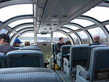
There are typically at least two of these cars on each train, one of which is available to economy passengers. They feature a lounge at each end, one with cafeteria-style tables and the other with long couches, and a glass dome viewing area with seating raised above the area in between. Below the dome area there is a narrow hallway with a snack bar and a kitchen. The kitchen is only open during the peak season for economy passengers, and in sleeper class the kitchen is closed and the snack bar provides bar service and complimentary light snacks. Various activities are available in one of these cars for sleeping class passengers, and live music is provided on some trips to passengers in both classes in in the lounge areas.
Park car
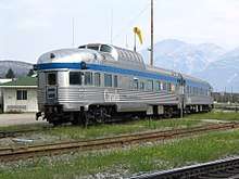
The last car on the train. Similar external appearance to the Skyline car, with a dome section sticking out. Houses two lower lounges, a dome section and Sleeper premier and accessible suites. Available exclusively to Sleeper class passengers in the off-peak season. In the peak season it is available only to Prestige Sleeper passengers, except between 19:00 and 22:00 when it is open to all Sleeper passengers.
Baggage car
Usually the first car of the train and generally closed to passengers.
Communications
As the train passes through some remote areas, cell phone service is not available along large parts of the journey. Most travellers with Canadian mobile contracts should be able to receive voice, text, and data service between Toronto and Capreol, in Gogama, Foleyet, Hornepayne, Caramat, Longlac, Nakina, Armstrong, Minaki, and Brereton Lake, between Winnipeg and Hinton, in Jasper, Valemont, and Blue River, between Clearwater and Ashcroft, in Boston Bar, and between Hope and Vancouver. Travellers with smaller Canadian or international mobile carriers should check with their carrier (Towers on the route belong to Rogers, Bell, Telus, Tbaytel, BellMTS and Sasktel, though many of these carriers have tower sharing agreements with each other that may extend to international carriers).
Free wireless internet is available at stations in Toronto, Winnipeg, Edmonton, Jasper and Vancouver.
Smoking
Smoking (and vaporizers) are prohibited on the train and that prohibition is strictly enforced. Designated smoking stops are Capreol, Hornepayne, Sioux Lookout, Winnipeg, Saskatoon, Edmonton, Jasper and Kamloops. The train crew may at times limit or cancel these stops if the train is behind schedule.
Eat and drink
Sleeping and Prestige Classes
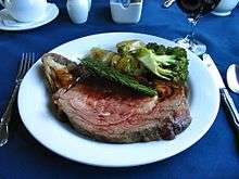
Throughout the year, sleeping car passenger receive free three course meals in the dining car. Complimentary snacks and non-alcoholic drinks are available in the Park and Skyline cars. There is at least one vegetarian option available and Gluten-free, Kosher and vegan meals can be requested by calling Via 10 days before departure. A children's menu is available.
Economy Class
During peak season passengers can purchase meals from the snack bar in their Skyline car. Meals are cooked in the kitchen next door and are of generally good quality, slightly better than Amtrak long-distance dining car food and cost around $10. There is at least one vegetarian option at every meal, but be sure to specify that you are vegetarian to avoid miscommunication. There are also a few children's options. Other special diets are not explicitly accommodated.
During off-peak season, the kitchen in the Skyline car is closed and service staff come around the economy cars offering to sign passengers up for dining car sittings.
In either season, the snack bar is open stocking hot and cold beverages, snacks and pre-made sandwiches.
The dining car is open to economy passengers in the off season, and economy passengers can often get a seating in the dining car during peak season if the train is not too full by asking service staff. As the quality of the dining car meals is most pronounced at dinner, this is the best meal to eat in the dining car. Prices are higher than in from the kitchen in the Skyline car, with dinner costing around $20, though the portions are somewhat larger and include salad and dessert.
Many passengers in economy bring their own food; hot water is available from the snack bar for instant food. There are no fridges or microwaves available for passengers.
Alcohol
Alcohol is available for purchase the Park car, Dining car (though only during meals) and economy class Skyline car. On board selection is limited to a few domestic beers, several wines and a small selection of spirits and mixers. Alcohol cannot be taken outside of the car where it was sold, though passengers with cabins may drink alcohol bought off the train in their cabins. Depending on what province you happen to be in at the time, the minimum age to purchase alcohol is 18 (Manitoba, Alberta) or 19 (Ontario, Saskatchewan, British Colombia). Prestige Sleeper passengers have the cost of alcohol included in their ticket.
Sleep
Prestige Sleeper
The most expensive option by far, a double bed that converts into an L shaped coach during the day, and a private washroom and shower. Based on double occupancy and including meals but excluding taxes, this cabin can cost $4,650-5,320 per person for the entire Toronto - Vancouver trip (2019).
Sleeper class
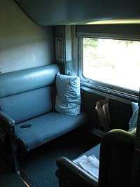
There are a variety of sleeping options in sleeper class. Pillows, sheets and blankets are provided for all.
- Berths: the cheapest sleeper option, the lower and slightly cheaper upper berth convert into couches during the day. Mattress dimensions are 178 cm x 109 cm (5 ft. 10 in. x 3 ft. 7 in.). Washrooms and showers are located in the same car. Unlike all other options on the train, these seats do not have their own electrical outlets, though some are available in the washrooms. Before discounts, fares for the entire length of the route start at $1,110 not including meals taxes, $1,320 in the peak season (2019).
- Cabin for one: Private room with a single bed that is replaced with a chair during the day. Mattress dimensions are 180 cm x 76 cm (5 ft. 11 in. x 2 ft. 6 in.) Includes private toilet and sink that folds into the wall, though toilet is covered when bed is set up and you must use the general toilets in the car instead. Shower is available in the car. A standard North American 120 VAC outlet is provided in the cabin. Some cabins require a small step up to the bed, passengers with mobility issues should call ahead to request a lower cabin. Before discounts, fares for the entire length of the route start at $1,900 including taxes ($2,600 in the peak season).
- Cabin for two: Private room with an upper and lower bed. Upper bed is accessed by a ladder. Mattress size is 180 cm x 79 cm (71 in. x 31 in.). Beds are replaced with chairs during the day. Includes a private washroom, access to a shower in the same car and a standard North American 120 VAC outlet. Before discounts, fares for the entire length of the route start at $2,900 including taxes for two people ($3,900 in the peak season).
- Cabin for three: Only carried in limited number during the peak season and sells out quickly. Mattress size is 153 cm x 91 cm (5 ft. 11½ in. x 2 ft. 7 in.)
- Cabin for four: Two combined two person cabins, not sold online.
- Accessible Cabin: Only one per train. Includes fully accessible washroom and shower. Full specifications are on VIA's website. Can only be booked over the phone.
Economy Class
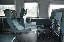
Large reclining seats in a 2x2 configuration, with airline-style tray tables, a standard North American 120 VAC outlet for each seat and a leg rest stowed underneath. There is a washroom and luggage storage area at each end of the car as well as overhead storage for small bags above your seat. Groups of four seats facing each other are offered to families. Passengers travelling alone are typically given two seats to themselves if they are travelling overnight will rarely be asked to give up the second seat. There is a wheelchair tie down and an accessible washroom at one end of the car. Before discounts, fares for the entire length of the route start at $444 excluding taxes year-round (2019).
Baggage
Carry on
Economy: 1 Personal bag (max 11.5 kg/25 lbs., 43 x 15 x 33 cm/17 x 6 x 13 in.) and either one large bag (max 23 kg/50 lbs., 158 linear cm/62 linear in.) or two smaller bags (max 11.5 kg/25 lbs., 54.5 x 39.5 x 23 cm/21.5 x 15.5 x 9 in.).
Sleeper: 1 Personal bag (max 11.5 kg/25 lbs., 43 x 15 x 33 cm/17 x 6 x 13 in.) and two small bags (max 11.5 kg/25 lbs., 54.5 x 39.5 x 23 cm/21.5 x 15.5 x 9 in.). As there is significantly less storage space than in the coach cars the larger bag is not an option.
Purses and small folding infant strollers are not included in the carry on baggage count.
Checked
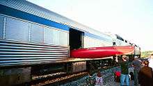
All passengers: Two large bags (max 23 kg/50 lbs., 158 linear cm/62 linear in. each)
Oversized and excess bags can be transported for a $40 fee. Pets in travelling crates can be kept in the baggage car for between $30-50. Bicycles can be transported for $25 ($50 for tandems and ebikes) and bike boxes are available for free at major stations. Canoes and kayaks can, with some care, be loaded into the baggage car for $100 fee, though Via requires that you email or phone them to book the space. As the train serves several remote communities between Capreol and Winnipeg, Via has a fee schedule for a moving variety of unusual items between those destinations, including groceries, construction materials, and appliances.
Get off
While many international travellers (and indeed many Canadians) opt for the full distance, a decent number of people get off and on along the way, particularly in Winnipeg, Saskatoon, Edmonton and Jasper.
Connections
Because the train is often late Via recommends against same day connections, though it will rebook you for free if you miss a connection to another Via train.
Toronto: Union Station is the busiest passenger terminal for any mode of transportation in Canada, though the intercity train concourse is quieter than the commuter concourse below it. From here you can catch VIA Trains to Ottawa, Montreal, and Southwestern Ontario, a daily Amtrak train to New York City, GO Transit commuter trains and buses to various points in Southern Ontario including Niagara Falls. There is a major subway station below the station. There is a rail shuttle to Toronto Pearson International Airport west of the station and a bus shuttle to Toronto Island Airport across the street in front of the Royal York Hotel. The Toronto Coach Terminal, which has buses throughout Ontario and to Quebec, Western Canada and the United States, is 1.5 km (1 mile) north or three subway stations away in either direction.
Sudbury Junction/Capreol: Via offers a train from downtown Sudbury to White River, Ontario that serves various remote communities in Northeastern Ontario. You can also catch a bus to various points in Northern Ontario (Sault Ste. Marie, North Bay, Timmins) in downtown Sudbury. Either way you will need to take a taxi. The on board service staff may be able to have the dispatcher call one for you to time it with the train's arrival.
Hornepayne: Ontario Northland provides daily buses to Sault Sainte Marie (Ontario) and Hearst. The bus station is about 1 km from the train station.
Longlac: Kasper Transportation offers a daily bus to Thunder Bay. The bus stop is roughly 1.5 km from the train stop.
Sioux Lookout: Kasper Transportation offers bus services at various frequencies to Thunder Bay, Dryden, Kenora, and Red Lake (Ontario). The bus stop is roughly 1 km from the train stop.
Winnipeg: Via Rail offers a twice-weekly train to the sub-Arctic port of Churchill, Manitoba, most notable for its polar bears.
Edmonton: Red Arrow and Ebus offer service from Edmonton to Calgary, Fort McMurray, and Cold Lake; the depot is a short taxi ride away in downtown Edmonton. Northern Express buses connect to other locations including High Prairie, Grande Prairie, Peace River, High Level, and Cold Lake. Various commuter services operate from downtown or the University of Alberta.
Jasper: This is the terminus of Via's thrice-weekly train to Prince George and Prince Rupert. Rocky Mountaineer tourist trains also depart from this station. SunDog operates intercity bus from Jasper to Calgary, Lake Louise and Banff,
Vancouver: Amtrak offers two trains a day to Seattle. Greyhound USA and Bolt Bus also use the station as a terminal providing connections to Washington State. There is a Skytrain station nearby to allow transfers to downtown Vancouver and Vancouver International Airport.
There is a bus/ferry service to Victoria that leaves from the station. You can buy an open-date voucher for the Victoria connection with your train tickets by specifying Victoria as your destination in the booking engine (though you might need to book it separately if you get your tickets on sale) or at the station. Tofino Bus also provides service to Tofino, Nanaimo, Campbell River, Port Hardy, and Victoria from the station.