Rheinburgenweg
The Rheinburgenweg is a 200 km (120 miles) hiking trail in the Middle Rhine Valley region of Germany.
- This article is an itinerary.
Understand
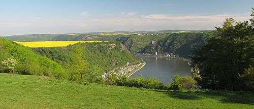
The Rheinburgenweg (Rhine castles trail) runs mainly parallel to the left (west) bank of the river Rhine from Bingen to Rolandsbogen south of Bonn. It runs mainly on elevated trails providing along the way excellent views of the UNESCO World Heritage Site valley and the many castles on both sides of the river.
History
The Rheinburgen-Wanderweg was started in 2004 with the path on the right side of the Rhine which is now part of the Rheinsteig. In 2006 the Koblenz to Bingen stretch was defined with the full path opening in 2010. It was also at this point awarded the "Qualitätsweg Wanderbares Deutschland".
Eat and drink
There are many places to eat along the way, not just in the towns along the way, but also a few isolated restaurants and taverns (Gaststätte) along the trail.
Sleep
Both sides of the Rhine river provide hotel and camping facilities. Places on the route are listed below, for others follow the links to the town pages.
Buy
On the trail is little chance for shopping. However in the villages you pass there is ample opportunity to purchase the local wines. In the towns on the river you will have the chance to buy typical German tourist trinkets. Some of the castles also sell wooden swords and other toys for children of all ages.
Landscape, flora and fauna
The trail alternates between the relative flat plateau above the Rhine and the steep sides the Rhine and its side valleys. A large part of the walk is in forest but also opens out into agricultural fields, meadows and vineyards in many places. In the mixed woods on the slopes of the valley there is a good chance to come across deer.
Climate
The generally mild weather in Germany means this trail is accessible all year round. The colours of fruit tree blossom in the spring and the orange leaves of trees in the autumn are both worth seeing. In the summer be aware that you could be exposed to the strong sun for a large portion of the walk, so do not forget sun protection. Some points of the walk you need to take caution on rainy days, particular on rock exposed slopes.
Prepare
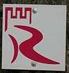
Most of the walk is on good paths with some steep rocky sections. Hiking footwear is highly recommended. The route generally passes through a town or village roughly every 10 km so only water and snack suppliers are needed. The route is well signed with the red R way-marker but a local map or guide book can still prove useful.
Get in
By plane
The area can easily be reached from Cologne/Bonn, Hahn and Frankfurt airports.

By car
The A61 autobahn runs north-south about 10 km to the west of the Rhine, providing a number of access points to the trail.
By train
From Mainz or Cologne the West Rhine railway (Linke Rheinstrecke) going through Bonn, Bingen and Koblenz provides a number of useful stop points.
By boat
There are car ferries (also for foot and bike) across the Rhine. See below in route listings for details of locations.
Get around
By car
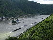
The B9 runs along the left bank of the Rhine between Bingen and Bonn and provides access to some interesting hairpin bend side roads to the trail.
By train
The West Rhine railway (Linke Rheinstrecke) provide a very scenic means of transport with stop in towns that the trail goes through.
By bus
Walk
| Listing Key | |||
|---|---|---|---|
| See | museums, castles, etc. | View | viewpoints |
| Do | pleasure rides, beaches, sports | Buy | shopping |
| Eat | restaurants, snack outlets | Drink | bars and cafes |
| Sleep | hotels, hostels, campsites | Go | car parking, rail stations, etc. |
| City | towns and villages | Vicinity | near route locations |
| Red | warning or points of concern | Other | |
The walk does not need to be done in a single expedition. There are points at convenient distances, between 8 and 12 km, where you can park a car allowing you to use the two car one direction hiking technique. There are also points where trains are available or even one of the Rhine cruise ships.
Route and sights of interest
Points of interest along the route listed below and shown on maps.
The milestone below each section shows kilometres from start and to end of the trail.
Upper Rhine section
Bingen - Trechtingshausen : 17 km
0←km→195
The walk starts on the northern edge of Bingen climbing steeply out of the Rhine valley and into the Bingen forest.
- 🌍 Parking - Bingen, Koblenzer Straße (Short walk, unfortunately along main road, to start of trail.). Parking lot and on side of the road (Koblenz Straße) near Shell station on the edge of Bingen
- 🌍 Mouse tower (Mäuseturm) (Level with the start of the trail.). 10th-century tower in the middle of the Rhine river.
- 🌍 Viewpoint Prinzenkopf. Views towards Bingen and Rüdesheim
- 🌍 Viewpoint Kreuzbach. View of Assmannshausen
- 🌍 Forsthaus Heiligkreuz (Down a small slope from the trail.), ☎ +49 6721 992975.
- 🌍 Villa Rustica (In Bingen forest (Binger Wald) near Weiler bei Bingen). Remains of a Roman villa.
- 🌍 Parking - Josefsbrunnen, Josefsbrunnen (Note the narrow road from Bingen via Forsthaus Heiligkreuz is closed to motor vehicles on Sundays and national holidays. Can also be reached from Weiler and Waldalgesheim.).
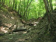
- 🌍 Steckeschlääferklamm. A small narrow gorge with some interesting wood carving made into the trees.
- 🌍 Parking - Kinderholungsheim (From Waldalgesheim good quality but narrow roads.).
- 🌍 Forsthaus Jägerhaus (at the bottom of Steckeschääferklamm take the path straight on and up the hill rather than right to follow the trail.), ☎ +49 6721 159241. Excellent food and quality rooms.
- 🌍 Schweizerhaus. Look attractive from the valley but based on web reviews the food and drink sounds as dangerous as the dogs and garden furniture look.
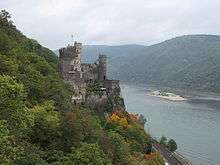
- 🌍 Burg Rheinstein. Medieval castle that is well worth a visit for the architecture and the views. Also a good small restaurant and a few accommodation rooms.
- 🌍 Waldgaststätte und Pension Haus Waldfrieden / Gerhardshof (By car best reached via stone/gravel road from Forsthaus Jägerhaus. A number of navigation systems show a route from Trechtingshausen to here, although passable, it is a narrow stony track with many potholes, only for the experience driver with a good vehicle who enjoy such fun driving.). Good food, friendly staff. Perfectly positioned for the hiker.
- above 🌍 Trechtingshausen
Trechtingshausen - Bacharach: 17 km
17←km→178
This section of the walk starts in the Binger Wald most of the time within the forest but returns eventually to above the Rhine valley providing spectacular views of the river and a number of castles before dropping down into the valley.
- 🌍 Viewpoint Sieben Burgen Blick.

- above 🌍 Burg Sooneck. Medieval castle
- 🌍 Parking - Burg Sooneck.
- 🌍 Parking - Niederheimbach (in Niederheimbach). limited space and some with time restrictions
- Niederheimbach
After climbing out of Heimbachtal you meander along the top of the valley in more open fields passing a number of small villages before returning to the Rhine valley bottom at Bacharach.
- Oberdiebach
- Medenscheid
- Neurath
- 🌍 Burg Stahleck. 12th-century castle, now a youth hostel.
- 🌍 Parking - Bacharach. On the main road at Bacharach.
Bacharach - Oberwesel: 14 km
34←km→161
The very steep climb out of Bacharach provides you some great views of the town and its defensive towers. You continue to climb through vineyards on the side of the valley before reaching the open fields of the plateau above.
- 🌍 Parking, Henschhausen (above the trail on the K21).
- Viewpoint Blüchenblick.
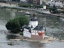
- 🌍 Pfalzgrafenstein Castle. 14th century toll station in the middle of the river
- Viewpoint Sauzahn Grillplatz.
- 🌍 Viewpont (Pfalzblick).
- 🌍 Parking, Pfalzblick (K89 between Oberwesel and Langscheid).
- 🌍 Schönburg. 12th century castle with expensive but impressive restaurant and hotel.
- 🌍 Oberwesel townwall (Oberwesel Stadtmauer). Excellent example of town wall with defensive towers
Oberwesel - St Goar: 9 km
48←km→147
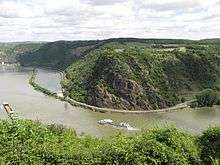
- 🌍 Parking - Siebenjungfrauenblick.
- 🌍 Günderode Haus, Rheingoldstraße (am Siebenjungfrauenblick), ☎ +49 6744 714011. German food with original flare. Building was located in this position with spectacular view of the Rhein for the film Heimat 3.
- Urbar
- 🌍 Parking - Urbar, Loreleystraße.
- 🌍 Viewpoint - Loreley Blick. View of the Loreley across the Rhein
- 🌍 Loreleyblick Maria Ruh, ☎ +49 6741 8020. Restaurant and beer garden. Great views but odd food menu. Good place to stop for a drink.
- 🌍 St. Goar
St. Goar - Bad Salzig: 18 km
57←km→138
Although starting off in the vineyard most of this section alternates between the woods clinging to the edge of the Rhine valley and the grazing pastures on the plateau above. The route provides many excellent views of the river valley and the towns below.
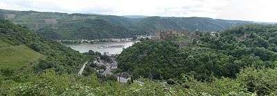
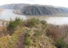
- 🌍 Burg Rheinfels. Impressive castle ruins, a must visit. Take a torch or candles to really explore the ruins.
- 🌍 Romantik Hotel Schloss Rheinfels, Schloßberg 47, ☎ +49 6741 802-0. Attached to the hotel, through the small shop is a restaurant excellent view of the valley.
- 🌍 Parking - Gründelbach (Just after the hospital parking).
Here is a very steep climb out of the valley.
- 🌍 Viewpoint Pilz.
This section follows the Alpinfad runing through the wood along the valley slope. The path is narrow with steep drops, not recommended after heavy rain.
- 🌍 Viewpoint - Heimbach.
- 🌍 Holzfelder Ziegenhof, Hof Taunusblick. limited opening hours. Chance to buy goats cheese or get a snack
- Holzfeld
Be care to follow the red markers and not the purple "Traumschleife" signs around Holzfeld, although there is an overlap for some time with these two routes.
- 🌍 Parking - Holzfeld, Ringstraße (Just below the church).
There are small narrow but steep valleys running into the main valley between Holzfeld and Bad Salzig, some section with narrow paths. Plan a little extra time to walk this section. Can be tricky when wet.
- 🌍 Viewpoint - Wilpertskopf (Aussichtspunkt).
The alpine path north from Herzenach is closed due to safety reasons. The alternate route bypassed the village.
- 🌍 Viewpoint - Europakuppel. Hut with view
- 🌍 Viewpoint - Ziehlay. With wooden carving of a praying nun.
- 🌍 Parking - Salzburnstraße. A few places next to the walk, more further up the road out of town.
- Bad Salzig
Bad Salzig - Rhens: 15.5 km
75←km→120
After going through the small Kurpark in Bad Salzig the path starts to climb slowly out of the outskirts of the town and into the woods. A final short steep section takes you back onto the flat section above the Rhine valley. Along the way there are good view back across the valley to the Feindliche Brüder (“Adversarial Brothers”), the two castles above Kamp-Bornhofen.
Once of the top the lane runs away from the edge of the valley. The official path temporarily diverts off this to follow the tree line, is easy to miss.
The drop back down into the valley before Boppard is a steep twisting narrow stone path.
After a stroll through the landscaped Bruder Michels Bach valley the path goes though the historic old town of Boppard and then along the promenade, one of the few stretches along the bank of the river.
- 🌍 Boppard a good selection of restaurants as well as accommodation.
- 🌍 Parking - Mühltal. 50 cents an hour or €4 for day ticket. WC and good Imbis on north end car pack.
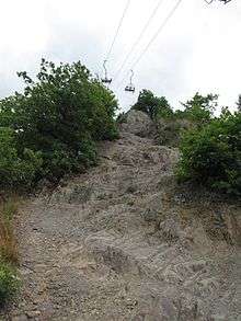
A long and steep climb out Boppard of over rocky terrain under the chairlift provides excellent views of the loop in the river. As a more adventurous alternative to the rocky steps, there is an alternative climbing "Klettersteig" route up to the Hirschkopf.
On reaching the top of the hill you walk though an oak wood and towards the buildings at the top of the chairlift.
- 🌍 GedeonsEck. Restaurant with outside seating and excellent view of the Rhine river loop at Filsen. Good menu selection with efficient and friendly service.
- 🌍 Vierseenblick. This is where the classic 4 lake view of the Rhine can been seen. Unfriendly service, you are expected to order the second you walk through the gate.
The walk continues on a relatively level section through the forest that run all the way into the Hunsrück.
- 🌍 Jakobsberg (less than 1 km off the trail.). Hotel, restaurant and golf resort
Along the way, before dropping down into the outskirt of the village of Brey through a narrow ravine, you can see some iron age burial mounds hidden in the undergrowth of the wood. Just off the trail you can find remains of a Roman water tunnel system. Across the valley you can see the Marksburg castle above Braubach.
- 🌍 Parking - Bramleystraße (on edge of the town centre). Free parking.
- Rhens
Lower Rhine section
Winningen - Bassenheim: 19 km
119←km→76
- Bassenheim
Bassenheim - Andernach: 13.5 km
138←km→57
- Andernach
Andernach - Bad Breisig: 19.5 km
151←km→43
- Bad Breisig
Bad Breisig - Remagen: 15.5 km
171←km→24
- Remagen
Remagen - Rolandsbogen: 14.5
186←km→0
- Rolandsbogen
Stay safe
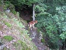
There are a few points with narrow path and steep drops but the route is basically a safe walk. The trail is not as well kept as the Rheinsteig and can be in places be overgrown, so expect the odd scratch from branches or irritations from stinging nettles. There is a very small chance in the region to come across wild boar, in this rare event stay well away from them!
Go next
- Rheinhöhenweg Trail
- Rheinsteig Trail on the right Rhine side