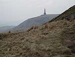
Pennine Way
The Pennine Way is a designated UK National Trail in the United Kingdom running for 429 km (268 miles) from Edale in Derbyshire to Kirk Yetholm in the Scottish Borders. On its way, the route passes through parts of the Peak District, the Yorkshire Dales and Northumberland National Park.
- This article is an itinerary.

Understand
The path was the idea of the journalist and rambler Tom Stephenson, inspired by similar trails in the United States of America, particularly the Appalachian Trail. Stephenson proposed the concept in an article for the Daily Herald in 1935, and later lobbied Parliament for the creation of an official trail. The walk was originally planned to end at Wooler, but eventually it was decided that Kirk Yetholm would be the finishing point. The final section of the path was declared open in a ceremony held on Malham Moor on 24 April 1965.
Although not the longest of the UK's long-distance paths, it is probably the best known and one of the more demanding routes. It generally follows the higher parts of the Pennines, a chain of moors and hills running north–south along the watershed of northern England. The Pennine Way can be walked in either direction, but is more commonly followed from south to north. This way you tend to have the wind at your back, and most travel guides (including this one) are written in this direction.
Prepare
Although it is waymarked and requires no specialist mountaineering skills, walking the Pennine Way requires a good level of fitness, appropriate equipment and adequate navigation skills. Accommodation is limited along some sections so if you are not camping, you might consider booking accommodation in advance. In particular, the last day normally involves a high-level 25-mile walk across the Cheviots from Byrness to Kirk Yetholm, though off-route accommodation can be used to split the long walk in two.
Get in
The trail officially starts at The Nags Head pub in Edale. Edale is best access by train. Sheffield and Manchester are both around a 45-minute train journey away. Bus services to Edale are very limited.
Walk
The route passes through or near the following (landmarks in italic):

- Mankinholes
- Hebden Bridge
- Top Withens
- Cowling and Lothersdale
- Thornton-in-Craven
- East Marton
- Gargrave
- Malham village, Malham Cove and Malham Tarn
- Fountains Fell
- Pen-y-Ghent
- Horton-in-Ribblesdale
- Gayle and Hawes
- Hardraw
- Great Shunner Fell
- Thwaite

- Keld
- Tan Hill Inn (highest public house in England)
- God's Bridge or Bowes
- Baldersdale
- Middleton-in-Teesdale
- Low Force and High Force (waterfalls)
- Forest-in-Teesdale
- Cauldron Snout (waterfall)

- High Cup Nick
- Dufton
- Knock Fell
- Great Dun Fell
- Little Dun Fell
- Cross Fell (highest point in the Pennines)
- Garrigill
- Alston

- Slaggyford
- Greenhead
- Thirlwall Castle and Hadrian's Wall
- Wark Forest
- Byrness
- Cheviot Hills
- Kirk Yetholm
Stay safe
Many parts of the Pennine Way are remote, exposed and prone to sudden changes in the weather. You should be familiar with moorland navigation and be suitably experienced and equipped for mountain walking.
Go next
The trail officially ends at The Border Inn in Kirk Yetholm. From here, a bus service links to Jedburgh via Kelso where further connections can be taken to Newcastle upon Tyne (total travel time approx. 2 hours) and Edinburgh (total travel time approx. 1 hour 45 minutes).
| Routes through Pennine Way |
| Edale ← | S |
→ Kirk Yetholm |