Jostedalsbreen
Jostedalsbreen is the largest glacier on the European mainland. It is located in the county of Sogn og Fjordane in Norway, and the many arms of the glacier can be seen from different parts of Sogn og Fjordane. Its size and position makes the glacier a key barrier to travel around the county. The glacier and the surrounding area is protected as a national park.
Understand
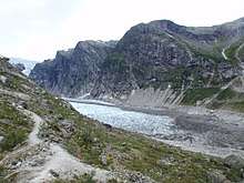
The main glacier rests on a mountain plateau west of the Jostedalen valley, hence the name. The glacier ice covers a total area of about 500 km2, while the national park is more than 1300 km2. Jostedalsbreen is a temperate glacier such that it is at melting point throughout the year, from its surface to its base. The glacier is not frozen to the bedrock but flows along the slopes and through the valleys like a river, albeit at very low speed from 1 cm/day up to 100 cm/day (3 feet per day). Flow is highest at surface and middle causing the ice to crack and break up. Chunks of ice regularly falls from the edge or front of the glacier, a process known as ice calving. The resulting huge waves in lakes or the chunks of ice themselves are deadly.
Glaciers are created by snow accumulated and gradually transformed into ice ("blue ice"). Snow melts off at lower parts of the glacier during summer revealing the blue ice (actual glacier), while the higher parts of the glacier has permanent snow cover. Glaciers like Jostedalsbreen are created and maintained by heavy snowfall at high altitudes, rather than by extreme temperatures as in the Antarctic.
Jostedalsbreen is basically a plateau glacier or ice cap, while the arms or branches are valley glaciers. Jostedalsbreen has some 30 named arms into the adjacent valleys, among the well-known are:
- Nigardsbreen in Jostedalen, Luster district
- Austerdalsbreen at Veitastrond, Luster
- Bøyabreen in Fjærland
- Briksdalsbreen at Olden
- Kjenndalsbreen at Loen
East of Jostedalen towards road 15 and 55 is the Breheimen ("Glacier park") protected area, and this area has number of smaller glaciers. West and South there are several smaller glacier not fully connected to Jostedalsbreen proper, but often seen as part of Jostedalsbreen system. Together with nextdoor Jotunheimen these form the highest and most alpine mountains in Norway.
Smaller, independent glaciers digging into mountain slopes creating amphitheater shapes are cirque glaciers, "botnbre" in Norwegian, hence the generic name "botn" in Norway's mountains.
History
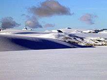
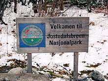
The glacier and the mountains surrounding it became a national park in 1991.
Jostedalen and many other secluded valleys in Sogn district were abandoned after the Black Death (1349) and remained uninhabited for the next 200 years. Around 1700, during the "Little Ice Age", glaciers advanced several kilometers down the valleys and destroyed farms.
Landscape
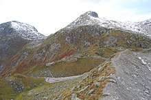
Mountains, some of them scrubbed bare by the ice. Many valleys. And glaciers rising to a height of 2083 m (6833 ft).
Flora and fauna
At lower elevation the flora is quite rich. This is because of the pure meltwater flowing down the valley. Closer to the glacier the flora is of an Arctic type. On the glacier there is not much animal life. Red deer, lynx and wolverines could be spotted. In the mountains and valleys around the fauna is richer. Especially the red deer can often be seen. Eagles can also be seen.
Climate
In the valleys and the mountain area around the glacier the climate can be temperate in summertime. On the glacier the temperature is lower. There can be snowfall even in mid-summer.
Stay safe

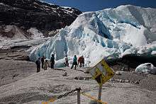
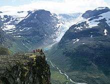
Glaciers are one of the most dangerous places for visitors to the Norwegian outdoor. Never underestimate the power of the glacier. Observe warning signs. Never approach the front of the glacier. A glacier is not a stable piece of ice, it is constantly moving like a river and huge chunks regularly fall of.
Do not enter the glacier without proper equipment and skilled guide. Preferably in an organised group tour with a guide.
Sunrays get reflected from the white snow, so it necessary to use sunscreen to protect your skin. Bring warm clothes for tours on the glacier.
Get in
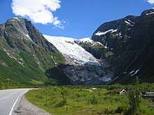
Jostedalsbreen largely rests on a mountain plateau with arms stretching in all directions to the valleys beneath. Only the arms of the glaciers are visible to visitors and the main glacier is visible only from airplane. The glacier can be approached from any of the valleys around the glacier, and there are many access points.
- The northeastern corner of the glacier is in Oppland in Skjåk district near road 15.
- Stryn district has several access points, notably the well known Briksdalsbreen at Olden
- Nigardsbreen arm in Luster district is also a popular place for glacier hiking
- Fjærland on road 5 has at least two arms of the glacier
Most of Jostedalsbreen is protected as national park which means that there are no roads within the park limits. Motor vehicles are not allowed outside roads. Motor transport is only to the edge of park or to one of the arms of the glacier.
Glaciers are treacherous and extremely dangerous, and visitors must keep a safe distance to the glacier arms. Visitors can hike on the glacier only with a professional guide. Guide services are available at Nigardsbreen (Jostedalen valley) and Olden/Loen/Stryn area.
By car
Public transport is limited with a few departures daily, so a car is the only flexible way to get to the edge of the park.
Road 5 Sogndal-Skei runs in a tunnel in the bedrock under the glacier, and the Bøyabreen arm is visible close to the road at the tunnel entrance in Fjærland.
The Stryn summer ski centre operates at the northern end of the glacier along road 258 Stryn-Grotli.
- From Oslo
- From Bergen
- From Trondheim
- Road E6 to Otta, then road 15 towards Stryn
- Road 55 to Luster
- From Geiranger
- Road 63 to Langvatn junction
- Road 15 to Stryn
- Road 15 to Grotli, road 258 (old road) to Stryn
- Road 15 to Lom, road 55 to Luster
By bus or rail
As Sogn og Fjordane county barely has railway lines, the best public transport option is by bus. Buses often operate on a limited schedule, but the entire county is well-covered. The map on Ruteinfo.net shows bus stations, bus stops and accommodation including telephone numbers. As the map is not in English, select one of the municipalities bordering the glacier (Jølster, Luster, Sogndal or Stryn) where it says VEL KOMMUNE. Local bus can be used for the last kilometers to the glacier front.
- From Trondheim
- From Bergen
- Express bus via Førde, Skei and Stryn towards Trondheim
- Express bus via Førde, Skei and Byrkjelo towards Ålesund
- Ekspress bus via Lærdal to Sogndal
- Train to Flåm, bus to Sogndal
- From Oslo and Oslo airport
By boat
No branch of the glacier reach sea level, but the glacier is partly visible from some of the surrounding fjords.
- Cruise ships calling at Skjolden (Luster) or Olden (Stryn district) offer bus transport some 30 km to the glacier.
- Express passenger boat from Bergen or Flåm to Balestrand or Sogndal can be used to connect to public transport on the north shore.
Fees and permits
There is no fee to enter the park. Hiking is allowed for anyone. There are mostly no fences and no guards on duty.
Get around
- See also: Hiking in the Nordic countries
There are no roads in the park, so the only option is by foot. Hiking in the area surrounding the glacier is very much possible, given you choose routes according to skill and experience. In no case should visitors get up on the glacier without a local professional or otherwise skilled enough guide; glaciers are extremely dangerous
See
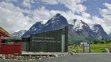
Some attractions related to the glacier and the park are situated outside the boundaries of the park:
- 🌍 Norsk bremuseum (Glacier museum of Norway), Fjærland, ☎ +47 57693288, fax: +47 57693287, e-mail: post@bremuseum.no. Jun-Aug: 09:00-21:00, Apr-May and Sep-Oct: 10:00-16:00. Museum regarding glaciers. Also visitor centre for the park. Adult:110 kr, students: 50 kr, children: 50 kr.
- Jostedalsbreen Nasjonalparksenter, Oppstryn, ☎ +47 57877200, e-mail: post@jostedalsbre.no. Visitor centre, with exhibition about flora, fauna and geology in the park.
- Breheimsenteret, Jostedal, ☎ +47 57683250, fax: +47 57683240, e-mail: jostedal@jostedal.com. 1 May-31 Sep: 10:00-17:00, 21 Jun-20 Aug: 10:00-19:00. Visitor centre.
If you only would like to see the glacier, without walking on it, these are the best options:
- 🌍 Nigardsbreen, Gaupne/Jostedalen (Route 55 to Gaupne then route 604). Arm of the great glacier. In Jostedal, 63 km from Sogndal. In the end of the road there is a parking space. From there departures a small boat over the lake in front of the glacier. The journeys takes 30 minutes. Observe from safe distance, guide needed for hike on the ice.
- 🌍 Bøyabreen (Bøyabreen glacier), Fjærland (Close to Route 5 towards Skei, right before the tunnel.). One of the few places where a glacier arm is readily visible from a main road. It is possible to see the glacier from the parking space. Or you could walk for about half an hour in relatively flat terrain. Keep a safe distance in case of falling ice.
- Supphellebreen (in Fjærland, 10 km on a side road from the village).
- 🌍 Briksdal glacier (Briksdalsbreen) (20 km (12 mi) from Olden, in the end of the valley), ☎ +47 57876800, fax: +47 57876801. Perhaps one of the most famous glacier in Norway. In the end of the valley. 22 km from Olden. This may be the most well known view of the glacier. The distance from the parking space to the glacier is 2.5 km (1.6 mi). You can walk or ride with motorised vehicles called Troll-car. Transport road–glacier: adults: 170 kr, children:65 kr.
- 🌍 Jostedalsbreen (Main glacier). The main glacier can as such be seen from air only. Approximate mid point indicated on map.
Do
Trekking and glacier walking should only be done with a professional, local guide. Here is a list of organised glacier tours:
- Bødalsbreen (Meet at Sande Camping), ☎ +47 57876800, +47 57874040. 10 Jun-15 Sep: at 10:00. A five hour treking, including three hour on the glacier. Children under 12 years are not allowed. 500 kr.
- Nigardsbreen, Nigardsbre (Meet diect by the glacier), ☎ +47 57683111, e-mail: post@bfl.no. at 11:30, 12:30, 14:00, 15:00. An easy tour, also suitable for children. Minimum age is six year. Adult: 200 kr, Children: 100 kr.
- Flatbreen, Fjærland (Meet at Bøyum Camping), ☎ +47 92854674, +47 57693189. 1 Jul-31 Aug: At 08:15. A tour suitable for person with some physical training. Trekking for 9 hours, including 3 hours on the glacier. Only children over ten years of age.
- 🌍 Stryn summer skiing, Old Stryn mt road (route 258). Ski lift at the northern end of Jostedalsbreen. This ski resort is open in summer only!
Individual tours could be arranged with the tour-guide upon request.
Hiking can be done around the glacier at safe distance. There are several good and safe viewpoints all around the glacier. The glacier must always be approached with great caution and careful planning. A detailed map 1:50,000 is needed. Visitors should consult locals, if in doubt go with a guide.
There are whitewater tours and also more quiet kayak tours available in the neighbourhood. Some of the tours are with the glacier in sight, some even include a glacier hike.
Buy
A ticket to the Norwegian Glacier Museum in Fjærland.
Eat
Traditional Sogn og Fjordane cuisine. Raspeballar, pinnekjøt or spekekjøt.
Drink
Olden, which is a bottled water from the Jostedalsbreen glacier. Its source lies in the Oldedalen valley south of Olden in Stryn municipality.
Sleep
Lodging
- Flatbrehytta, Fjærland, ☎ +47 57693229.
- Briksdalsbre fjellstove, Briksdalsbre, ☎ +47 57876800.
- Bødalseter, Loen, ☎ +47 57874590.
- Tungestølen turisthytte, Veitastrond, ☎ +47 41404655, e-mail: info@tungestolen.no.
- Further accommodation options in adjacent villages and districts:
- Stryn with nearby Olden and Loen on the norhern perimeter
- Fjærland and Sogndal on the southern edge
- Luster with Jostedalen valley east of the glacier
- Skei village and Jølster district on the western side
- Skjåk and Otta valley
Camping
There are no designated camping grounds in the park. There are camping sites at some accommodations in the neighbourhood.
Backcountry
Normal right to access applies to wild camping: visitors are allowed to stay over night in tents in the wilderness and at least 150 meters from buildings. Camping on roads, in gardens and fields is not permitted. Visitors must not leave any traces or garbage.
Go next
The rest of Sogn og Fjordane county is scenic. Also, nearby counties have a lot of splendid scenery too. There is a vast variety of things to do and see on your way to, e.g., Oslo or Bergen.
- Geiranger
- Valdres
- Gudbrandsdalen
- Lærdal
- Flåm/Aurland
- Jotunheimen - Norway's highest and most alpine mountains southeast of Jostedalsbreen
- Ålesund