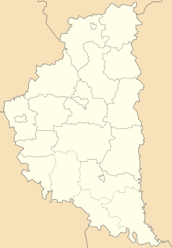
Zalishchyky, Buchach Raion
Mali Zalishchyky (Ukrainian: Малі Заліщики, Polish: Zaleszczyki Małe) is a village in the Buchach Raion (district) of the Ternopil Oblast (province) in western Ukraine. Small river Yazlovchyk (left tributary of the river Vilhovets) flows near of the village. In the village 473 inhabitants lived on 2003.
Mali Zalishchyky Малі Заліщики | |
|---|---|
 Mali Zalishchyky  Mali Zalishchyky | |
| Coordinates: 48°59′22″N 25°26′39″E | |
| Country | |
| Oblast | |
| Raion | Buchach Raion |
| Area | |
| • Total | 1.550 km2 (0.598 sq mi) |
| Population (2003) | |
| • Total | 473 |
| • Density | 305.16/km2 (790.4/sq mi) |
| Time zone | UTC+2 (EET) |
| • Summer (DST) | UTC+3 (EEST) |
| Postal code | 48467 |
| Area code(s) | +380 3544 |
History
First written mention comes from the 15th century. Then belonged to the Polish-Lithuanian Commonwealth, from 1772 until 1918 to Austrian (Habsburg Monarchy, Austrian Empire, Austria-Hungary) empires, in 1918-1919 to West Ukrainian People's Republic. From 1991 belonged to Ukraine.
Reading room of Ukrainian society Prosvita operated in the village.
Attractions
- Church of St. George
- Church of the Blessed Virgin Mary
- Chapel
- Monument to soldiers of Ukrainian Insurgent Army
People
- Bohdan Vandiak, Ukrainian artist, poet
- Antoni Prochaska, Polish historian
gollark: I am fourteen years in age and this has great depth.
gollark: * fixed-size
gollark: Maybe turtle graphics, except with a fixed bitmap grid thing and the value of each pixel actually affects control flow.
gollark: Idea: turtle graphics, esolang edition?
gollark: I recently purchased a phone, but I can actually hold mine. Picking one only took several days! They're mostly way too big.
References
Sources
- (in Ukrainian) Б. Таняк, М. Філаченкова, Малі Заліщики // Ternopil Encyclopedic Dictionary: in 4 v. / editorial board: H. Yavorskyi and other, Ternopil: "Zbruch", 2005, V. 2: К—О, S. 447. — ISBN 966-528-199-2.
External links
- (in Ukrainian) Заліщики
- Zalishchyky, google maps
- Zaleszczyki (4) Małe, wś, pow. buczacki in the Geographical Dictionary of the Kingdom of Poland, volume XIV (Worowo — Żyżyn) 1895, S. 347. (in Polish)
This article is issued from Wikipedia. The text is licensed under Creative Commons - Attribution - Sharealike. Additional terms may apply for the media files.