Zalaszentgrót
Zalaszentgrót | |
|---|---|
 Flag  Coat of arms | |
 Zalaszentgrót Location of Zalaszentgrót | |
| Coordinates: 46.94040°N 17.08138°E | |
| Country | |
| County | Zala County |
| Area | |
| • Total | 81.62 km2 (31.51 sq mi) |
| Population (2004) | |
| • Total | 7,875 |
| • Density | 96.48/km2 (249.9/sq mi) |
| Time zone | UTC+1 (CET) |
| • Summer (DST) | UTC+2 (CEST) |
| Postal code | 8790 |
| Area code(s) | 83 |
Twin towns — sister cities
Zalaszentgrót is twinned with:

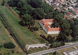
Aerialphotography of Zalaszentgrót
gollark: Great, I guess. What do you need two for?
gollark: <@224348995844177920> I just read this, might be interesting? https://www.cnx-software.com/2021/11/29/octo4a-app-installs-octoprint-server-on-android-smartphones/
gollark: It is a shame that the good mobile phone SoCs never make their way into single board computer products.
gollark: Released 2018, 4 Cortex-A75s and 4 other core things.
gollark: Quite good, I think.
External links
| Wikimedia Commons has media related to Zalaszentgrót. |
| Wikivoyage has a travel guide for Zalaszentgrót. |
- Street map (in Hungarian)

.svg.png)
| Authority control |
|---|
This article is issued from Wikipedia. The text is licensed under Creative Commons - Attribution - Sharealike. Additional terms may apply for the media files.