Zachariae Isstrom
Zachariae Isstrom (Danish: Zachariae Isstrøm; Isstrøm being the Danish word for ice stream) is a large glacier located in King Frederick VIII Land, northeast Greenland.
| Zachariae Isstrom | |
|---|---|
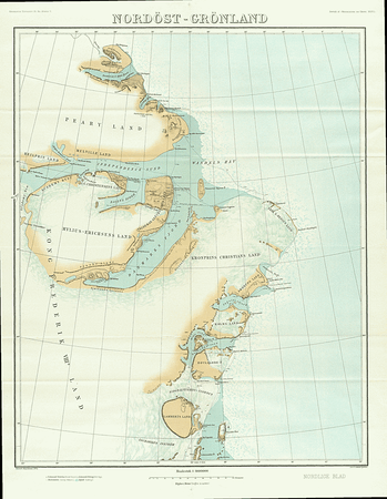
 1911 map with the Zachariæ Isstrøm at the bottom | |
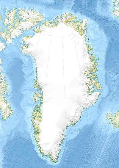
 Location within Greenland | |
| Type | Piedmont glacier |
| Location | Greenland |
| Coordinates | 78°0′N 30°0′W |
| Area | 91,780 km2 (35,440 sq mi) |
| Width | 26 km |
| Terminus | Jokel Bay, Greenland Sea North Atlantic Ocean |
This glacier was named by the Denmark expedition 1906–08 after Georg Hugh Robert Zachariae (1850–1937), an officer of the Danish Navy.[1]
Geography
It drains an area of 91,780 km2 (35,440 sq mi) of the Greenland Ice Sheet with a flux (quantity of ice moved from the land to the sea) of 11.7 km3 (2.8 cu mi) per year, as calculated for 1996,[2] increasing to 15 km3 (3.6 cu mi) in 2015.[3] The glacier holds a 0.5-meter sea-level rise equivalent.
Zachariae Isstrøm has its terminus in the northern part of Jokel Bay, south of Lambert Land and north of Nørreland, near the Achton Friis Islands.[4] It terminates into an embayment previously packed with multi-year calf ice.[5]
Glacier retreat
Zachariae Isstrøm broke loose from a stable position in 2012 and entered a phase of accelerated retreat as predicted in 2008.[6]
From a state of approximate mass balance until 2003 it is now losing mass at about 5 Gt/yr. The ice velocity increased by 50% in 2000–2014. In 2012 it detached from a stabilizing sill and retreated rapidly along a downward-sloping, marine-based bed[3] with substantial calving[7]
See also
References
- Place names, NE Greenland - GEUS
- Rignot E., Kanagaratnam P. (2006). "Changes in the velocity structure of the Greenland Ice Sheet". Science. 311 (5763): 986–990. doi:10.1126/science.1121381. PMID 16484490.
- Fast Retreat of Zachariæ Isstrøm, Northeast Greenland
- "Zachariae Isstrøm". Mapcarta. Retrieved 16 June 2016.
- Greenland marine-terminating glacier area changes: 2000–2010
- Glacier changes for 2008 Greenland ice sheet outlet glacier front changes: comparison of year 2008 with past years
- NASA Earth Observatory December 4, 2015