Wyoming Highway 71
Wyoming Highway 71 (WYO 71) is a 10.83-mile-long (17.43 km) north–south Wyoming state highway known as Sage Creek Road in Carbon County that travels from near the Teton Reservoir north into the southern part of Rawlins.
| ||||
|---|---|---|---|---|
| Sage Creek Road | ||||
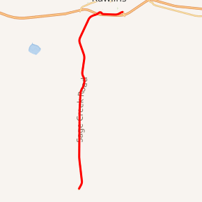
WYO 71 highlighted in red | ||||
| Route information | ||||
| Maintained by WYDOT | ||||
| Length | 10.83 mi[1] (17.43 km) | |||
| Major junctions | ||||
| South end | ||||
| North end | ||||
| Location | ||||
| Counties | Carbon | |||
| Highway system | ||||
State highways in Wyoming
| ||||

Route description
Highway 71, predominantly south of Rawlins, travels from Carbon County Route 401 near the Teton Reservoir[1] area north to Rawlins. Upon entering the Rawlins city limits, and after passing under Interstate 80/U.S. Route 30, WYO 71 heads in a more east-west direction paralleling the interstate. Downtown Rawlins can be accessed via Jackson and Washington Streets[2] Highway 71 comes to its northern end at Wyoming Highway 78[3] just 0.15 miles (790 ft) from exit 214 of I-80/US 30.[2]
Carbon County Route 401 continues south from WYO 71 to the Medicine Bow National Forest boundary where the designation for the roadway changes to Forest Service Road 801 till its end at Wyoming Highway 70. The road is dirt and gravel for the entire county and forest service portion.[1]
Major intersections
The entire route is in Carbon County.
| Location | mi | km | Destinations | Notes | |
|---|---|---|---|---|---|
| | 0.00 | 0.00 | Southern terminus | ||
| Rawlins | 10.03 | 16.14 | |||
| 10.47 | 16.85 | ||||
| 10.83 | 17.43 | Northern terminus; northern terminus of WYO 78 | |||
| 1.000 mi = 1.609 km; 1.000 km = 0.621 mi | |||||
References
- Wyoming @ AARoads.com - Wyoming Routes 000-099
- Google (14 August 2016). "Wyoming Highway 71" (Map). Google Maps. Google. Retrieved 14 August 2016.
- Wyoming Department of Transportation Reference Marker Book - November 2004 (PDF) (Map). WYDOT. Archived from the original (PDF) on July 17, 2011. Retrieved 2010-02-11.
- Official 2003 State Highway Map of Wyoming