Wyoming Highway 371
Wyoming Highway 371 (WYO 371) is a 7.3-mile-long (11.7 km) north-south Wyoming State Road in Sweetwater County that provides travel to the old coal mining town of Superior.[1]
| ||||
|---|---|---|---|---|
| Superior Road | ||||

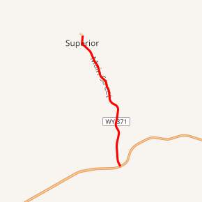
WYO 371 highlighted in red | ||||
| Route information | ||||
| Maintained by WYDOT | ||||
| Length | 7.30 mi[1] (11.75 km) | |||
| Existed | June 1971[2]–present | |||
| Major junctions | ||||
| South end | ||||
| North end | Upper Superior Road in Superior | |||
| Location | ||||
| Counties | Sweetwater | |||
| Highway system | ||||
State highways in Wyoming
| ||||
Route description
Wyoming Highway 371 begins its southern end at exit 122 of Interstate 80/U.S. Route 30 south of Superior. From there, WYO 371 travels north and passes through the town of Superior between Mileposts 6.78 and 7.16.[1] Not long after, Wyoming Highway 371 ends after 7.3 miles at Upper Superior Road.[3]
Major intersections
The entire route is in Sweetwater County.
| Location | mi | km | Destinations | Notes | |
|---|---|---|---|---|---|
| | 0.00 | 0.00 | Southern terminus of WYO 371 Exit 122 (I-80/US 30) | ||
| Superior | 7.30 | 11.75 | Upper Superior Road | Northern terminus of WYO 371 | |
| 1.000 mi = 1.609 km; 1.000 km = 0.621 mi | |||||
gollark: ++roll 3d6
gollark: I'm free iff apioforms approach you.
gollark: I am free at all times at which I am free.
gollark: ++roll 1d6
gollark: (Reduced Planck constant)
References
- Wyoming @ AARoads.com - Wyoming Routes 300-399
- "New Highway Signs Appear". Casper Star-Tribune. June 25, 1971. p. 9. Retrieved December 18, 2019 – via Newspapers.com.

- Google (19 July 2010). "Overview Map of Wyoming Highway 371" (Map). Google Maps. Google. Retrieved 19 July 2010.
This article is issued from Wikipedia. The text is licensed under Creative Commons - Attribution - Sharealike. Additional terms may apply for the media files.
