Wyoming Highway 354
Wyoming Highway 354 (WYO 354) is a 6.17-mile-long (9.93 km) east-west Wyoming state road located in north-central Sublette County.
| ||||
|---|---|---|---|---|
| Daniel-Merna Road | ||||
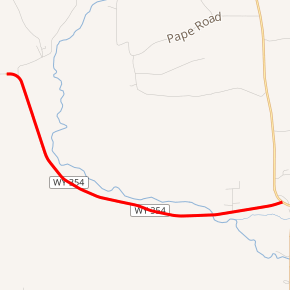
WYO 354 highlighted in red | ||||
| Route information | ||||
| Maintained by WYDOT | ||||
| Length | 6.17 mi[1] (9.93 km) | |||
| Major junctions | ||||
| West end | ||||
| East end | ||||
| Location | ||||
| Counties | Sublette | |||
| Highway system | ||||
State highways in Wyoming
| ||||

Route description
Wyoming Highway 354 begins its western end at Sublette CR 112 (Daniel-Merna Road) northwest of Daniel. Highway 354 turns southeasterly and follows the southern bank of the Green River. WYO 354 passes by the former site of Fort Bonneville, a fortified winter camp and fur trading post established in 1832, however no structure remains at the site today.[2] Nearing 5 miles, WYO 354 crosses the Green River. At 6.17 miles reaches its end at US 189/US 191 just west of their junction at Daniel Junction, north of Daniel.[3][4]
Major intersections
The entire route is in Sublette County.
| Location | mi[1] | km | Destinations | Notes | |
|---|---|---|---|---|---|
| | 0.00 | 0.00 | Western terminus of WYO 354 | ||
| Daniel Junction | 6.17 | 9.93 | Eastern terminus of WYO 354 | ||
| 1.000 mi = 1.609 km; 1.000 km = 0.621 mi | |||||
gollark: The Vega 56 is somewhat lower-end than the 64, and the Nvidia GTX 1660 Ti is I think comparable to that (probably worth checking out benchmarks for the specific games you play), but turns out to be a lot cheaper in Australia.
gollark: I think the Radeon RX 5700 (NOT the much older 5700 series HD ones) is *fairly* perf-comparable to the Vega 64, and they seem to be similar prices in Australia.
gollark: I think the AMD Vega cards have been replaced by the Navi ones now, which got released on Sunday.
gollark: *Tronzoid brings up a random vaguely political topic nobody asked about, again*
gollark: There are probably a bunch of different implementations in use, and possibly meta-repnets for weighting each repnet.
References
- Wyoming Department of Transportation Reference Marker Book (PDF) (Map). WYDOT. November 2004. Archived from the original (PDF) on July 17, 2011. Retrieved February 28, 2012.
- Sublette County GIS MapServer
- Google (March 1, 2012). "Overview Map of Wyoming Highway 354" (Map). Google Maps. Google. Retrieved March 1, 2012.
- Wyoming @ AARoads.com - Wyoming Routes 300-399
This article is issued from Wikipedia. The text is licensed under Creative Commons - Attribution - Sharealike. Additional terms may apply for the media files.