Wyoming Highway 170
Wyoming Highway 170 (WYO 170) is a 15.41-mile-long (24.80 km) Wyoming state road located in central Hot Springs County. WYO 170 is predominately an east-west highway, although it travels southeast to northwest for its last 5 miles.
| ||||
|---|---|---|---|---|
| Owl Creek Road Hamilton Dome Road | ||||
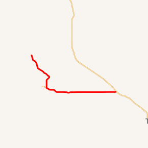
WYO 170 highlighted in red | ||||
| Route information | ||||
| Maintained by WYDOT | ||||
| Length | 15.41 mi[1] (24.80 km) | |||
| Major junctions | ||||
| West end | ||||
| East end | ||||
| Location | ||||
| Counties | Hot Springs | |||
| Highway system | ||||
State highways in Wyoming
| ||||

Route description
Wyoming Highway 170 begins its northwestern end in an area called Hamilton Dome within the census-designated place of Owl Creek at Hot Springs CR 15. Via CR 15 (Hamilton Dome Road) and CR 10 (Cottonwood Creek Road) one can return to Wyoming Highway 120.[2]
Highway 170 travels southeasterly from Hamilton Dome, locally named Hamilton Dome Road, and meets the eastern terminus of Wyoming Highway 174 approximately 5.5 miles south of Hamilton Dome. Here WYO 170 turns east and is named Owl Creek Road. WYO 170 will continue east for the remainder of its routing as it parallels Owl Creek along north edge of Wind River Indian Reservation. Highway 170 reaches Wyoming Highway 120 at 15.41 miles and ends, eight miles northwest of Thermopolis.[2][3]
Major intersections
The entire route is in Hot Springs County.
| Location | mi[1] | km | Destinations | Notes | |
|---|---|---|---|---|---|
| Owl Creek | 0.00 | 0.00 | Western (northern) terminus of WYO 170 | ||
| | 5.67 | 9.12 | Eastern terminus of WYO 174 | ||
| | 15.41 | 24.80 | Eastern terminus of WYO 170 | ||
| 1.000 mi = 1.609 km; 1.000 km = 0.621 mi | |||||
References
- Wyoming Department of Transportation Reference Marker Book (PDF) (Map). WYDOT. November 2004. Archived from the original (PDF) on July 17, 2011. Retrieved February 14, 2012.
- Wyoming @ AARoads.com - Wyoming Routes 100-199
- Google (24 February 2012). "Overview Map of Wyoming Highway 170" (Map). Google Maps. Google. Retrieved 24 February 2012.