Weldiya
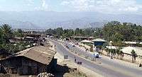
Weldiya (Amharic: ወልደ,wäldiya, "Son") is the capital of the Semien Wollo Zone, and woreda in northern Ethiopia. Located north of Dessie and southeast of Lalibela in the Amhara Region, this town has an elevation of 2112 meters above sea level.
Weldiya ወልደ | |
|---|---|
 | |
 Flag | |
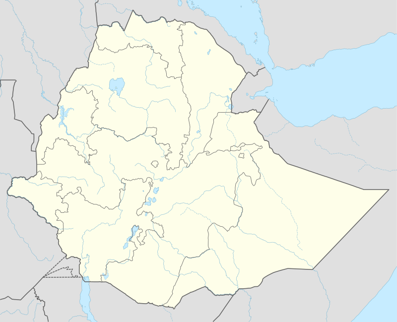
 Weldiya Location within Ethiopia | |
| Coordinates: 11°49′50″N 39°36′0″E | |
| Country | Ethiopia |
| Region | Amhara |
| Zone | Semien Wollo Zone |
| Elevation | 2,112 m (6,929 ft) |
| Population (2019) | |
| • Total | 180.000 |
| Time zone | UTC+3 (EAT) |
| Climate | Csb |
A notable landmark is a church Weldiya Gebriel.
History
18th century
When the missionary Johann Ludwig Krapf passed through Weldiya in April 1842, it was the headquarters of Dejazmach Faris Aligas and his brother Birru. They were absent at the time of Krapf's visit, raiding the territories of Imam Liban of the Were Himano.[1]
As early as 1890, Weldiya was the administrative center of Yejju Province. Its Tuesday market was well known for its mules.[2]
20th century
Weldiya was attacked in 1948 by the Raya Azebo as part of the "Woyane Rebellion." Revolting after their appeals over their loss of land, they seized the prison in Weldiya and freed the prisoners. Despite this success, the revolt was eventually put down.[3] On 16–17 November 1988 Weldiya was subjected to an aerial attack by the Derg, but no deaths were reported.[4]
Demographics
Based on the 2019 national census conducted by the Central Statistical Agency of Ethiopia (CSA), this town has a total population of 180,000, of whom 81,750 are men and 98,250 women. The majority of the inhabitants practiced Ethiopian Orthodox Christianity, with 80.49% reporting that as their religion, while 18.46% of the population said they were Muslim.[5]
The 1994 national census reported a total population for Weldiya of 24,533 in 5,413 households, of whom 11,689 were men and 12,844 were women. The two largest ethnic groups reported in this were the Amhara (93.92%), and the Tigrayan (4.32%); all other ethnic groups made up 1.76% of the population. Amharic was spoken as a first language by 95.2%, and 3.75% spoke Tigrinya; the remaining 1.05% spoke all other primary languages reported. 79.75% of the population practiced Ethiopian Orthodox Christianity, and 19.44% of the population said they were Muslim.[6]
Education
There is a rising university, Weldiya University, and about a dozen other governmental and private primary and secondary schools.
Economy
Travertine for use in building has been worked on a minor scale nearby.[2]
Transportation
Weldiya is connected by all weather roads to Addis Ababa and Mekelle by highway 2 and to Debre Tabor by highway 22.
The city will be served by two railways under construction: the Weldiya-Mekelle Railway and the Awash-Weldiya Railway.
Notes
- Journals of the Rev. Messrs. Isenberg and Krapf, Missionaries of the Church Missionary Society, Detailing their proceedings in the kingdom of Shoa, and journeys in other parts of Abyssinia, in the years 1839, 1840, 1841 and 1842, (London, 1843), p. 443
- "Local History in Ethiopia") The Nordic Africa Institute website (accessed 19 November 2007)
- Bahru Zewde (2001). A History of Modern Ethiopia (second ed.). Oxford: James Currey. p. 218. ISBN 0-85255-786-8.
- Africa Watch Report, Ethiopia: "Mengistu has Decided to Burn Us like Wood": Bombing of Civilians and Civilian Targets by the Air Force, 24 July 1990
- Census 2007 Tables: Amhara Region, Tables 2.1, 2.4, 2.5, 3.1, 3.2 and 3.4.
- This town is located on the way from Dessie to mekkele and to be connected by railroad on four directions. 1994 Population and Housing Census of Ethiopia: Results for Amhara Region, Vol. 1, part 1, Tables 2.1, 2.7, 2.10, 2.13, 2.17, Annex II.2 (accessed 9 April 2009)