Wisconsin Highway 125
State Trunk Highway 125 (often called Highway 125, STH 125 or WIS 125) is a 2.62-mile (4.22 km) state highway in Outagamie County in the U.S. state of Wisconsin. It runs from Interstate 41 in the Town of Grand Chute east to Wisconsin Highway 47 in Appleton; the route is located entirely within these two municipalities. Highway 125 is maintained by the Wisconsin Department of Transportation.
| ||||
|---|---|---|---|---|
| College Avenue | ||||
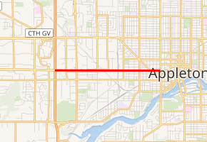
WIS-125 highlighted in red | ||||
| Route information | ||||
| Maintained by WisDOT | ||||
| Length | 2.62 mi[1] (4.22 km) | |||
| Major junctions | ||||
| West end | ||||
| East end | ||||
| Location | ||||
| Counties | Outagamie | |||
| Highway system | ||||
| ||||

Route description
Highway 125 begins at a junction with I-41 and County Highway CA in the Town of Grand Chute. From here, the route heads east as a divided highway called College Avenue, passing through a business district. It meets County Highway AA (Bluemound Drive) before passing a baseball diamond. After entering Appleton, the highway meets County Highway A (Lynndale Drive). Past this junction, the route crosses the Canadian National Railway. The highway runs through a mixed residential and business area, passing to the south of Wilson Middle School. After crossing Badger Avenue, Highway 125 terminates at a junction with Highway 47; College Avenue continues east of the intersection.[2][3] Valley Transit's Route 15 West College bus serves much of Highway 125, including the entire eastern half of the road.[4]
Major intersections
The entire route is in Outagamie County.
| Location | mi[2] | km | Destinations | Notes | |
|---|---|---|---|---|---|
| Town of Grand Chute | 0.0 | 0.0 | Western terminus | ||
| 0.27 | 0.43 | ||||
| Appleton | 1 | 1.6 | |||
| 2.5 | 4.0 | Eastern terminus | |||
| 1.000 mi = 1.609 km; 1.000 km = 0.621 mi | |||||
References
- Bessert, Chris. "Wisconsin Highways: Highways 120-129 (Highway 125)". Wisconsin Highways. Retrieved 2007-03-20.
- Google (January 28, 2011). "Overview map of Highway 125 Distances Between Interchanges" (Map). Google Maps. Google. Retrieved January 28, 2011.
- Outagamie County (PDF) (Map). Wisconsin Department of Transportation. 2011. Retrieved February 7, 2012.
- Route 15 - West College (PDF) (Map). Valley Transit. Retrieved February 7, 2012.
| Wikimedia Commons has media related to Wisconsin Highway 125. |