Willoughby on the Wolds
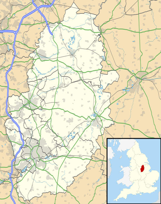
Willoughby on the Wolds is a small village in Nottinghamshire, England, on the border with Leicestershire. Its nearest neighbouring villages are Wysall, Widmerpool, Wymeswold and Keyworth, with the nearest towns and cities being Loughborough, Melton Mowbray, Nottingham and Leicester. According to the 2001 census it had a population of 484,[1] increasing to 572 at the 2011 census.[2]
| Willoughby on the Wolds | |
|---|---|
 Willoughby on the Wolds Location within Nottinghamshire | |
| Population | 572 (2011) |
| OS grid reference | SK637253 |
| District |
|
| Shire county | |
| Region | |
| Country | England |
| Sovereign state | United Kingdom |
| Post town | LOUGHBOROUGH |
| Postcode district | LE12 |
| Dialling code | 01509 |
| Police | Nottinghamshire |
| Fire | Nottinghamshire |
| Ambulance | East Midlands |
| UK Parliament | |
The village has its own Parish Council and comes within the jurisdiction of the Nottinghamshire County Council.[3] but its postal address is Leicestershire.
The village is the approximate location of the minor civil war battle of Willoughby Field which took place in July 1648. It is also closely linked with the Roman encampment of Vernometum on the Fosse way which runs only a few hundred yards from the village.
See also
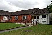
- Church of St. Mary and All Saints, Willoughby-on-the-Wolds
References
- Office For National Statistics
- "Civil Parish population 2011". Neighbourhood Statistics. Office for National Statistics. Retrieved 17 April 2016.
- Willoughby On The Wolds Parish Council
External links
| Wikimedia Commons has media related to Willoughby-on-the-Wolds. |