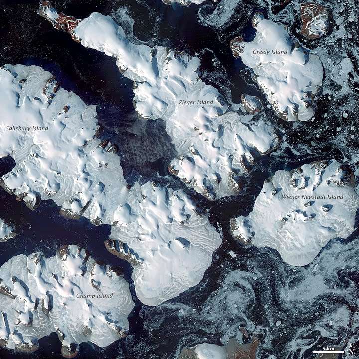
Wiener Neustadt Island
Wiener Neustadt Island (Russian: Остров Винер-Нёйштадт, Ostrov Viner-Neyshtadt,[1] also Остров Винер-Нойштадт, Ostrov Viner-Noyshtadt)[2] is an island in Franz Josef Land, Russian Federation.
| остров Винер-Нойштадт | |
|---|---|
.jpg) View of Wiener Neustadt Island | |
Location of Wiener Neustadt Island in Franz Josef Land | |
| Geography | |
| Location | Arctic |
| Coordinates | 80°48′N 58°20′E |
| Archipelago | Franz Josef Archipelago |
| Area | 237 km2 (92 sq mi) |
| Length | 22 km (13.7 mi) |
| Width | 16 km (9.9 mi) |
| Highest elevation | 620 m (2,030 ft) |
| Highest point | Peak Parnass |
| Administration | |
Russian Federation | |
| Demographics | |
| Population | 0 |
History
This island was named after Wiener Neustadt, a town located south of Vienna, by the Payer-Weyprecht Austro-Hungarian Arctic expedition.[3]
Geography
Wiener Neustadt Island is part of the Zichy Land subgroup of the Franz Josef Archipelago. It is separated from Ziegler Island and Salisbury Island by the narrow Collinson Sound (Proliv Kollinsona).
Wiener Neustadt Island's area is 237 km² and it is almost completely glacierized. The highest point of this island, Peak Parnass, is 620 m, the highest in Franz Josef Land.[4]
 Various islands of Franz Josef Land |
gollark: Also hydrogen as energy storage.
gollark: I have it mostly because I like the atomic disassemblers and ore production.
gollark: Slightly related: 2 fusion reactors in a compact machine with room for 3.
gollark: See, vast numbers.
gollark: The nuclearcraft ones must be spammed in vast numbers to work.
References
- Geography of the City of Arkhangelsk from city administration web site (Russian)
- Geography of Russia, letter Ф (Russian)
- Historical data
- Islands - UNEP
This article is issued from Wikipedia. The text is licensed under Creative Commons - Attribution - Sharealike. Additional terms may apply for the media files.