Widensolen
Widensolen is a communes in the Haut-Rhin department in Grand Est in north-eastern France.
Widensolen | |
|---|---|
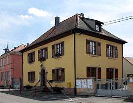
 The town hall in Widensolen | |
.svg.png) Coat of arms | |
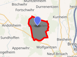
Location of Widensolen 
| |
 Widensolen  Widensolen | |
| Coordinates: 48°03′47″N 7°28′51″E | |
| Country | France |
| Region | Grand Est |
| Department | Haut-Rhin |
| Arrondissement | Colmar-Ribeauvillé |
| Canton | Ensisheim |
| Intercommunality | Pays Rhin-Brisach |
| Government | |
| • Mayor (2014-2020) | Josiane Bigel |
| Area 1 | 10.67 km2 (4.12 sq mi) |
| Population (2017-01-01)[1] | 1,177 |
| • Density | 110/km2 (290/sq mi) |
| Time zone | UTC+01:00 (CET) |
| • Summer (DST) | UTC+02:00 (CEST) |
| INSEE/Postal code | 68367 /68320 |
| Elevation | 184–194 m (604–636 ft) (avg. 188 m or 617 ft) |
| 1 French Land Register data, which excludes lakes, ponds, glaciers > 1 km2 (0.386 sq mi or 247 acres) and river estuaries. | |
Population
| Year | Pop. | ±% |
|---|---|---|
| 2006 | 1,214 | — |
| 2007 | 1,238 | +2.0% |
| 2008 | 1,244 | +0.5% |
| 2009 | 1,252 | +0.6% |
| 2010 | 1,237 | −1.2% |
| 2011 | 1,223 | −1.1% |
| 2012 | 1,208 | −1.2% |
| 2013 | 1,206 | −0.2% |
| 2014 | 1,197 | −0.7% |
| 2015 | 1,190 | −0.6% |
| 2016 | 1,184 | −0.5% |
gollark: There are various misfeatures allowing generation of stupid amounts of money.
gollark: Playing a very broken game.
gollark: Over the past 12ish hours.
gollark: People are making horrendously giant quantities of money. My exploiting of one issue is barely having an effect.
gollark: The central bank balance is dropping impressively fast with all of the exploiting taking place.
See also
References
- "Populations légales 2017". INSEE. Retrieved 6 January 2020.
| Wikimedia Commons has media related to Widensolen. |
This article is issued from Wikipedia. The text is licensed under Creative Commons - Attribution - Sharealike. Additional terms may apply for the media files.