Whitfield, Northamptonshire
Whitfield is a village and parish in the south-west of the English county of Northamptonshire in the valley of the River Great Ouse which forms the border with Buckinghamshire. Nearby villages include Syresham, Biddlesden, Helmdon and Silverstone. At the time of the 2001 census, the parish had 215 inhabitants,[1] including Radstone and increasing to 274 at the 2011 Census.[2]
| Whitfield | |
|---|---|
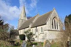
 St John the Evangelist's Church in Whitfield | |
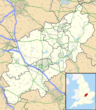
 Whitfield Location within Northamptonshire | |
| Population | 274 (2011) |
| OS grid reference | SP6039 |
| District | |
| Shire county | |
| Region | |
| Country | England |
| Sovereign state | United Kingdom |
| Post town | Brackley |
| Postcode district | NN13 |
| Dialling code | 01280 |
| Police | Northamptonshire |
| Fire | Northamptonshire |
| Ambulance | East Midlands |
| UK Parliament | |
The Church of England parish church is dedicated to St John the Evangelist and is a Grade II listed building, built in 1870.[3] The original church, built in the 13th century, was damaged by a heavy gale on 1 February 1869, which blew down the west tower, which required it to be rebuilt entirely.[4]
History
Whitfield was a Saxon parish, that was owned by the King at the time of the Domesday Book, in 1086, as part of his manor of Kings Sutton. It had a population of 34.[5]
In medieval times, the parish consisted of a single manor, which belonged to Worcester College, Oxford, who were also the patron of the church.[6]
The population of the parish peaked in 328 in 1831, before dropping to a low of 133 in 1951, recovering to 274 at the last census.[7]
References
- Office for National Statistics: Whitfield CP: Parish headcounts. Retrieved 30 November 2009
- "Civil Parish population 2011". Neighbourhood Statistics. Office for National Statistics. Retrieved 9 July 2016.
- "Whitfield Village Design Guide" (PDF). South Northamptonshire District Council. Retrieved 12 May 2018.
- Historic England. "CHURCH OF ST JOHN THE EVANGELIST, Whitfield (1190537)". National Heritage List for England. Retrieved 12 May 2018.
- Powell-Smith, Anna. "Whitfield | Domesday Book". opendomesday.org. Retrieved 12 May 2018.
- "History of Whitfield". www.visionofbritain.org.uk. Retrieved 12 May 2018.
- "Whitfield AP/CP - Total Population". www.visionofbritain.org.uk. Retrieved 12 May 2018.