White River Township, Barry County, Missouri
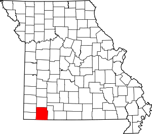
White River Township is one of twenty-five townships in Barry County, Missouri, United States. As of the 2000 census, its population was 2,434.
White River Township | |
|---|---|
 | |
| Coordinates: 36°32′17″N 093°37′49″W | |
| Country | United States |
| State | Missouri |
| County | Barry |
| Area | |
| • Total | 35.58 sq mi (92.16 km2) |
| • Land | 29.27 sq mi (75.82 km2) |
| • Water | 6.31 sq mi (16.35 km2) 17.74% |
| Elevation | 1,070 ft (326 m) |
| Population (2000) | |
| • Total | 2,434 |
| • Density | 83.2/sq mi (32.1/km2) |
| FIPS code | 29-79522[2] |
| GNIS feature ID | 0766273 |
White River Township was established in 1841.[3]
Geography
White River Township covers an area of 35.58 square miles (92.2 km2) and contains three incorporated settlements: Arrow Point, Emerald Beach and Shell Knob. It contains three cemeteries: McGuire, Viney and Viola.
The streams of Owl Creek, Rock Creek, Sweetwater Creek and Viney Creek run through this township.
Transportation
White River Township contains two airports or landing strips: Bel-Voir Acres Airport and Table Rock Airport.
gollark: The position of the earth relative to the sun at which it is your birthday.
gollark: * you are close to the birthday position, technically
gollark: That would be uncool.
gollark: I SUPPOSE you could use TIO.
gollark: osmarks.tk's secondary computing cluster, obviously...
References
- "US Board on Geographic Names". United States Geological Survey. 2007-10-25. Retrieved 2008-01-31.
- "U.S. Census website". United States Census Bureau. Retrieved 2008-01-31.
- "Barry County Place Names, 1928-1945 (archived)". The State Historical Society of Missouri. Archived from the original on 24 June 2016. Retrieved 30 August 2016.
This article is issued from Wikipedia. The text is licensed under Creative Commons - Attribution - Sharealike. Additional terms may apply for the media files.
