Wettin, Saxony-Anhalt
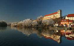
Wettin is a small town and a former municipality in the Saalekreis district of Saxony-Anhalt, Germany, situated on the River Saale north of Halle. Since 1 January 2011, it is part of the town Löbejün-Wettin. It is known for Wettin Castle, the ancestral seat of the House of Wettin, ruling dynasty of Saxony and Poland. Wettin sights include the Tower of Bismarck, the town hall, and the castle (used as the Burggymnasium).
Wettin | |
|---|---|
Ortsteil of Löbejün-Wettin | |
 Wettin Castle on the Saale river | |
 Coat of arms | |
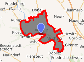
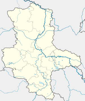
Location of Wettin 
| |
 Wettin  Wettin | |
| Coordinates: 51°35′N 11°48′E | |
| Country | Germany |
| State | Saxony-Anhalt |
| District | Saalekreis |
| Town | Löbejün-Wettin |
| Area | |
| • Total | 27.19 km2 (10.50 sq mi) |
| Elevation | 73 m (240 ft) |
| Population (2009-12-31) | |
| • Total | 2,355 |
| • Density | 87/km2 (220/sq mi) |
| Time zone | CET/CEST (UTC+1/+2) |
| Postal codes | 06193 |
| Dialling codes | 034607 |
| Vehicle registration | SK |
| Website | www.wettin.de |
History
Archbishopric of Magdeburg 1288-1680
Duchy of Magdeburg 1680-1807
Kingdom of Prussia 1701-1918
Province of Saxony 1815-1944
North German Confederation 1866-1871
German Empire 1871-1918
Free State of Prussia 1918-1933
Weimar Republic 1919-1933
Nazi Germany 1933-1945
Halle-Merseburg 1944-1945
Allied-occupied Germany 1945-1949
Saxony-Anhalt 1946-1952
East Germany 1949-1990
Saxony-Anhalt 1990-
Wettin was first documented as Vitin civitas in a 961 deed issued by German king Otto I. The settlement thereafter was a burgward within the Saxon Eastern March, held by Dietrich I von Wettin, the progenitor of the dynasty. His descendants became Margraves of Lusatia in 1032 and of Meissen in 1123. In 1288 Wettin was acquired by the Magdeburg archbishop Eric of Brandenburg.
- Mücheln
- The small village of Mücheln (not to be confused with the larger Mücheln near Merseburg) became part of Wettin and includes the restored old chapel of the Poor Fellow-Soldiers of Christ and of the Temple of Solomon (Knights Templar).
- Lützkendorf
- As bombing targets of the Oil Campaign of World War II, the Lützkendorf oil facilities 2 miles East of Mücheln included
- a small Wintershall AG[1] crude oil refinery (100,000 tons/yr),
- a Bergius process hydrogenation unit (125,000 tons/yr) for blending gasolines,
- a Fischer-Tropsch plant (80,000 tons/yr) to process heavier gasoline cuts from synthesized oil,[2] and
- tankage for about 75,000 metric tons.
- The Lützkendorf Grube supplied lignite from the south end of the mine to the two interconnected plants ("Lutzkendorf" and "Lutzkendorf-Mücheln")[3] at 51°17′N 11°52′E, and the facility also used tar for Low Temperature Carbonization.[2]
| Wikimedia Commons has media related to Wettin. |
References
- "The How and Why Air Attacks Crippled the German Oil-Chemical Industry: Natural Oil Targets". Orbat.com. Archived from the original on 2011-06-14. Retrieved 2009-10-24.
-
Stranges, Dr. Anthony. "Fischer-Tropsch Archive". Washington, D.C.: Fischer-Tropsch.org. Retrieved 2009-10-23.
- U.S. Government Technical Oil Mission. "Summaries: Microfilm 2" (PDF). pp. 2, 5, 11, 14, 15. Archived from the original (PDF) on 2011-07-16. Retrieved 2009-10-23.
- Western Axis Subcommittee. "ITEM 11D: Synthetic Oil Plants in Germany" (PDF). Enemy Oil Committee. pp. 160, 191. Retrieved 2009-10-23.
- HQ. U.S.S.T.A.F. (5 March 1944), Plan for Completion of Combined Bomber Offensive, Dwight D. Eisenhower Presidential Library: SMITH, WALTER BEDELL: Collection of World War II Documents, 1941-1945; Box No.: 48: HQ, U.S.S.T.A.F,
Copy 1 … MOST SECRET … DECLASSIFIED … 4/4/74
CS1 maint: location (link)