Wetteraukreis
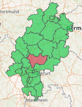
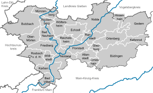
The Wetteraukreis is a Kreis (district) in the middle of Hesse, Germany. Neighbouring districts are Landkreis Gießen, Vogelsbergkreis, Main-Kinzig-Kreis, district-free Stadt Frankfurt, Hochtaunuskreis and Lahn-Dill-Kreis.
Wetteraukreis | |
|---|---|

| |
| Country | Germany |
| State | Hesse |
| Adm. region | Darmstadt |
| Capital | Friedberg |
| Area | |
| • Total | 1,101.71 km2 (425.37 sq mi) |
| Population (31 December 2018)[1] | |
| • Total | 306,460 |
| • Density | 280/km2 (720/sq mi) |
| Time zone | UTC+01:00 (CET) |
| • Summer (DST) | UTC+02:00 (CEST) |
| Vehicle registration | FB, BÜD |
| Website | http://www.wetteraukreis.de |

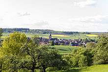
Area view of Eckartshausen
History
The district was created in 1972 when the two districts Friedberg and Büdingen were merged.
Geography
The district is located between the Taunus mountains and the Vogelsberg volcanic mountain. The main rivers of the district are the Nidda River and the Wetter River.
Coat of arms
 |
The imperial eagle in the top of the coat of arms was chosen because the Wetterau was imperial possession in the past. The bars in the bottom derive from the lords of Isenburg-Büdingen, who owned most of the area. The wavy line depicts the river Wetter which flows through the capital Friedberg. |
Towns and municipalities

Towns and municipalities in Wetteraukreis
| Towns | Municipalities |
|---|---|
gollark: It's not polling. They have a "firehose" API.
gollark: No, I mean I can probably use the same API it uses to extract commit logs from all of GitHub to harvest other API tokens.
gollark: Hmm. What if I do this to extract API keys?
gollark: Oh, the latest is 13 now. It doesn't look like they changed it however.
gollark: Your link is to documentation for 4 major versions ago, but I used the latest one (12).
References
- "Bevölkerungsstand am 31.12.2018". Hessisches Statistisches Landesamt (in German). July 2019.
This article is issued from Wikipedia. The text is licensed under Creative Commons - Attribution - Sharealike. Additional terms may apply for the media files.