West Langwell
West Langwell is a small crofting settlement in Rogart, Sutherland is in the Scottish council area of Highland within the Scottish Highlands.[1]
| West Langwell | |
|---|---|
 | |
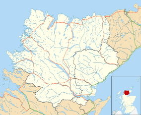 West Langwell Location within the Sutherland area | |
| OS grid reference | NC719095 |
| Council area | |
| Country | Scotland |
| Sovereign state | United Kingdom |
| Post town | Rogart |
| Postcode district | IV28 3 |
| Police | Scotland |
| Fire | Scottish |
| Ambulance | Scottish |
East Langwell lies 2 miles (3 km) directly southeast of West Langwell, and approximately 8 miles (13 km) north of Golspie.
Gallery
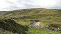 Abhainn Srath na Seilge View towards Creag Dhubh Dail nan Gillean across Srath na Seilge.
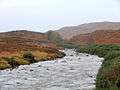
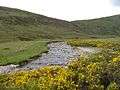 Abhainn Srath na Seilge or Black Water The river has now changed its name on the 1:25,000 map to Black Water. The river drains a large area of Ben Armine Forest and there is only one bridge upstream of here.
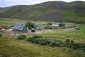 Acheilidh from above Looking down on the houses of Acheilidh and the level crossing
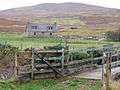 Braegrudie Only a footbridge leads to this remote croft
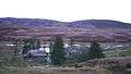 Craigton. Isolated, but still inhabited house in Strath Brora
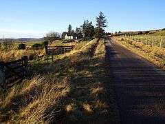
- West Langwell. From the road.
 Looking up the Brora from Braegrudie
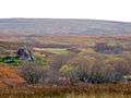 Split rocks at Braegrudie
gollark: pico is the one 10^-3 lower than nano.
gollark: Please learn SI prefixes.
gollark: It's obviously not random. It has approximately sensical grammar.
gollark: Spontaneous tetrational apiogenesis makes them unstable at sufficiently high densities.
gollark: I like to `rg -v "[A-Z']" ` instead of `cat`ing.
References
- Microsoft; Nokia (14 October 2017). "West Langwell" (Map). Bing Maps. Microsoft. Retrieved 14 October 2017.
This article is issued from Wikipedia. The text is licensed under Creative Commons - Attribution - Sharealike. Additional terms may apply for the media files.