Werleshausen
Werleshausen is a village in the northern part of Hesse, Germany. First recorded mention was in 876. Since 1972 it belongs to the town of Witzenhausen.
Werleshausen | |
|---|---|
Stadtteil of Witzenhausen | |
Location of Werleshausen 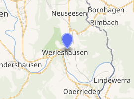
| |
 Werleshausen 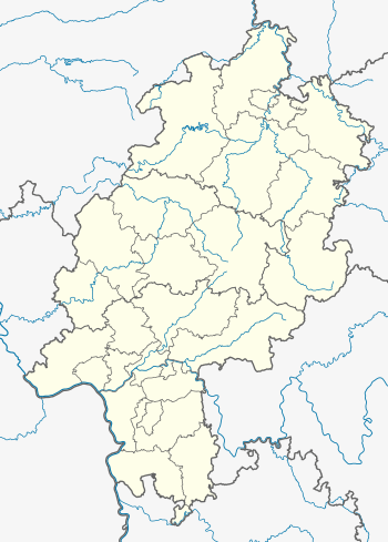 Werleshausen | |
| Coordinates: 51°19′30″N 9°54′50″E | |
| Country | Germany |
| State | Hesse |
| Admin. region | Kassel |
| District | Werra-Meißner |
| Town | Witzenhausen |
| Area | |
| • Total | 6.78 km2 (2.62 sq mi) |
| Elevation | 140 m (460 ft) |
| Population | |
| • Total | 500 |
| • Density | 74/km2 (190/sq mi) |
| Time zone | CET/CEST (UTC+1/+2) |
| Postal codes | 37214 |
| Dialling codes | 05542 |
| Vehicle registration | ESW + WIZ |
| Website | |
Location
The village of Werleshausen lies in the Werra valley near the Hoher Meißner, right on the boundary with Thuringia, almost at Germany's geographical centre, 33 km east of Kassel. The Bebra-Göttingen railway crosses the village in the east.
Neighbouring villages
Werleshausen borders in the east on the municipalities of Lindewerra and Bornhagen (Thuringia's Eichsfeld district), in the south on the village of Oberrieden, in the west on the village Wendershausen and in the north on the villages of Unterrieden and Neuseesen (town of Witzenhausen).
Sightseeing
- Historic framework buildings in the village core
- Manor
- Ludwigstein Castle
- Hanstein Castle (Bornhagen)
- Devil's rock ("Teufelskanzel") near Lindewerra
Gallery
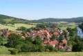 Village view
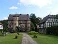 Manor in Werleshausen
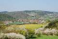 Blossom of cherry tries
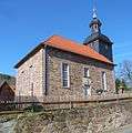 Church
gollark: So Plan 9 but asm2bf?
gollark: Just use an embedded TempleOS instance for IO.
gollark: Do not. We already have 1902751851518295267058712849012084571268904718904710924 in containment.
gollark: Ah, so a "frontend" framework.
gollark: Of what sort?
References
External links
- Homepage of Werleshausen (in German and English)
- Homepage of Witzenhausen (in German and English)
| Wikimedia Commons has media related to Werleshausen. |
Towns and municipalities in Werra-Meißner-Kreis district | ||
|---|---|---|
Wappen des Landkreises Werra-Meißner-Kreis | ||
This article is issued from Wikipedia. The text is licensed under Creative Commons - Attribution - Sharealike. Additional terms may apply for the media files.