Wellsford, Kansas
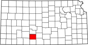
Wellsford is an unincorporated community in Kiowa County, Kansas, United States.
Wellsford, Kansas | |
|---|---|
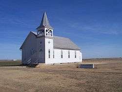
 Church in Wellsford (2006) | |
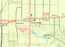
 KDOT map of Kiowa County (legend) | |
 Wellsford  Wellsford | |
| Coordinates: 37°37′00″N 99°01′43″W | |
| Country | United States |
| State | Kansas |
| County | Kiowa |
| Founded | 1880s |
| Incorporated | ? |
| Disincorporated | 1975 |
| Elevation | 2,116 ft (645 m) |
| Time zone | UTC-6 (CST) |
| • Summer (DST) | UTC-5 (CDT) |
| Area code | 620 |
| GNIS ID | 474264[1] |
History
Wellsford had a post office from the 1880s until 1955.[2]
Previously, Wellsford was an incorporated city, but it disincorporated in 1975. Wellsford was the most recent Kansas town to be disincorporated until Treece was in 2012.
Today, the townsite contains a church and a historic one-room jailhouse from the late 1800s.
Geography
Wellsford is located at 37°37′00″N 99°01′43″W (37.616685, -99.028714).[3]
gollark: I have a local server for file storage and that sort of thing.
gollark: If you store data in open formats on stuff you control with decent backups, digital media does *not* randomly disappear.
gollark: Though I looked at it a while ago and silicon or germanium might be better.
gollark: Loads of things. The highest-density is data encoded in big diamonds through different isotopes of carbon.
gollark: I mean, if it's fun, why not, but I don't think it's the most effective way to preserve data.
References
- "US Board on Geographic Names". United States Geological Survey. 2007-10-25. Retrieved 2008-01-31.
- "Kansas Post Offices, 1828-1961 (archived)". Kansas Historical Society. Archived from the original on October 9, 2013. Retrieved 12 June 2014.
- "US Gazetteer files: 2010, 2000, and 1990". United States Census Bureau. 2011-02-12. Retrieved 2011-04-23.
Further reading
External links
| Wikimedia Commons has media related to |
- Kiowa County Map, KDOT
This article is issued from Wikipedia. The text is licensed under Creative Commons - Attribution - Sharealike. Additional terms may apply for the media files.
