Watsonville Airport
Watsonville Airport was an airport in Watsonville, California. Watsonville Airport was used during World War 2 for antisubmarine blimp in the defense of California. Opened in 1930 by Watsonville Airport Incorporated, it was the city's first airport. Watsonville Airport Incorporated sold five thousand shares of stock to purchase land for the airport. Watsonville Airport Incorporated purchased 85 acres of land southwest of the city. The airport was built California State Route 1 and Salinas road in Monterey County, California. The Watsonville Airport has three 2,300 feet dirt runways in triangle shape. In 1930 Watsonville Airport Incorporated first president was Harlow Ford and Claude Wilson began first airport manager and flight instructor.
| Watsonville Airport | |
|---|---|
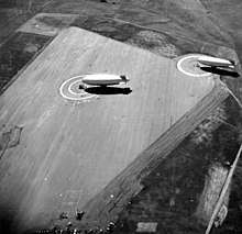 Old Watsonville NAAF Airield of US Navy in 1944 with antisubmarine blimps from Moffett Field. | |
| Location | Watsonville, California |
| Coordinates | 36°52′01″N 121°46′23″W |
| Area | 81 acres |
| Built | 1931 (Closed 1946) |
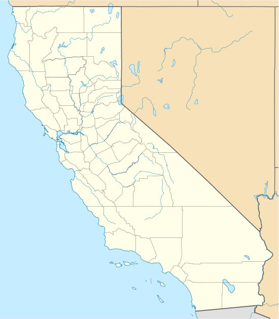 Location of Watsonville Airport in California | |
World War 2
The US Navy leased the Watsonville Airport in 1942 and used it as an auxiliary field, called Watsonville NAAF (LTA). Antisubmarine blimps from Moffett Field were stationed at the Watsonville Airport, after the Attack on Pearl Harbor on December 7, 1941. The Navy made paved the runways and built three blimp mooring circles. The Navy also built barracks for 166 Troops station at the Airport of a month and used the Airports existing 60 x 60 foot hangar. One or two K-class blimp and a L-class blimp were based at the Airport. The blimps depart in 12-hour shifts to look for submarines, give convoy support and when needed help in air-sea rescues. At the end of the war in later 1945 the Navy closed the base there and returned the Airport to Watsonville Airport Incorporated. The Airport was renamed to Watsonville Airport No. 2 as the larger Watsonville Municipal Airport has opened three miles (5 km) northwest of Watsonville. In 1947, the Watsonville Airport Incorporated sold the land to Edwin and Flora Peterson, the land was changed to a cattle feed lot. There are no traces of the Watsonville Airport today.[1][2][3]
See also
References
- airfields-freeman.com, Watsonville Airport, old
- irst Supplemental Surplus Appropriation Recission Bill, 1946, Part 2,By United States. Congress. House. Committee on Appropriations, page 40
- aval aerofiles.com, Flying Fields in the USA
External links
- Watsonville Municipal Airport (official site)