Waitotara
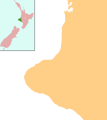
Waitotara (Māori: Waitōtara) is a town in South Taranaki, New Zealand. Waverley is 10 km to the north-west, and Wanganui is 34 km to the south-east. State Highway 3 passes through it. The Waitotara River flows past the east side of the town.[1][2]
Waitotara | |
|---|---|
 Waitotara | |
| Coordinates: 39°48′21″S 174°44′4″E | |
| Country | New Zealand |
| Region | Taranaki |
| District | South Taranaki District |
| Population (2013) | |
| • Total | 66 |
According to the 2013 New Zealand census, Waitotara has a population of 66, a decrease of 3 people since the 2006 census. There were 36 males and 27 females. Figures have been rounded and may not add up to totals.[3] More than 30 homes were evacuated during flooding in February 2004.[4]
A local freezing works is a major employer.[5]
Marae
Waitotara has five marae associated with the hapū of Ngā Rauru Kītahi:
- Te Ihupuku (see Gazette) and Te Kawerau meeting house and Karepoonia are affiliated with Ngati Hinewaiata as Gazetted see MLC ref.
- Kaipō or Wharetapapa Marae and its Tokanuhea III meeting house are affiliated with Ngāti Hou Tipua
- Takirau Marae and Ko Te Marunga Nui o Pourua meeting house are affiliated with Ngāti Pourua
- Tauranga Ika Marae and Te Aputa ki Wairau meeting house are affiliated with Ngāti Ruaiti
- Waipapa or Moumahaki Marae and Ngā Paiaka meeting house are affiliated with Ngā Ariki[6][7]
Education
Waitotara School is a coeducational full primary (years 1-8) school with a roll of 38 students as of March 2020.[8][9] The school was founded in 1874.[10]
Notes
- Peter Dowling (editor) (2004). Reed New Zealand Atlas. Reed Books. pp. map 44. ISBN 0-7900-0952-8.CS1 maint: extra text: authors list (link)
- Roger Smith, GeographX (2005). The Geographic Atlas of New Zealand. Robbie Burton. pp. map 104. ISBN 1-877333-20-4.
- 2013 Census QuickStats about a place : Waitotara
- "Cyclone set to miss NZ but heavy rain coming". The New Zealand Herald. 26 February 2004.
- Maslin, John (15 May 2008). "Dannevirke works closure could mean expansion at Waitotara". Wanganui Chronicle.
- "Te Kāhui Māngai directory". tkm.govt.nz. Te Puni Kōkiri.
- "Māori Maps". maorimaps.com. Te Potiki National Trust.
- "New Zealand Schools Directory". New Zealand Ministry of Education. Retrieved 26 April 2020.
- Education Counts: Waitotara School
- "Welcome to Waitotara School". Waitotara School.