Waioneke
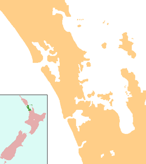
Waioneke is a locality on the South Head peninsula of the Kaipara Harbour, in the Rodney District of New Zealand. Parakai is 22 km to the south-east, and the road continues another 14 km to the north-west. Rangitira Beach and Woodhill Forest are to the west, and Omokoiti Flats and the southern Kaipara Harbour are to the east.[1][2]
Waioneke | |
|---|---|
 Waioneke | |
| Coordinates: 36°32′30″S 174°18′05″E | |
| Country | New Zealand |
| Region | Auckland Region |
| Ward | Rodney Ward |
History
A Māori pa existed at Waioneke prior to European settlement of the area.[3] The Waioneke block was taken up in 1868 by Daniel Pollen (who later became Premier of New Zealand) and William Spearman Young, to graze cattle.[4][5]
A Waioneke Road Board was formed after 1884, and was responsible for forming and maintaining roads over much of the South Head peninsula. The board was dissolved by 1899.[6]
Waioneke was a centre of gum digging from 1880 to 1900.[7]
Deer farming began in the area in the 1970s, and a processing plant was built in Waioneke.[8]
The Kaipara Estate winery began in the Waioneke Valley in 1995.[9][10]
Demographics
| Year | Pop. | ±% p.a. |
|---|---|---|
| 2006 | 1,878 | — |
| 2013 | 2,040 | +1.19% |
| 2018 | 2,595 | +4.93% |
| Source: [11] | ||
The statistical area of South Head, which at 340 square kilometres is much larger than this locality, covers the entire peninsula, but does not include Parakai or Helensville. It had a population of 2,595 at the 2018 New Zealand census, an increase of 555 people (27.2%) since the 2013 census, and an increase of 717 people (38.2%) since the 2006 census. There were 903 households. There were 1,317 males and 1,281 females, giving a sex ratio of 1.03 males per female. The median age was 42.2 years, with 546 people (21.0%) aged under 15 years, 384 (14.8%) aged 15 to 29, 1,278 (49.2%) aged 30 to 64, and 387 (14.9%) aged 65 or older.
Ethnicities were 87.7% European/Pākehā, 18.6% Māori, 3.9% Pacific peoples, 2.9% Asian, and 2.1% other ethnicities (totals add to more than 100% since people could identify with multiple ethnicities).
The proportion of people born overseas was 18.2%, compared with 27.1% nationally.
Although some people objected to giving their religion, 60.8% had no religion, 28.0% were Christian, and 4.0% had other religions.
Of those at least 15 years old, 327 (16.0%) people had a bachelor or higher degree, and 375 (18.3%) people had no formal qualifications. The median income was $31,900. The employment status of those at least 15 was that 1,083 (52.9%) people were employed full-time, 330 (16.1%) were part-time, and 54 (2.6%) were unemployed.[11]
Education
Waioneke School is a coeducational full primary (years 1-8) school with a roll of 85 students as of March 2020.[12][13] The school traces its origins to Mairetahi School, established in 1928. The school moved to its present site and took its current name in 1938.[14]
Notes
- Peter Dowling (editor) (2004). Reed New Zealand Atlas. Reed Books. pp. map 11. ISBN 0-7900-0952-8.CS1 maint: extra text: authors list (link)
- Roger Smith, GeographX (2005). The Geographic Atlas of New Zealand. Robbie Burton. pp. map 34. ISBN 1-877333-20-4.
- Jennings, Jesse David (1979). The Prehistory of Polynesia. p. 244. ISBN 0-674-70060-0.
- Sheffield, Colleen M. (1963). Men Came Voyaging. p. 78.
- Ryburn, Wayne (1999). Tall Spars, Steamers & Gum. p. 21. ISBN 0-473-06176-7.
- Ryburn, p 89
- Ryburn, p 132
- "South Head". Helensville Pioneer Museum. Retrieved 2008-10-10.
- "Kaipara Estate - History". Retrieved 2008-10-10.
- "Kaipara Estate - People". Retrieved 2008-10-10.
- "Statistical area 1 dataset for 2018 Census". Statistics New Zealand. March 2020. South Head (110700). 2018 Census place summary: South Head
- "New Zealand Schools Directory". New Zealand Ministry of Education. Retrieved 26 April 2020.
- Education Counts: Waioneke School
- "Waioneke School History". Waioneke School. Retrieved 2008-10-07.