Vrh pri Trebelnem
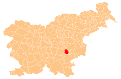
Vrh pri Trebelnem (pronounced [ˈʋəɾx pɾi tɾɛˈbeːu̯nɛm]) is a small dispersed settlement in the hills west of Trebelno in the Municipality of Mokronog-Trebelno in southeastern Slovenia. The area is part of the historical region of Lower Carniola. The municipality is now included in the Southeast Slovenia Statistical Region.[2]
Vrh pri Trebelnem | |
|---|---|
 Vrh pri Trebelnem Location in Slovenia | |
| Coordinates: 45°54′26.07″N 15°7′49.09″E | |
| Country | |
| Traditional region | Lower Carniola |
| Statistical region | Southeast Slovenia |
| Municipality | Mokronog-Trebelno |
| Area | |
| • Total | 0.85 km2 (0.33 sq mi) |
| Elevation | 529.8 m (1,738.2 ft) |
| Population (2002) | |
| • Total | 27 |
| [1] | |
Name
The name of the settlement was changed from Vrh to Vrh pri Trebelnem in 1953.[3]
gollark: PotatoASM™.
gollark: The PotatOS v8.34 irreality amplifier [DATA EXPUNGED] projection into conceptual/linguistic space [REDACTED] permitting possible <SQUARE BRACKETS DELETED> neutralization of ideatic anomalies.
gollark: Of course, they could fail, so we have orbital recreational nukes standing by.
gollark: Orbital laser strikes *should* be able to neutralize whom.
gollark: The one we call "whom" cannot be tolerated any more. It is time for indecisive action.
References
- Statistical Office of the Republic of Slovenia
- Mokronog-Trebelno municipal website
- Spremembe naselij 1948–95. 1996. Database. Ljubljana: Geografski inštitut ZRC SAZU, DZS.
External links
This article is issued from Wikipedia. The text is licensed under Creative Commons - Attribution - Sharealike. Additional terms may apply for the media files.