Vrh, Loška Dolina
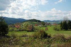
Vrh (pronounced [ˈʋəɾx], German: Werch[2]) is a small village south of Podgora in the Municipality of Loška Dolina in the Inner Carniola region of Slovenia.[3]
Vrh | |
|---|---|
 | |
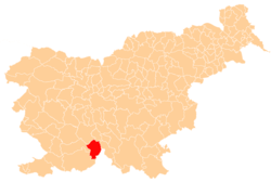
 Vrh Location in Slovenia | |
| Coordinates: 45°40′49.87″N 14°29′25.27″E | |
| Country | |
| Traditional region | Inner Carniola |
| Statistical region | Littoral–Inner Carniola |
| Municipality | Loška Dolina |
| Area | |
| • Total | 14.66 km2 (5.66 sq mi) |
| Elevation | 644.8 m (2,115.5 ft) |
| Population (2002) | |
| • Total | 36 |
| [1] | |
Mass grave
Vrh is the site of a mass grave from the period immediately after the Second World War. The Nevinje Cave Mass Grave (Slovene: Grobišče Nevinje jama), also known as the Troha Woods Cave Mass Grave (Jama v Trohovem gozdu), lies in the northeast foothills of Mount Snežnik, 1 kilometer (0.62 mi) east of the Grajševka hunting lodge. It was used after the war to liquidate opponents of the communist movement.[4]
Church

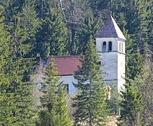
Saint Thomas's Church
The local church in the settlement is dedicated to Saint Thomas and belongs to the Parish of Stari Trg.[5]
gollark: You'd also need your UPID, but you can just call an observation drone to scan your DNA and neuron imprint.
gollark: Well, you'd need your phone to access GTech™.
gollark: Yes, GTech™ is the only relevant one.
gollark: GTech™'s IIDB allows lookup by UPID (universal PotatOS ID) which would work.
gollark: Internal GTech™ APIs. You don't have an API key.
References
- Statistical Office of the Republic of Slovenia
- Leksikon občin kraljestev in dežel zastopanih v državnem zboru, vol. 6: Kranjsko. Vienna: C. Kr. Dvorna in Državna Tiskarna. 1906. p. 132.
- Loška Dolina municipal site
- Ferenc, Mitja (December 2009). "Grobišče Nevinje jama". Geopedia (in Slovenian). Ljubljana: Služba za vojna grobišča, Ministrstvo za delo, družino in socialne zadeve. Retrieved May 9, 2020.
- Družina RC Church in Slovenia Journal website
This article is issued from Wikipedia. The text is licensed under Creative Commons - Attribution - Sharealike. Additional terms may apply for the media files.
