Voivodeni
Voivodeni (also Sânioana or Sântioana; Hungarian: Vajdaszentivány, Szentivány; German: Johannisdorf, Johannesdorf) is a commune in Mureș County, Transylvania, Romania. It is composed of two villages, Toldal (Toldalag) and Voivodeni.[2][3][4] The former village is much less populated than the latter.
Voivodeni Vajdaszentivány | |
|---|---|
 Zichy-castle | |
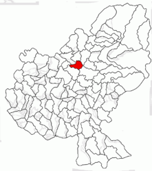 Location in Mureș County | |
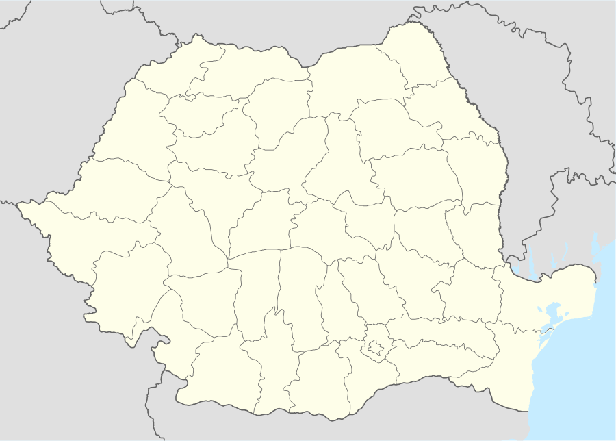 Voivodeni Location in Romania | |
| Coordinates: 46°42′0″N 24°38′0″E | |
| Country | |
| County | Mureș |
| Government | |
| • Mayor | Vasile Boer (PSD) |
| Population (2011)[1] | 1,756 |
| Time zone | EET/EEST (UTC+2/+3) |
| Vehicle reg. | MS |
This a commune is within a region known as Transylvania and is the centrally located in Romania. It is about 174 miles north of Bucharest, about 8 miles southwest of the city of Reghin, about 14 miles north of the county capital of Târgu Mureș, and about 86 miles northwest of Brașov.[5] It is also at an average altitude of 1230 feet, which is less than the average height where a landmass is considered a mountain (2,000 feet).
The commune has a hemiboreal climate with the average temperature as 48 degrees Fahrenheit, with the warmest in July at about 70 degrees and the coldest in December at about 21 degrees.[6][7][8] The average rainfall is about 31 inches a year, with about 5 inches in May and about 1.5 inches in February on average.
History
The first mention of the town was in 1332, under the name of Sancto Johanne.[9][10] Archaeological finds have shown that the area comprising the Voivodendi village was first settled during the Bronze period. Find have showed settlement on a hill called Benghát, 374 meters tall, and Roman presence as made clear by an existing Roman road nearby. In the commune town of Toldal, there is definite finds of Roman settlers, who focused on agricultural production.
During the Kingdom of Hungary, the commune belonged to the Régen district. It had been was part of the Székely Land region of the historical Transylvania province. This was kept when the Kingdom was absorbed into the Austrian Empire and the Austro-Hungarian Empire. For instance, in 1876, there was an administrative reorganization of Transylvania, and it was attached to the county of Maros-Torda. This meant that until 1918, the village belonged to the Maros-Torda County.
After the Treaty of Trianon of 1920, it became part of Romania and later became part of the district of Mureș, then Mureș County. It was occupied by Hungary from 1940 to 1944, during which the small Jewish community in the area was exterminated by the Nazis. It became part of Romania again in 1945.
The commune features the Zichy Castle, with relics from the Roman area and Hungarian presence.[11] Famous people who have lived in the commune include politician István Dán and biologist (and geographer) Pál Samu, born on June 28, 1935.
Demographics
The highest number of people living in the commune, since recording of population information began in 1850, was in 1956, with a total of 2,849 inhabitants.[12][13][14][15][16] The highest number of Magyars was in 1941, while Romanians reached their highest number in the commune in 1966, Roma in 1939, and Romanian Germans in 1941. To put it in perspective, in 1910 the commune had 1729 inhabitants but this had only risen to 1768 by 1992.
According to the last census, in 2011, the population of the Voivodeni commune was 1,756 inhabitants.[17] This was a decrease from the last census, in 2002, when 1,957 were living in the commune. Of the inhabitants, about 60% were Hungarian, while the rest were either Romanian (28.4%) or Roma (9.05%), with about 2% having an unknown ethnicity.[18] This means that the commune has a (Székely) Hungarian majority.
In terms of religious belief, most are Reformed (about 57%), while the rest are either Orthodox (about 28%), Seventh-Day Adventists (about 4%), Jehovah's Witnesses (3.4%), Roman Catholic (2.5%) or non-religious (1.6%).[19] About 2% of the population had religious beliefs that cannot be determined.
Present day
The commune of Voivodeni is administered by a mayor and a local council which is composed of 11 councilors. The Mayor is Vasile Boer, from the Social Democratic Party, who was elected in 2012. The local council has the following composition of political parties after local elections in 2016:[20]
- Social Democratic Party (Romania) - 7 seats
- Hungarian Democratic Union of Romania - 3 seats
- Hungarian Civic Party - 1 seat
Dance classes are held in the commune, like other parts of Transylvania, and churches made of wood are still standing.[21][22] The economy of the town is based on agriculture and livestock. The municipality is also located on the regional road DJ154J Breaza -Glodeni, near the national road DN15 Târgu Mureș - Reghin.
Tourist attractions in the commune include the Reformed-Calvinist Church in the village of Voivodeni, built in the 15th century, and the Zichy Mansion in Vojvodina, constructed in the 18th century, to name two historical monuments.[23][24] There are also several lakes, like Lacul Sate, where tourists can fish.
References
- "Populaţia stabilă pe judeţe, municipii, oraşe şi localităti componenete la RPL_2011" (in Romanian). National Institute of Statistics. Retrieved 4 February 2014.
- Arcanum Kézikönyvtár: Historical-administrative place name book of Transylvania, Banat and Partium. Accessed on July 6, 2019. Resource is in Hungarian.
- Population nunbers on 1.01.2009 in Romania. Archived from the original 10-09-2012. Cited on July 6, 2019.
- Structura Etno-demografică a României (Romanian). Archived from the original 7-29-2013. Cited on July 6, 2019.
- Physical distances are calculated according to the coordinates of settlements.
- Peel, MC; Finlayson, B L. "Updated world map of the Köppen-Geiger climate classification". Hydrology and Earth System Sciences 11: 1633-1644. doi: 10.5194 / hess-11-1633-2007. Retrieved on July 6, 2019.
- NASA Earth Observations Data Set Index. NASA.
- NASA Earth Observations: Rainfall (1 month - TRMM).NASA / Tropical Rainfall Monitoring Mission
- Heinz Heltmann, Gustav Servatius (ed.): Travel Guide Transylvania. Kraft, Würzburg 1993, ISBN 3-8083-2019-2, p. 517.
- Institute of Archeology - Voivodeni. Accessed on July 6, 2019. Romanian language resource.
- Kovacs Lorant, "Assessment of the environmental value of the Zichy Castle Park in Voivodeni, Romania – Brief description," 2014.
- Census 1850-2002, last update 2 November 2008 (PDF, 1 MB, Hungarian).
- Official 2002 Census Statistics.
- Census of the Mureş County from 1850 to 2002.
- The population of Voivodeni in 2007 on the website of the National Institute of Statistics of Romania.
- «Population on January 1, 2009».INSSE. Retrieved on July 6, 2019. Archived from the original July 26, 2009.}}
- "Population and Housing Census 2002 - population of administrative units by ethnicity". Kulturális Innovációs Alapítvány (KIA.hu - Cultural Foundation for Innovation). Accessed July 6, 2019.
- Final results of the 2011 Census:"Tab8. Ethnic stable population - counties, municipalities, towns, communes ". National Institute of Statistics of Romania. July 2013. Accessed July 6, 2019.
- Final results of the 2011 Census:"Tab13. Stable population by religion - counties, municipalities, towns, communes". National Institute of Statistics of Romania. July 2013. Accessed on July 6, 2019.
- ^'List of Competitors Obtaining Mandates' (XLSX) . Central Electoral Bureau for the 2016 local elections. Accessed July 6, 2019.
- Lucy Mallows and Rudolf Abraham, Transylvania (US: Bradt Travel Guides, 2012), p 105.
- Nuria Sanz, Living Wooden Culture Throughout Europe (Council of Europe, 2002), p 59.
- List of historical monuments of the Romanian Ministry of Culture, updated in 2015 (PDF, 12.7 MB, Romanian.
- Information on Lacul Sate at locuridepescuit.net, retrieved on July 6, 2019. Romanian language resource.
External links
- Official site of commune
- Wikimedia Atlas of Romania
- Wikimedia Atlas of Transylvania
- Voivodeni Castle
- Administrative map of the district
- Communes of Romania
- Romanian Law and Miscellaneous
- Map of Mureş County
