Villarrica, Paraguay
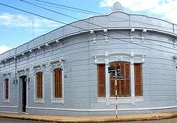
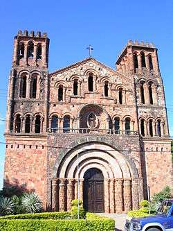
Villarrica del Espíritu Santo (Spanish pronunciation: [ˌbiʎaˈrika ðel esˈpiritu ˈsanto]), using its formal name is a city located in the middle of the Oriental Region of the Paraguayan territory, it is the capital of the Guairá Department. It was founded by the Spanish Captain Ruy Diaz de Melgarejo on May 14, 1570 in the old Guaira, today in Brazilian territory.
Villarrica | |
|---|---|
City | |
Villarrica del Espíritu Santo
 | |
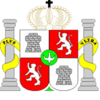
 Flag  Coat of arms | |
 Villarrica | |
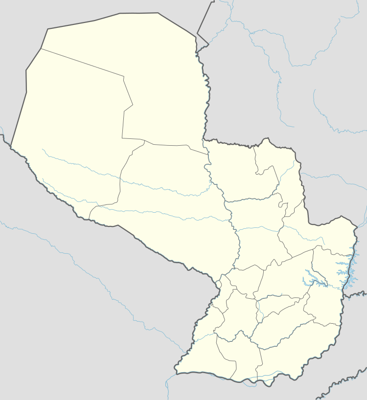
| Coordinates: 25°45′S 56°26′W | |
| Country | |
| Department | Guairá |
| Founded | May 14, 1570 |
| Founded by | Ruy Díaz de Melgarejo |
| Government | |
| • Intendente Municipal | Federico Alderete Guggiari |
| Area | |
| • Total | 247 km2 (95 sq mi) |
| Elevation | 180 m (590 ft) |
| Population | |
| • Total | 56,385 |
| • Density | 230/km2 (590/sq mi) |
| Time zone | UTC-04 (AST) |
| • Summer (DST) | UTC-03 (ADT) |
| Postal code | 5000 |
| Area code(s) | (595) (541) |
Villarrica has many places that honor the Paraguayan culture, such as the monument to the memory of Manuel Ortiz Guerrero, honorary citizen of the city. About this city Bacón Duarte Prado (journalist and musician) wrote: Villarrica is the city of the eternal youth, born from the waters of the Ycuá Pytá and the breeze that comes from the hills.
Founded by the Spanish Ruy Diaz de Melgarejo, 350 km east from the Saltos del Guaira, on May 14, 1570, with the name Villa Rica del Espíritu Santo (Villa Rica of the Holy Spirit), finally settled in 1682 in the hills near the Ybytyruzu, part of the Caaguazú Cordillera, 180 m above ocean level.
The city is located near the Ybyturuzú, part of the Caaguazú mountain chain. The land is elevated, rough and wooded, appropriate for cultivate of sugar cane, trees for wood and cattle.
History
In the 16th century, Ruy Díaz de Melgarejo left Ciudad Real with 40 men and 53 horses to the East, where they expected to find mines of gold and silver. After arriving in the lands of Cacique (Chief) Cuaracyberá, he founded on May 14, 1570 a new town, christened Villa Rica del Espíritu Santo. It was named that way because the belief that there was abundant gold and silver in the area and also because the foundation occurred in the proximities of this religious festivity. Due to the constant invasions Paulist Bandeirantes, the city had to be moved seven times before settling in a definite place. For this reason it received the name of “Wandering city”.
In 1592, Ruy Díaz de Guzman moved the city 100 km east. In 1599 he moved it again, this time near the Mboteitei River, 100 leagues from Asunción. After long years of peaceful existence, the city was invaded in 1632 by the Mamelucos, and after 4 years of pilgrimage the population settled in the closeness of Mbaracayú. Two years later, the Governor Valderrama determined to situate it in the fields of Yarú. In 1642 the population migrated again to Curuguaty.
In 1678 the population settled close to the Tobatyry River, a place called “Espinillo”, but the soil was no good for agriculture so many people decided to organize and do a recognition expedition to the area beyond the Tebicuary River. They found fertile land near Ybyturuzú, so they requested the Governor authorization to move the city to that place. On May 25, 1682, he gave licence to establish in Ybyturuzú, only if the King approved it too, which he did on May 14, 1701. This date became the definite date of foundation. The Franciscan Missioners helped the consolidation of the city, founding a Guaraní Mission in Itapé.
In 1906 it was created the fourth department of the country, formed by Villarrica, Itapé, Hiaty, Mbocayaty and Yataity. During the 20th century, exploitation of the wood industry in Caaguazú and the importance of Villarrica as an urban center spurred the creation of a railway crossing the entire department from east to west.
Climate
The climate, in general is benign and healthy, with an average temperature of 21 °C . In summer it reaches 38 °C, while in winter it can drop to 1 °C. The rainiest months are January and November.
The neighborhoods are: Ybaroty, San Miguel de Carumbey, Estación, Santa Librada, Santa Lucía, San Blás and Tutytimí.
| Climate data for Villarrica, Paraguay | |||||||||||||
|---|---|---|---|---|---|---|---|---|---|---|---|---|---|
| Month | Jan | Feb | Mar | Apr | May | Jun | Jul | Aug | Sep | Oct | Nov | Dec | Year |
| Record high °C (°F) | 39.5 (103.1) |
38.8 (101.8) |
37.2 (99.0) |
36.4 (97.5) |
33.4 (92.1) |
31.3 (88.3) |
32.4 (90.3) |
34.5 (94.1) |
36.2 (97.2) |
37.0 (98.6) |
40.0 (104.0) |
40.4 (104.7) |
40.4 (104.7) |
| Average high °C (°F) | 32.3 (90.1) |
31.9 (89.4) |
30.8 (87.4) |
27.8 (82.0) |
25.0 (77.0) |
22.8 (73.0) |
23.3 (73.9) |
24.6 (76.3) |
25.8 (78.4) |
28.5 (83.3) |
30.1 (86.2) |
31.7 (89.1) |
27.9 (82.2) |
| Daily mean °C (°F) | 26.5 (79.7) |
26.0 (78.8) |
24.8 (76.6) |
21.8 (71.2) |
18.9 (66.0) |
16.8 (62.2) |
17.0 (62.6) |
18.2 (64.8) |
19.7 (67.5) |
22.3 (72.1) |
24.2 (75.6) |
25.9 (78.6) |
21.8 (71.2) |
| Average low °C (°F) | 21.0 (69.8) |
20.9 (69.6) |
19.7 (67.5) |
16.8 (62.2) |
14.1 (57.4) |
12.1 (53.8) |
12.3 (54.1) |
13.2 (55.8) |
14.5 (58.1) |
16.6 (61.9) |
18.3 (64.9) |
20.1 (68.2) |
16.6 (61.9) |
| Record low °C (°F) | 12.0 (53.6) |
11.0 (51.8) |
7.5 (45.5) |
4.9 (40.8) |
1.0 (33.8) |
−1.4 (29.5) |
−2.8 (27.0) |
−3.4 (25.9) |
1.1 (34.0) |
5.6 (42.1) |
5.6 (42.1) |
7.6 (45.7) |
−3.4 (25.9) |
| Average precipitation mm (inches) | 185.0 (7.28) |
124.1 (4.89) |
154.6 (6.09) |
169.9 (6.69) |
131.0 (5.16) |
116.0 (4.57) |
67.3 (2.65) |
104.7 (4.12) |
110.5 (4.35) |
155.2 (6.11) |
172.4 (6.79) |
145.9 (5.74) |
1,636.9 (64.44) |
| Average precipitation days (≥ 0.1 mm) | 10 | 9 | 9 | 9 | 8 | 8 | 7 | 9 | 9 | 10 | 9 | 10 | 107 |
| Average relative humidity (%) | 72 | 75 | 76 | 78 | 79 | 78 | 74 | 72 | 71 | 71 | 70 | 70 | 74 |
| Source: NOAA[1] | |||||||||||||
Economy
The most important economical activities of the department are: the agriculture, breed of small animals, dairy products, the textile industry, commerce and services.
Communications
The department has the Route No. 8 “Blas Garay”, which parts from the joint of Route No. 2 and Route No. 7 and is paved until it reaches Caazapá. There is also another route that joins with Route No. 7, which passes through Mbocayaty, Natalicio Talavera, Troche and Blas Garay.
Education
The city counts with the Catholic University, one of the oldest in the interior of the country. There is also Filial Faculties of the Asunción National University and North University.
It has numerous educational institutions and schools, such as: the National School, the Ortiz Guerreo School, Technical and Vocational National School, the Diosesano Seminar, the Agriculture Regional School, Women Professional Institute, and the Pío XII School of Arts and Crafts.
Culture

Regarded by many as the second most important city in Paraguay, due to the extraordinary number of celebrated exponents in the arts, literature, culture and political thought which have greatly increased the profile of the city in the national stage also gaining international recognition. Today the city boasts a substantial university population becoming a hub for learning. For many people, the city's name is synonymous with academia, scientific & cultural accomplishment. Historically, Villarrica has been a place of unusually heavy European immigration (Spaniards, Italians, French, Germans) compared to its neighboring towns and cities, also receiving immigrants from the middle east (Syrians, Lebanese, Palestine, Jewish). Among the different social, recreational and cultural institutions, the next can be mentioned: “Club Porvenir Guaireño”, “El Centro Español”, “El Club de Leones” (Lions Club), “Instituto de Cultura Hispánica” (Hispanic Culture Institute), “Teatro Municipal” (Municipal Theatre), “Orquesta de Cámara” (Camara Orchestra), “Escuela Municipal de Danza” (Dance School), “Asociación de Productores de Caña de Azúcar” (Sugar Cane Producers Association), “Liga Guaireña de Fútbol” (Guaira Soccer League) and “Liga Guaireña de Basquetbol” (Guaira Basketball League).
The city has several radio stations, television cable service and a television station, the Channel No. 8.
The people from Guaira have preserve in their culture some myths and legends of the old natives, like the myth of póra (some kind of ghostly figure), pombero, jasy jateré, kurupi, urutau, karau, jakare, among others.
Among the traditions of European origins, many they keep, many religious festivities, such as the Crucifix day, also horse races, cockfights, bullfights and many of dances and typical way of dressing.
Main sights
One of the most visited places is the Manuel Ortiz Guerrero Park (named this way in 1936, before it was called Ycua Pyta). The park is located in the north of the city, between the neighborhoods of Ybaroty and San Miguel.
Other centers of culture include the “Maestro Fermín López” Municipal Library and Museum, housing personal belongings of Fermín López and Natalicio Talavera; arms and ammunitions from the Chaco War, a collection of Paraguayan coins and bills, as well as other artifacts: native arrows, axes and bows, old furniture, machines, paintings, photographs and pieces of religious art.
People from Villarrica
- Manuel Ortiz Guerrero
- Natalicio de María Talavera
- Efraím Cardozo
- Helio Vera
- Juan Natalicio González
- Alfredo Seiferheld
- Marcos Zeida
- Jacobo Rauskin - Poet/Literary Figure
- Arsenio "Arci" Aguilar - Painter/Artist
References
- "Villarrica Climate Normals 1961–1990". National Oceanic and Atmospheric Administration. Retrieved March 9, 2015.
External sources
- Geografía Ilustrada del Paraguay. Tercera Edición. Distribuidora Quevedo de Ediciones. Buenos Aires.1998.
- Atlas y Geografía de Paraguay y el Mundo. Ediciones India Guapa. Asunción. 1997.
- Atlas Paraguay. Cartografía Didáctica. Fausto Cultural Ediciones. Enero 2000.
- Franco Preda, Artemio. El Guairá y su aporte a la cultura paraguaya. Editora Litocolor S.R.L. Villarrica,2003.