Vichy — Charmeil Airport
Vichy – Charmeil Airport (French: Aéroport de Vichy - Charmeil) (IATA: VHY, ICAO: LFLV) is an airport located in Charmeil, 5 km (3 NM) north-northwest of Vichy,[1] both communes in the Allier department of the Auvergne region in central France.
Vichy – Charmeil Airport Aéroport de Vichy - Charmeil | |||||||||||
|---|---|---|---|---|---|---|---|---|---|---|---|
| Summary | |||||||||||
| Airport type | Public | ||||||||||
| Operator | Mairie de Vichy | ||||||||||
| Serves | Vichy, France | ||||||||||
| Location | Charmeil | ||||||||||
| Elevation AMSL | 817 ft / 249 m | ||||||||||
| Coordinates | 46°10′18″N 003°24′15″E | ||||||||||
| Map | |||||||||||
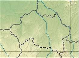 LFLV Location of airport in Allier department Location of Allier department in France 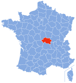 | |||||||||||
| Runways | |||||||||||
| |||||||||||
Facilities
The airport resides at an elevation of 817 feet (249 m) above mean sea level. It has one runway designated 01/19 with an asphalt surface measuring 2,200 by 45 metres (7,218 ft × 148 ft).[1]
gollark: For a cheaper alternative, you can use those vaguely knockoffy Banana Pis and Orange Pis.
gollark: 1. get a Raspberry Pi through Amazon or something, the Raspberry Pi 4 is recommended2. obtain apples3. grind up the apples into small apple fragments4. place the raspberry pi into the apple fragments5. a displacement reaction should occur, converting the raspberry pi into an apple pi(e) and producing a raspberry precipitate
gollark: That actually seems really useful and it seems weird that nobody thought of this before. Maybe it could list the text scale too.
gollark: It's quite hard to make memes as images, much easier to just describe them.
gollark: [picture of Meme Man in front of a generic hackertyper-looking terminal on a computer]sekurity
References
- LFLV – VICHY CHARMEIL. AIP from French Service d'information aéronautique, effective 13 August 2020.
External links
- Airport information for LFLV at World Aero Data. Data current as of October 2006.
This article is issued from Wikipedia. The text is licensed under Creative Commons - Attribution - Sharealike. Additional terms may apply for the media files.