Varanger Peninsula
Varanger Peninsula (Norwegian: Varangerhalvøya; Northern Sami: Várnjárga; Kven: Varenkinniemi) is a peninsula in Finnmark county, Norway. It is located in the northeasternmost part of Norway, along the Barents Sea. The peninsula has the Tanafjorden to the west, the Varangerfjorden to the south, and the Barents Sea to the north and east. The municipalities of Vadsø, Båtsfjord, Berlevåg, Vardø, Tana, and Nesseby share the 2,069-square-kilometre (799 sq mi) peninsula. Nesseby and Tana are only partially on the peninsula, with the rest being entirely on the peninsula.[1]
| Varanger Peninsula | |
|---|---|
| Varangerhalvøya Várnjárga | |
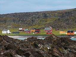 Hamningberg in Båtsfjord Municipality is an abandoned fishing village on the northern coast of the peninsula | |
| Location | Finnmark, Norway |
| Coordinates | 70°29′01″N 29°32′26″E |
| Offshore water bodies | Barents Sea, Tanafjorden, Varangerfjorden |
The peninsula gave the name to the Varangian glaciation episode. A large part of this peninsula, including the town of Vardø (located on an island just off the coast of the peninsula), has an Arctic tundra climate. However, on the south coast, including the town of Vadsø, there is sufficient summer heat for birch trees to grow. The area has rugged mountain terrain with altitudes up to 633 metres (2,077 ft).[1]
The Norwegian Directorate for Nature Management has a project on the peninsula for the reintroduction and protection of the Arctic fox, which is critically endangered on the Norwegian mainland. In addition to introducing animals into nature, the larger and stronger Red fox is hunted down.
There are many species of sea birds along the coast of the peninsula; some arctic species of birds spend the winters along the coast of the peninsula. The Varangerhalvøya National Park protects a majority of the land on the peninsula.
Geology
Much of the relief of Varanger Peninsula is a paleic surface similar to the one found in the highlands of southern Norway. In the peninsula the paleic surface is made up of an undulating plateau between the altitudes of 200 and 600 m.a.s.l.. The higher parts of the undulating plateau are made up by erosion-resistant rocks like quartzite. The lower parts are made up by weak rocks like shale and mudstone. At intermediate levels sandstone is common. Some parts of the paleic surface in Varanger Peninsula are a re-exposed unconformity that underlie sedimentary rock of Vendian (Late Neoproterozoic) age. The paleic surface might have been uplifted as much as 200-250 meters since middle Pliocene times.[2]
Landforms resulting from Quaternary periglaciation are recurrent across the peninsula. Among the most common are block fields and solifluction lobes.[3] Blockfields are most extensive on the northern half of the peninsula, chiefly in the plateau area.[4] Polygonal ground is found in some places, but there is no known modern ice wedges.[3] Permafrost was as of 1985 only known from bogs, and in a few places this permafrost had originated thermokarst depressions.[3]
Media gallery
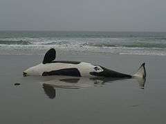 Stranded Orca whale on a beach, Varanger Peninsula
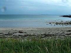 The Arctic beach at Hamningberg
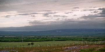 On the northern shore of the Varangerfjord between Vardø and Vadsø
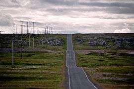 Highway from Vardø to Hamningberg
References
- Store norske leksikon. "Varangerhalvøya" (in Norwegian). Retrieved 2013-02-25.
- Fjellanger, J; Sørbel, L (2007). "Origin of the palaeic landforms and glacial impact on the Varanger Peninsula, northern Norway" (PDF). Norwegian Journal of Geology. 87: 223–238.
- Malmström, Bo; Palmér, Owe (1985). Glacial och periglal gemorfologi på Varangerhalvön, Nordnorge [Glacial and Periglacial Geomorphology on the Varanger Peninsula, Northern Norway]. Meddelanden från Lunds universitet geografiska institution. Avhandlingar XCIII (in Swedish). Lund, Sweden: Lund University. pp. 86–87. ISBN 91-7222-818-0.
- Malmström & Palmér 1985, pp. 91–92.
External links
| Wikimedia Commons has media related to Varanger Peninsula. |