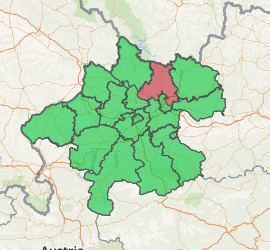
Urfahr-Umgebung District
Bezirk Urfahr Umgebung is a district of the state of Upper Austria in Austria. It is named after Urfahr, a former city, today a borough of Linz, seat of the district's administration (Bezirkshauptmannschaft).
Urfahr-Umgebung District Bezirk Urfahr-Umgebung | |
|---|---|
District | |
| |
| Country | Austria |
| State | Upper Austria |
| Number of municipalities | 27 |
| Area | |
| • Total | 649.3 km2 (250.7 sq mi) |
| Population (2001) | |
| • Total | 77,742 |
| • Density | 120/km2 (310/sq mi) |
| Time zone | UTC+01:00 (CET) |
| • Summer (DST) | UTC+02:00 (CEST) |
Municipalities
Towns (Städte) are indicated in boldface; market towns (Marktgemeinden) in italics.
- Alberndorf in der Riedmark
- Altenberg bei Linz
- Bad Leonfelden
- Eidenberg
- Engerwitzdorf
- Feldkirchen an der Donau
- Gallneukirchen
- Goldwörth
- Gramastetten
- Haibach im Mühlkreis
- Hellmonsödt
- Herzogsdorf
- Kirchschlag bei Linz
- Lichtenberg
- Oberneukirchen
- Ottenschlag im Mühlkreis
- Ottensheim
- Puchenau
- Reichenau im Mühlkreis
- Reichenthal
- Schenkenfelden
- Sonnberg im Mühlkreis
- Sankt Gotthard im Mühlkreis
- Steyregg
- Vorderweißenbach
- Walding
- Zwettl an der Rodl
| Cities |  | |
|---|---|---|
| Districts | ||
| Authority control |
|
|---|
gollark: ... what?
gollark: How odd.
gollark: Is that just an obfuscation thing or does it actually *use* it?
gollark: It requires k.lua, you say? Hmm.
gollark: Hmm, a potatOS uninstaller? REVERSE ENGINEERING TIME!
This article is issued from Wikipedia. The text is licensed under Creative Commons - Attribution - Sharealike. Additional terms may apply for the media files.