Upson, Wisconsin
Upson is an unincorporated community located in Iron County, Wisconsin, United States. Upson is located at the junction of Wisconsin Highway 77 and Wisconsin Highway 122 12 miles (19 km) southwest of Hurley, in the town of Anderson. Upson had an Air Defense Command radar station of the Permanent System radar network (P-16B, 46°25′10″N 090°23′06″W) and a post office, which closed on March 16, 1985.[3] One of the three people that surveyed the area was named Upson.[4]
Upson, Wisconsin | |
|---|---|
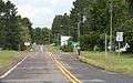
 Looking east in Upson on WIS77 | |
 Upson  Upson | |
| Coordinates: 46°22′09″N 90°24′25″W | |
| Country | |
| State | |
| County | Iron |
| Town | Anderson |
| Elevation | 454 m (1,489 ft) |
| Time zone | UTC-6 (Central (CST)) |
| • Summer (DST) | UTC-5 (CDT) |
| ZIP code | 54565[1] |
| Area code(s) | 715 & 534 |
| GNIS feature ID | 1576004[2] |
Images
 Looking north at Upson from southern terminus of WIS122
 Looking east at the sign for Upson on WIS77
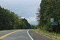 Looking west at the sign for Upson on WIS77
gollark: I automated it, would you like to overhaul the windows with it?
gollark: The glass part is the planned magic research center, primarily designed for Botania.
gollark: We have 20000 paper and stuff.
gollark: It's even more of a horrible mess now.
gollark: Really need to fix that.
References
| Wikimedia Commons has media related to Upson, Wisconsin. |
- United States Postal Service (2012). "USPS - Look Up a ZIP Code". Retrieved 2012-02-15.
- U.S. Geological Survey Geographic Names Information System: Upson, Wisconsin
- "Postmaster Finder - Post Offices by ZIP Code". United States Postal Service. Retrieved September 25, 2011.
- Gard, Robert E.; Sorden, L. E. The Romance of Wisconsin Place Names (1st ed.). New York, NY: October House. p. 128.
Municipalities and communities of Iron County, Wisconsin, United States | ||
|---|---|---|
| Cities |  | |
| Towns | ||
| CDPs | ||
| Unincorporated communities | ||
| Indian reservations | ||
| Footnotes | ‡This populated place also has portions in an adjacent county or counties | |
This article is issued from Wikipedia. The text is licensed under Creative Commons - Attribution - Sharealike. Additional terms may apply for the media files.