Upper Madawaska River Provincial Park
Upper Madawaska River Provincial Park is a waterway-class provincial park on the Madawaska River in the Municipality of South Algonquin in Nipissing District, Ontario, Canada.[1][2][3][4][5] The park consists of a strip of land along both shores of the Madawaska River from the communities of Whitney to Madawaska. It is upstream and north of (and not contiguous with) the Lower Madawaska River Provincial Park.
| Upper Madawaska River Provincial Park | |
|---|---|
IUCN category II (national park) | |
Madawaska River at Whitney, the western/upstream boundary of the park. | |
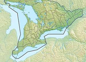
 Location of the park on a map of Southern Ontario | |
| Location | Nipissing District, Ontario |
| Nearest city | Pembroke, Ontario |
| Coordinates | 45°29′41″N 78°04′08″W[1] |
| Area | 1,085 ha (4.19 sq mi) |
| Governing body | Ontario Parks |
| www | |
As a non-operating park, it offers neither facilities nor services. Its most popular use is for whitewater kayaking and canoeing.
A rail corridor along the river that was originally built for the now-abandoned Ottawa, Arnprior and Parry Sound Railway has been incorporated into the park in the form of a rail trail.
See also
- List of Ontario parks
References
- "Upper Madawaska River Provincial Park". Geographical Names Data Base. Natural Resources Canada. Retrieved 2018-08-30.
- "Toporama (on-line map and search)". Atlas of Canada. Natural Resources Canada. Retrieved 2018-08-30.
- "Ontario Geonames GIS (on-line map and search)". Ontario Ministry of Natural Resources and Forestry. 2014. Retrieved 2018-08-30.
- Map 14 (PDF) (Map). 1 : 1,600,000. Official road map of Ontario. Ministry of Transportation of Ontario. 2016-01-01. Retrieved 2018-08-30.
- Restructured municipalities - Ontario map #5 (Map). Restructuring Maps of Ontario. Ontario Ministry of Municipal Affairs and Housing. 2006. Retrieved 2018-08-30.
External links
This article is issued from Wikipedia. The text is licensed under Creative Commons - Attribution - Sharealike. Additional terms may apply for the media files.
